Nerežišće
Located in Municipality of Nerežišća, Split-Dalmatia County Coordinates: 43°19′52″ N 16°34′43″ E

- Population
- 642
- 642
- Elevation
- 391 m
- above sea level
- Local time
- UTC+01:00
- Europe/Zagreb · UTC+01:00
- Airports
- BWK Brač Airport10 km
- SPU Split Saint Jerome Airport32 km
About Nerežišće
Nerežišće is a city. Location: Municipality of Nerežišća, Split-Dalmatia County. Population: 642. Elevation: 391 m.
Nerežišća (Croatian pronunciation: [něreʒiːɕt͡ɕa]) is a village and a municipality on the island Brač in Croatia. In the past, Nerežišća was the capital of the island. It was founded inside the island, not on its coast, because of fear of pirates marauding the Adriatic Sea. Once these pirates were eradicated by the Venetians, the locals started populating the settlements by the sea, especially Supetar and Sutivan, across the Brač Channel facing Split.
Source: Wikipedia · CC BY-SA 4.0
Photos of Nerežišće
-

Argo Navis · CC BY-SA 4.0 -

Argo Navis · CC BY-SA 4.0 -

Mark Ahsmann · CC BY-SA 3.0 -

Unknown author Unknown author · CC0 -
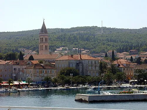
Brač Wikimedia Commons · CC BY-SA 3.0


Places bordering Nerežišće
- Milna
- Supetar
- Postira
- Bol
Climate of Nerežišće
Best months for sightseeingBest months for sightseeing: May–July, September.
This month · November
A wet month
Day 14° · Night 8° · Rain 101 mm
- Hottest month
- July (day 28°)
- Coldest month
- February (night 3°)
- Wettest month
- November (101 mm)
- Driest month
- July (28 mm)
Bars: average monthly low and high temperature. Below: precipitation. Monthly averages for 1970–2000 at about 18 km resolution, adjusted for elevation. Highlighted months are mild and relatively dry. Source: WorldClim 2.1 (CC BY 4.0).
Show values as a table
| Month | Jan | Feb | Mar | Apr | May | Jun | Jul | Aug | Sep | Oct | Nov | Dec |
|---|---|---|---|---|---|---|---|---|---|---|---|---|
| Average high (°C) | 9° | 10° | 12° | 16° | 21° | 25° | 28° | 28° | 23° | 19° | 14° | 11° |
| Average low (°C) | 4° | 3° | 5° | 8° | 13° | 16° | 19° | 18° | 15° | 12° | 8° | 5° |
| Precipitation (mm) | 72 | 60 | 66 | 63 | 51 | 44 | 28 | 45 | 65 | 85 | 101 | 88 |
Other places to visit in this season: May June July September
How to get to Nerežišće
The nearest airport is Brač Airport (BWK), 10 km to the southeast as the crow flies. For international flights: Split Saint Jerome Airport (SPU) (32 km). The nearest large city is Split, 23 km to the northwest.
Airports
- Brač Airport (BWK) Gornji Humac 10 kmsoutheast
- Split Saint Jerome Airport (SPU) Split 32 kmnorthwest
- Mostar International Airport (OMO) Mostar 103 kmeast
Nearby large cities
- Split Population: 149.8K 23 kmnorthwest
- Rijeka Population: 108K 280 kmnorthwest
- Zagreb Population: 663.6K 280 kmnorth
- Pécs Population: 145.3K 332 kmnortheast
- Ljubljana Population: 272.2K 344 kmnorthwest
Straight-line distances; road distances are longer. Airport data: OurAirports.
Day trips from Nerežišće
Within 100 km: 8 historic and cultural sites, 13 natural sites, 43 lakes, rivers and coasts.
0–25 km13 places
- Brač Island 5 kmE
- Šolta Island 24 kmW
- Diocletian's Palace Historic site 23 kmNW
- Marjan Mountain 24 kmNW
25–60 km13 places
- Otok Mali Drvenik Island 43 kmW
- Otok Šćedro Island 29 kmS
- Biokovo Mountain 40 kmE
- Biokovo Nature Park Natural site 42 kmE
60–100 km38 places
- Lagosta Island Island 69 kmS
- Otok Prvić Island 78 kmNW
- Otok Zlarin Island 71 kmNW
- Otok Kaprije Island 81 kmNW
Straight-line distances.
Nearby attractions & nature
Everything nearby-
Brač Island, Split-Dalmatia County4.9 km E
-
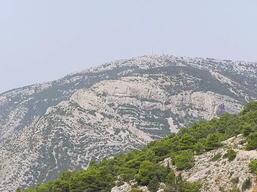 Vidova Gora Mountain, Split-Dalmatia County6.5 km SE
-
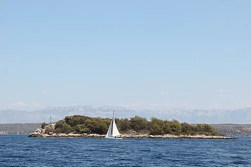 Otok Mrduja Island, Split-Dalmatia County13 km W
-
 Cetina River, Croatia15 km NE
-
Diocletian's Palace Historic site, Croatia23 km NW
-
 Salona Historic site, Croatia24 km N
-
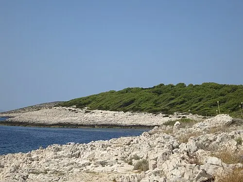 Otok Jerolim Island, Split-Dalmatia County22 km SW
-
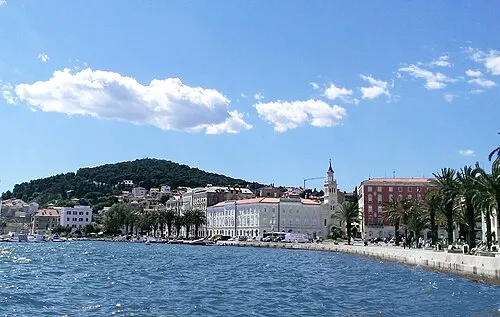 Marjan Mountain, Split-Dalmatia County24 km NW
Sources & licences
Data last updated: · 2 independent sources