Teplice nad Bečvou
Located in Přerov District, Olomouc Region Coordinates: 49°31′41″ N 17°44′04″ E
- Elevation
- 328 m
- above sea level
- Local time
- UTC+01:00
- Europe/Prague · UTC+01:00
- Places inside
- 1
- listed under Teplice nad Bečvou
- Airports
- OSR Leoš Janáček Airport Ostrava33 km
- BRQ Brno-Tuřany Airport86 km
About Teplice nad Bečvou
Teplice nad Bečvou is a municipality. Location: Přerov District, Olomouc Region. Elevation: 328 m. The best months to visit are June–August. The nearest airport is Leoš Janáček Airport Ostrava (33 km). Nearby sights include Nad Doly [Hranice-Slavíč] and Kuželek [Loučka-Lázy].
Climate of Teplice nad Bečvou
Best months for sightseeingBest months for sightseeing: June–August.
This month · November
A cold month
Day 6° · Night 0° · Rain 47 mm
- Hottest month
- July (day 23°)
- Coldest month
- January (night -5°)
- Wettest month
- June (100 mm)
- Driest month
- January (30 mm)
Bars: average monthly low and high temperature. Below: precipitation. Monthly averages for 1970–2000 at about 18 km resolution, adjusted for elevation. Highlighted months are mild and relatively dry. Source: WorldClim 2.1 (CC BY 4.0).
Show values as a table
| Month | Jan | Feb | Mar | Apr | May | Jun | Jul | Aug | Sep | Oct | Nov | Dec |
|---|---|---|---|---|---|---|---|---|---|---|---|---|
| Average high (°C) | 1° | 3° | 7° | 13° | 18° | 21° | 23° | 23° | 18° | 13° | 6° | 2° |
| Average low (°C) | -5° | -4° | -1° | 3° | 8° | 10° | 12° | 12° | 8° | 4° | 0° | -3° |
| Precipitation (mm) | 30 | 31 | 33 | 47 | 77 | 100 | 92 | 87 | 62 | 44 | 47 | 41 |
How to get to Teplice nad Bečvou
The nearest airport is Leoš Janáček Airport Ostrava (OSR), 33 km to the northeast as the crow flies. The nearest large city is Brno, 90 km to the southwest.
Airports
- Leoš Janáček Airport Ostrava (OSR) Mošnov 33 kmnortheast
- Brno-Tuřany Airport (BRQ) Brno 86 kmsouthwest
- Sliač Airport (SLD) Sliač 142 kmsoutheast
Nearby large cities
- Brno Population: 404.3K 90 kmsouthwest
- Győr Population: 129.3K 205 kmsouth
- Prague Population: 1.2M 246 kmwest
- Székesfehérvár Population: 101.6K 265 kmsouth
- Miskolc Population: 154.5K 274 kmsoutheast
Straight-line distances; road distances are longer. Airport data: OurAirports.
Day trips from Teplice nad Bečvou
Within 100 km: 13 historic and cultural sites, 450 natural sites.
0–25 km12 places
- Křížový Mountain 25 kmSE
- Ubřezí Mountain 17 kmW
- Růžový Kopec Mountain 18 kmNW
- Nad Doly [Hranice-Slavíč] Mountain 7 kmNW
25–60 km124 places
- Strčí Hlava Mountain 47 kmSE
- Holý vrch Mountain 56 kmSE
- Kamenná Mountain 44 kmNW
- Zvonina Mountain 55 kmE
60–100 km327 places
- Bugaj Mountain 94 kmE
- Sucha Kopa Mountain 99 kmNW
- Březová Dolina Natural site 70 kmS
- Úsobrnka Natural site 69 kmW
Straight-line distances.
Places in Teplice nad Bečvou
1 placeBar: population relative to the most populous place in this list.
Nearby attractions & nature
Everything nearby-
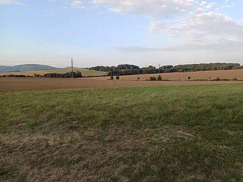 Nad Doly [Hranice-Slavíč] Mountain, Hranice6.7 km NW
-
Kuželek [Loučka-Lázy] Mountain, Mikulůvka16 km SE
-
Čerňava [Chvalčov] Mountain, Chvalčov17 km S
-
Bludný Mountain, Rajnochovice19 km SE
-
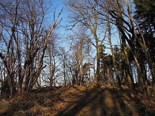 Huštýn Mountain, Zašová24 km E
-
Jaroňová Mountain, Hošťálková21 km S
-
Lysina [Holešov-Žopy] Mountain, Holešov22 km S
-
Humenec Mountain, Hošťálková24 km S
Sources & licences
Data last updated: