Ústí nad Orlicí District
Located in Pardubice Region, Czechia Coordinates: 50°00′00″ N 16°32′00″ E
- Population
- 138,301
- 138.3K
- Elevation
- 449 m
- above sea level
- Local time
- UTC+01:00
- Europe/Prague · UTC+01:00
- Places inside
- 115
- listed under Ústí nad Orlicí District
About Ústí nad Orlicí District
Ústí nad Orlicí District is a district. Location: Pardubice Region, Czechia. Population: 138,301.
In comparison
- 3 sights and natural places within 10 km Žampach, Studený
- Listed here: Municipality: 115
Places in Ústí nad Orlicí District
115 places-
Albrechtice Municipality
-
Anenská Studánka Municipality
-
Běstovice Municipality
-
Bošín Municipality
-
Brandýs nad Orlicí Municipality
-
Bučina Municipality
-
Bystřec Municipality
-
Čenkovice Municipality
-
Červená Voda Municipality
-
Česká Rybná Municipality
-
Česká Třebová Municipality
-
České Heřmanice Municipality
-
České Libchavy Municipality
-
České Petrovice Municipality
-
Choceň Municipality
-
Cotkytle Municipality
-
Damníkov Municipality
-
Dlouhá Třebová Municipality
-
Dlouhoňovice Municipality
-
Dobříkov Municipality
-
Dolní Čermná Municipality
-
Dolní Dobrouč Municipality
-
Dolní Morava Municipality
-
Džbánov Municipality
-
Hejnice Municipality
-
Helvíkovice Municipality
-
Hnátnice Municipality
-
Horní Čermná Municipality
-
Horní Heřmanice Municipality
-
Horní Třešňovec Municipality
-
Hrádek Municipality
-
Hrušová Municipality
-
Jablonné nad Orlicí Municipality
-
Jamné nad Orlicí Municipality
-
Javorník Municipality
-
Jehnědí Municipality
-
Kameničná Municipality
-
Klášterec nad Orlicí Municipality
-
Koldín Municipality
-
Kosořín Municipality
-
Králíky Municipality
-
Krasíkov Municipality
-
Kunvald Municipality
-
Lanškroun Municipality
-
Leština Municipality
-
Letohrad Municipality
-
Libchavy Municipality
-
Libecina Municipality
-
Lichkov Municipality
-
Líšnice Municipality
-
Lubník Municipality
-
Lukavice Municipality
-
Luková Municipality
-
Mistrovice Municipality
-
Mladkov Municipality
-
Mostek Municipality
-
Nasavrky Municipality
-
Nekoř Municipality
-
Nové Hrady Municipality
-
Orlické Podhůří Municipality
Nature and heritage in Ústí nad Orlicí District
-
Suchý vrch Mountain, Orličky
-
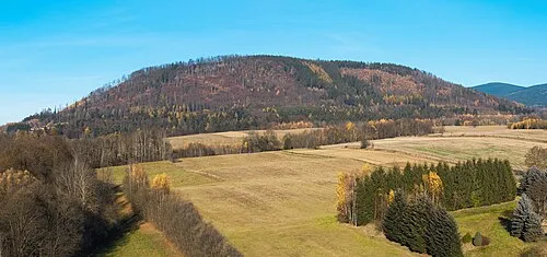
Podhoří Mountain, Orlické Podhůří
-
Studený Mountain, Studené
-
Vysoký Kámen Mountain, Mladkov
-
Hled'sebe Mountain, Dolní Morava
-
Bouda Mountain, Těchonín
Nearby attractions & nature
Everything nearby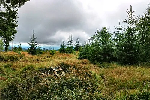
Sources & licences
Data last updated: