Dlouhá Třebová
Located in Ústí nad Orlicí District, Pardubice Region Coordinates: 49°56′30″ N 16°26′15″ E
- Elevation
- 404 m
- above sea level
- Local time
- UTC+01:00
- Europe/Prague · UTC+01:00
- Places inside
- 1
- listed under Dlouhá Třebová
- Airports
- PED Pardubice Airport51 km
- BRQ Brno-Tuřany Airport90 km
About Dlouhá Třebová
Dlouhá Třebová is a municipality. Location: Ústí nad Orlicí District, Pardubice Region. Elevation: 404 m. The best months to visit are June–August. The nearest airport is Pardubice Airport (51 km). Nearby sights include Kubincův kopec and Šuráňkův Kopec.
Photos of Dlouhá Třebová
-
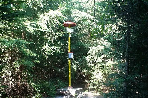
Palice Aeromix · CC BY 3.0 -
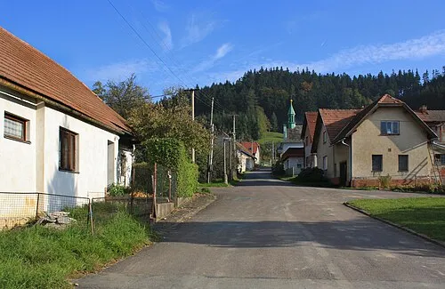
Podhoří This file is available under Creative Commons BY-SA license . Basically: You can use this picture for any purpose, provi · CC BY-SA 3.0


Climate of Dlouhá Třebová
Best months for sightseeingBest months for sightseeing: June–August.
This month · November
A cold month
Day 5° · Night 0° · Rain 36 mm
- Hottest month
- August (day 23°)
- Coldest month
- January (night -5°)
- Wettest month
- June (87 mm)
- Driest month
- January (24 mm)
Bars: average monthly low and high temperature. Below: precipitation. Monthly averages for 1970–2000 at about 18 km resolution, adjusted for elevation. Highlighted months are mild and relatively dry. Source: WorldClim 2.1 (CC BY 4.0).
Show values as a table
| Month | Jan | Feb | Mar | Apr | May | Jun | Jul | Aug | Sep | Oct | Nov | Dec |
|---|---|---|---|---|---|---|---|---|---|---|---|---|
| Average high (°C) | 1° | 2° | 7° | 12° | 18° | 21° | 23° | 23° | 18° | 12° | 5° | 2° |
| Average low (°C) | -5° | -4° | -1° | 2° | 7° | 10° | 11° | 11° | 8° | 4° | 0° | -3° |
| Precipitation (mm) | 24 | 24 | 29 | 36 | 62 | 87 | 83 | 68 | 47 | 35 | 36 | 30 |
How to get to Dlouhá Třebová
The nearest airport is Pardubice Airport (PED), 51 km to the west as the crow flies. The nearest large city is Brno, 84 km to the south.
Airports
- Pardubice Airport (PED) Pardubice 51 kmwest
- Brno-Tuřany Airport (BRQ) Brno 90 kmsouth
- Leoš Janáček Airport Ostrava (OSR) Mošnov 123 kmeast
Nearby large cities
- Brno Population: 404.3K 84 kmsouth
- Prague Population: 1.2M 145 kmwest
- Bratislava Population: 423.7K 205 kmsouth
- Dresden Population: 564.9K 228 kmnorthwest
- Linz Population: 204.8K 240 kmsouthwest
Straight-line distances; road distances are longer. Airport data: OurAirports.
Day trips from Dlouhá Třebová
Within 100 km: 41 historic and cultural sites, 713 natural sites.
0–25 km29 places
- Zahořanský Kopec Mountain 16 kmW
- Vysoký Kámen Mountain 22 kmNE
- Velká Suchá Mountain 21 kmN
- Šuráňkův Kopec Mountain 6 kmW
25–60 km250 places
- Sucha Kopa Mountain 49 kmNE
- Úsobrnka Natural site 48 kmSE
- Goworek Mountain 38 kmNE
- Ptak Mountain 58 kmN
60–100 km475 places
- Královský vršek Mountain 85 kmSW
- Hořánck Mountain 85 kmW
- Leszek Mountain 67 kmN
- Czuba Mountain 93 kmN
Straight-line distances.
Places in Dlouhá Třebová
1 placeBar: population relative to the most populous place in this list.
Nearby attractions & nature
Everything nearby-
Kubincův kopec Mountain, Ústí nad Orlicí6.1 km NW
-
Šuráňkův Kopec Mountain, Sloupnice6.4 km W
-
Podhoří Mountain, Orlické Podhůří7.3 km NW
-
Palice Mountain, Česká Třebová6.5 km SE
-
U Končin Mountain, Litomyšl11 km SW
-
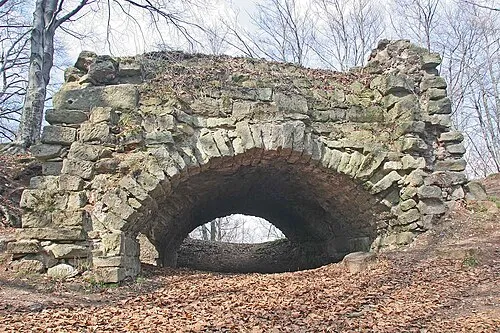 Žampach Mountain, Žampach11 km N
-
Hliník Mountain, Orlické Podhůří11 km NW
-
Havranův kopec Mountain, Sedliště12 km W
Sources & licences
Data last updated: