Poběžovice
Located in Domažlice District, Plzeň Region Coordinates: 49°30′43″ N 12°48′04″ E
- Elevation
- 436 m
- above sea level
- Local time
- UTC+01:00
- Europe/Prague · UTC+01:00
- Places inside
- 1
- listed under Poběžovice
- Airports
- KLV Karlovy Vary Airport77 km
- PRG Václav Havel Airport Prague124 km
About Poběžovice
Poběžovice is a municipality. Location: Domažlice District, Plzeň Region. Elevation: 436 m. The best months to visit are June–August. The nearest airport is Karlovy Vary Airport (77 km). Nearby sights include Starý Herštejn and Lysá [Mnichov-Pivoň].
Photos of Poběžovice
-
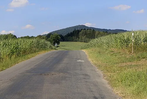
Starý Herštejn Pavel Hrdlička · CC BY-SA 4.0

Climate of Poběžovice
Best months for sightseeingBest months for sightseeing: June–August.
This month · November
A cold month
Day 6° · Night 0° · Rain 48 mm
- Hottest month
- July (day 22°)
- Coldest month
- February (night -4°)
- Wettest month
- July (93 mm)
- Driest month
- February (44 mm)
Bars: average monthly low and high temperature. Below: precipitation. Monthly averages for 1970–2000 at about 18 km resolution, adjusted for elevation. Highlighted months are mild and relatively dry. Source: WorldClim 2.1 (CC BY 4.0).
Show values as a table
| Month | Jan | Feb | Mar | Apr | May | Jun | Jul | Aug | Sep | Oct | Nov | Dec |
|---|---|---|---|---|---|---|---|---|---|---|---|---|
| Average high (°C) | 2° | 3° | 7° | 12° | 18° | 20° | 22° | 22° | 18° | 12° | 6° | 2° |
| Average low (°C) | -4° | -4° | -1° | 2° | 7° | 10° | 12° | 11° | 8° | 4° | 0° | -3° |
| Precipitation (mm) | 52 | 44 | 48 | 44 | 61 | 82 | 93 | 77 | 59 | 56 | 48 | 61 |
How to get to Poběžovice
The nearest airport is Karlovy Vary Airport (KLV), 77 km to the north as the crow flies. The nearest large city is Regensburg, 75 km to the southwest.
Airports
- Karlovy Vary Airport (KLV) Karlovy Vary 77 kmnorth
- Václav Havel Airport Prague (PRG) Prague 124 kmnortheast
- Nuremberg Airport (NUE) Nuremberg 125 kmwest
Nearby large cities
- Regensburg Population: 151.4K 75 kmsouthwest
- Nuremberg Population: 515.5K 125 kmwest
- Erlangen Population: 102.7K 130 kmwest
- Ingolstadt Population: 120.7K 130 kmsouthwest
- Fürth Population: 132K 131 kmwest
Straight-line distances; road distances are longer. Airport data: OurAirports.
Day trips from Poběžovice
Within 100 km: 175 historic and cultural sites, 1,670 natural sites, 318 lakes, rivers and coasts.
0–25 km107 places
- Drachensee Lake 23 kmS
- Haidberg Mountain 17 kmSW
- Breselberg Mountain 20 kmSW
- Dieberg Mountain 21 kmS
25–60 km622 places
- Biber-Revier River 37 kmS
- Bohemian Forest Mountain 59 kmS
- Český Les Mountain 28 kmNW
- Unterer Markweiher Lake 55 kmSW
60–100 km1,434 places
- Spitzelberg Mountain 98 kmW
- Deckersberg Mountain 97 kmW
- Stoličná Mountain 95 kmN
- Pláň Mountain 94 kmN
Straight-line distances.
Places in Poběžovice
1 placeBar: population relative to the most populous place in this list.
Nearby attractions & nature
Everything nearby-
Starý Herštejn Mountain, Mnichov7.7 km SW
-
Lysá [Mnichov-Pivoň] Mountain, Nemanice6.5 km SW
-
Škarmanka Mountain, Postřekov7.4 km SW
-
Bezvěrovský vrch Mountain, Mutěnín7.9 km NW
-
Lískovec Mountain, Bělá nad Radbuzou8 km NW
-
Kamenec Mountain, Mutěnín8 km NW
-
Haltrava Mountain, Postřekov8.2 km S
-
Sádek Mountain, Klenčí pod Čerchovem9.3 km S
Sources & licences
Data last updated: