Chudenín
Located in Klatovy District, Plzeň Region Coordinates: 49°17′03″ N 13°04′53″ E
- Elevation
- 506 m
- above sea level
- Local time
- UTC+01:00
- Europe/Prague · UTC+01:00
- Places inside
- 7
- listed under Chudenín
- Airports
- KLV Karlovy Vary Airport103 km
- JCL České Budějovice South Bohemian Airport105 km
About Chudenín
Chudenín is a municipality. Location: Klatovy District, Plzeň Region. Elevation: 506 m. The best months to visit are June–August. The nearest airport is Karlovy Vary Airport (103 km). Nearby sights include Jezvinec and Stangenruck.
Climate of Chudenín
Best months for sightseeingBest months for sightseeing: June–August.
This month · November
A cold month
Day 6° · Night 0° · Rain 73 mm
- Hottest month
- July (day 22°)
- Coldest month
- January (night -5°)
- Wettest month
- July (116 mm)
- Driest month
- April (57 mm)
Bars: average monthly low and high temperature. Below: precipitation. Monthly averages for 1970–2000 at about 18 km resolution, adjusted for elevation. Highlighted months are mild and relatively dry. Source: WorldClim 2.1 (CC BY 4.0).
Show values as a table
| Month | Jan | Feb | Mar | Apr | May | Jun | Jul | Aug | Sep | Oct | Nov | Dec |
|---|---|---|---|---|---|---|---|---|---|---|---|---|
| Average high (°C) | 2° | 3° | 7° | 11° | 17° | 20° | 22° | 22° | 17° | 12° | 6° | 2° |
| Average low (°C) | -5° | -4° | -1° | 2° | 6° | 10° | 11° | 11° | 8° | 3° | 0° | -3° |
| Precipitation (mm) | 81 | 63 | 72 | 57 | 76 | 100 | 116 | 92 | 76 | 72 | 73 | 95 |
How to get to Chudenín
The nearest airport is Karlovy Vary Airport (KLV), 103 km to the north as the crow flies. The nearest large city is Regensburg, 77 km to the west.
Airports
- Karlovy Vary Airport (KLV) Karlovy Vary 103 kmnorth
- České Budějovice South Bohemian Airport (JCL) České Budějovice 105 kmeast
- Václav Havel Airport Prague (PRG) Prague 124 kmnortheast
Nearby large cities
- Regensburg Population: 151.4K 77 kmwest
- Prague Population: 1.2M 132 kmnortheast
- Ingolstadt Population: 120.7K 134 kmsouthwest
- Linz Population: 204.8K 140 kmsoutheast
- Nuremberg Population: 515.5K 147 kmwest
Straight-line distances; road distances are longer. Airport data: OurAirports.
Places in Chudenín
7 placesBar: population relative to the most populous place in this list.
Cities & villages1
- Červené Dřevo · Village
Mountains & nature3
- Hoher Stein · Mountain
- Kameňák · Mountain
- Lišák · Mountain
Nearby attractions & nature
Everything nearby-
Jezvinec Mountain, Pocinovice4.3 km N
-
Stangenruck Mountain, Germany3.5 km W
-
Bohemian Forest Mountain, Czechia6 km S
-
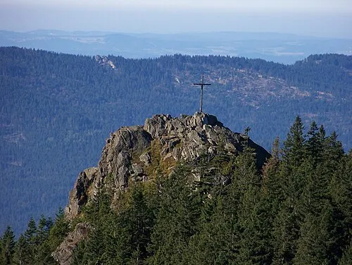 Kleiner Osser Mountain, Lam, Markt9.3 km S
-
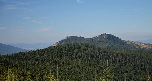 Osser Mountain, Lam, Markt9.2 km S
-
Lovečná Mountain, Hamry7.8 km S
-
Jägerhübel Mountain, Germany7.9 km S
-
Helm Wald Natural site, Bavaria6.5 km S
Sources & licences
Data last updated: