Horní Planá
Located in Cesky Krumlov, South Bohemian Region Coordinates: 48°45′42″ N 14°01′06″ E
- Elevation
- 725 m
- above sea level
- Local time
- UTC+01:00
- Europe/Prague · UTC+01:00
- Places inside
- 5
- listed under Horní Planá
- Airports
- JCL České Budějovice South Bohemian Airport37 km
- LNZ Linz-Hörsching Airport60 km
About Horní Planá
Horní Planá is a municipality. Location: Cesky Krumlov, South Bohemian Region. Elevation: 725 m. The best months to visit are June–August. The nearest airport is České Budějovice South Bohemian Airport (37 km). Nearby sights include Sulzberg and Bärenstein.
Photos of Horní Planá
-
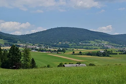
Sulzberg Haeferl · CC BY-SA 4.0 -
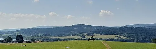
Lhotský vrch Kvetinka48 · CC BY-SA 4.0


Climate of Horní Planá
Best months for sightseeingBest months for sightseeing: June–August.
This month · November
A cold month
Day 5° · Night -1° · Rain 79 mm
- Hottest month
- July (day 21°)
- Coldest month
- January (night -6°)
- Wettest month
- July (127 mm)
- Driest month
- April (69 mm)
Bars: average monthly low and high temperature. Below: precipitation. Monthly averages for 1970–2000 at about 18 km resolution, adjusted for elevation. Highlighted months are mild and relatively dry. Source: WorldClim 2.1 (CC BY 4.0).
Show values as a table
| Month | Jan | Feb | Mar | Apr | May | Jun | Jul | Aug | Sep | Oct | Nov | Dec |
|---|---|---|---|---|---|---|---|---|---|---|---|---|
| Average high (°C) | 1° | 2° | 6° | 11° | 16° | 19° | 21° | 21° | 17° | 12° | 5° | 2° |
| Average low (°C) | -6° | -5° | -2° | 1° | 6° | 9° | 11° | 11° | 7° | 3° | -1° | -4° |
| Precipitation (mm) | 82 | 70 | 79 | 69 | 83 | 111 | 127 | 99 | 82 | 69 | 79 | 97 |
How to get to Horní Planá
The nearest airport is České Budějovice South Bohemian Airport (JCL), 37 km to the northeast as the crow flies. The nearest large city is Linz, 54 km to the south.
Airports
- České Budějovice South Bohemian Airport (JCL) České Budějovice 37 kmnortheast
- Linz-Hörsching Airport (LNZ) Linz 60 kmsouth
- Salzburg Airport (SZG) Salzburg 131 kmsouthwest
Nearby large cities
- Linz Population: 204.8K 54 kmsouth
- Salzburg Population: 157.2K 129 kmsouthwest
- Regensburg Population: 151.4K 143 kmwest
- Prague Population: 1.2M 150 kmnorth
- Ingolstadt Population: 120.7K 191 kmwest
Straight-line distances; road distances are longer. Airport data: OurAirports.
Day trips from Horní Planá
Within 100 km: 132 historic and cultural sites, 845 natural sites, 335 lakes, rivers and coasts.
0–25 km84 places
- Teufelsschüssel Mountain 14 kmW
- Zwiesel Berg Mountain 12 kmW
- Hochbühel Mountain 16 kmSW
- Hirschenstein Mountain 25 kmSE
25–60 km420 places
- Unter-Rosenhofer Teich Lake 54 kmSE
- Ober-Rosenhofer Teich Lake 53 kmSE
- Rannasee Lake 31 kmSW
- Zeissberg Mountain 46 kmSE
60–100 km808 places
- Biber-Revier River 89 kmNW
- Gusen I Concentration Camp Historic site 65 kmSE
- Laudachsee Lake 99 kmS
- Kranbühel Mountain 97 kmE
Straight-line distances.
Places in Horní Planá
5 places
Bližší Lhota
Population: 2.9K
Horní Planá
Population: 1.9K

Hůrka
Population: 300

Žlábek
Population: 256
-
Nearby attractions & nature
Everything nearby-
Sulzberg Mountain, Ulrichsberg7.7 km SW
-
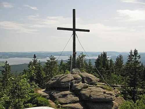 Bärenstein Mountain, Ulrichsberg9.1 km S
-
Kozí stráň [Černá v Pošumaví-Kyselov] Mountain, Aigen-Schlägl7.5 km S
-
Aussichtsturm Moldaublick Landmark, Ulrichsberg7.4 km SW
-
Smrčina [Horní Planá] Mountain, Klaffer am Hochficht7.7 km W
-
Hochficht Mountain, Klaffer am Hochficht8.1 km SW
-
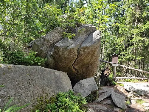 Perník Mountain, Stožec11 km NW
-
Hraničník [Nová Pec] Mountain, Rohrbach district8.4 km W
Sources & licences
Data last updated: