- Elevation
- 440 m
- above sea level
- Local time
- UTC+01:00
- Europe/Prague · UTC+01:00
- Airports
- JCL České Budějovice South Bohemian Airport31 km
- PRG Václav Havel Airport Prague103 km
About Panský Kopec
Panský Kopec is a mountain. Location: Mažice, Tábor District. Elevation: 440 m. The best months to visit are June–September. The nearest airport is České Budějovice South Bohemian Airport (31 km). Nearby sights include Velký Kameník and Račicky.
Climate of Panský Kopec
Best months for sightseeingBest months for sightseeing: June–September.
This month · November
A cold month
Day 6° · Night 0° · Rain 44 mm
- Hottest month
- August (day 24°)
- Coldest month
- January (night -4°)
- Wettest month
- July (86 mm)
- Driest month
- February (33 mm)
Bars: average monthly low and high temperature. Below: precipitation. Monthly averages for 1970–2000 at about 18 km resolution, adjusted for elevation. Highlighted months are mild and relatively dry. Source: WorldClim 2.1 (CC BY 4.0).
Show values as a table
| Month | Jan | Feb | Mar | Apr | May | Jun | Jul | Aug | Sep | Oct | Nov | Dec |
|---|---|---|---|---|---|---|---|---|---|---|---|---|
| Average high (°C) | 1° | 3° | 8° | 13° | 19° | 22° | 24° | 24° | 18° | 12° | 6° | 2° |
| Average low (°C) | -4° | -4° | -1° | 3° | 8° | 11° | 13° | 12° | 8° | 4° | 0° | -3° |
| Precipitation (mm) | 37 | 33 | 41 | 44 | 67 | 81 | 86 | 70 | 49 | 40 | 44 | 44 |
Other places to visit in this season: June July August September
How to get to Panský Kopec
The nearest airport is České Budějovice South Bohemian Airport (JCL), 31 km to the southwest as the crow flies. The nearest large city is Prague, 100 km to the north.
Airports
- České Budějovice South Bohemian Airport (JCL) České Budějovice 31 kmsouthwest
- Václav Havel Airport Prague (PRG) Prague 103 kmnorth
- Linz-Hörsching Airport (LNZ) Linz 112 kmsouth
Nearby large cities
- Prague Population: 1.2M 100 kmnorth
- Linz Population: 204.8K 102 kmsouth
- Brno Population: 404.3K 145 kmeast
- Regensburg Population: 151.4K 184 kmwest
- Salzburg Population: 157.2K 194 kmsouthwest
Straight-line distances; road distances are longer. Airport data: OurAirports.
Day trips from Panský Kopec
Within 100 km: 56 historic and cultural sites, 945 natural sites, 215 lakes, rivers and coasts.
0–25 km6 places
- Zdoba Mountain 20 kmW
- Větrník Mountain 20 kmS
- Velký Kameník Mountain 17 kmSW
- Račicky Mountain 20 kmSW
25–60 km276 places
- Hutbühel Mountain 58 kmSE
- Steinberg Mountain 60 kmSE
- Hoher Stein Mountain 55 kmSE
- Steinbühel Mountain 45 kmSE
60–100 km934 places
- Královský vršek Mountain 75 kmE
- Unter-Rosenhofer Teich Lake 71 kmS
- Ober-Rosenhofer Teich Lake 71 kmS
- Rannasee Lake 96 kmSW
Straight-line distances.
Nearest towns and villages


Nearby attractions & nature
Everything nearby-
Velký Kameník Mountain, Hluboká nad Vltavou17 km SW
-
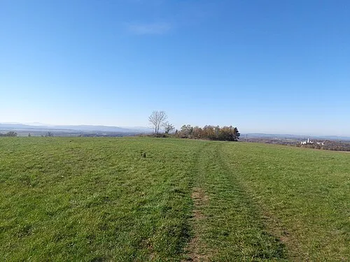 Račicky Mountain, Hosín20 km SW
-
Chlum [Pleše]outlook p. Mountain, Pleše15 km E
-
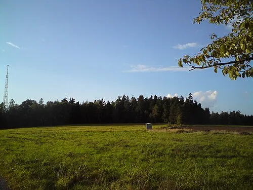 Větrník Mountain, Lišov20 km S
-
Babina [Bechyně-Hvožďany] Mountain, Bechyně17 km NW
-
Zdoba Mountain, Všemyslice20 km W
Sources & licences
Data last updated: · 2 independent sources