Radonín
Located in Žďár nad Sázavou, Žďár nad Sázavou District Coordinates: 49°32′41″ N 15°55′57″ E

- Population
- 125
- 125
- Elevation
- 579 m
- above sea level
- Local time
- UTC+01:00
- Europe/Prague · UTC+01:00
- Airports
- PED Pardubice Airport54 km
- BRQ Brno-Tuřany Airport71 km
About Radonín
Radonín is a village. Location: Žďár nad Sázavou, Žďár nad Sázavou District. Population: 125. Elevation: 579 m.
Radonín (German: Radonin) is a village and municipal part of Žďár nad Sázavou in Žďár nad Sázavou District in the Vysočina Region of the Czech Republic. It has about 60 inhabitants. It is located in the southern part of the town's territory.
Source: Wikipedia · CC BY-SA 4.0
At a glance
- Area
- 91 ha
Source: Wikidata
Photos of Radonín
-

Tomáš Tichý · CC BY-SA 3.0 -

Tomáš Tichý · CC BY-SA 3.0


Population of Radonín over time
| 1900 | 105 | |
|---|---|---|
| 1910 | 109 | |
| 1921 | 88 | |
| 1930 | 98 | |
| 1950 | 50 | |
| 1961 | 58 | |
| 1970 | 63 | |
| 1980 | 72 | |
| 1991 | 80 | |
| 2001 | 71 | |
| 2011 | 66 | |
| 2021 | 63 |
Censuses and official estimates; source: Wikidata.
Climate of Radonín
Best months for sightseeingBest months for sightseeing: June–August.
This month · November
A cold month
Day 4° · Night -1° · Rain 40 mm
- Hottest month
- August (day 22°)
- Coldest month
- January (night -5°)
- Wettest month
- June (86 mm)
- Driest month
- January (27 mm)
Bars: average monthly low and high temperature. Below: precipitation. Monthly averages for 1970–2000 at about 18 km resolution, adjusted for elevation. Highlighted months are mild and relatively dry. Source: WorldClim 2.1 (CC BY 4.0).
Show values as a table
| Month | Jan | Feb | Mar | Apr | May | Jun | Jul | Aug | Sep | Oct | Nov | Dec |
|---|---|---|---|---|---|---|---|---|---|---|---|---|
| Average high (°C) | 0° | 1° | 6° | 11° | 17° | 20° | 21° | 22° | 17° | 11° | 4° | 1° |
| Average low (°C) | -5° | -5° | -2° | 2° | 6° | 9° | 11° | 10° | 8° | 4° | -1° | -4° |
| Precipitation (mm) | 27 | 27 | 33 | 41 | 64 | 86 | 82 | 69 | 48 | 36 | 40 | 34 |
How to get to Radonín
The nearest airport is Pardubice Airport (PED), 54 km to the north as the crow flies. The nearest large city is Brno, 63 km to the southeast.
Airports
- Pardubice Airport (PED) Pardubice 54 kmnorth
- Brno-Tuřany Airport (BRQ) Brno 71 kmsoutheast
- České Budějovice South Bohemian Airport (JCL) České Budějovice 128 kmsouthwest
Nearby large cities
- Brno Population: 404.3K 63 kmsoutheast
- Prague Population: 1.2M 124 kmnorthwest
- Bratislava Population: 423.7K 178 kmsoutheast
- Linz Population: 204.8K 183 kmsouthwest
- Dresden Population: 564.9K 229 kmnorthwest
Straight-line distances; road distances are longer. Airport data: OurAirports.
Day trips from Radonín
Within 100 km: 50 historic and cultural sites, 976 natural sites, 136 lakes, rivers and coasts.
0–25 km17 places
- Šibenice Mountain 9 kmS
- Pohledecká Skála Mountain 15 kmE
- Kříby Mountain 12 kmNE
- Hradiště Mountain 24 kmS
25–60 km336 places
- Královský vršek Mountain 29 kmSW
- Seč Mountain 48 kmSW
- Zlobica Mountain 49 kmSE
- Zahořanský Kopec Mountain 45 kmNE
60–100 km809 places
- Kranbühel Mountain 87 kmSW
- Hutbühel Mountain 92 kmSW
- Geißbühel Mountain 92 kmSW
- Steinberg Mountain 87 kmS
Straight-line distances.
Nearby attractions & nature
Everything nearby-
Šibenice Mountain, Radostín nad Oslavou8.6 km S
-
Pořežínský kopec Mountain, Velká Losenice10 km NW
-
Dědkovská hora Mountain, Blízkov13 km S
-
Kříby Mountain, Nové Město na Moravě12 km NE
-
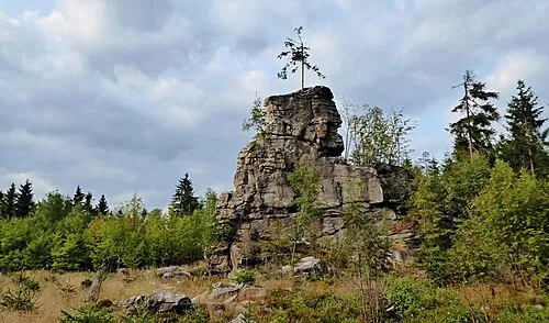 Pohledecká Skála Mountain, Nové Město na Moravě15 km E
-
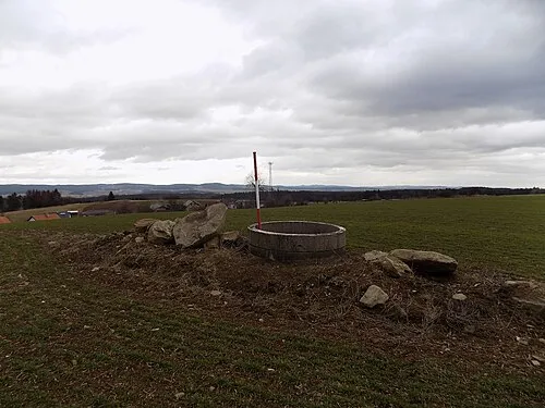 Řehořovský vrch Mountain, Kamenice20 km SW
Other cities and towns in Žďár nad Sázavou


Sources & licences
Data last updated: · 2 independent sources