- Elevation
- 735 m
- above sea level
- Local time
- UTC+01:00
- Europe/Prague · UTC+01:00
- Airports
- OSR Leoš Janáček Airport Ostrava55 km
- BRQ Brno-Tuřany Airport92 km
About Svéradov
Svéradov is a mountain. Location: Pozděchov, Vsetín District. Elevation: 735 m. The best months to visit are June–August. The nearest airport is Leoš Janáček Airport Ostrava (55 km). Nearby sights include Kláštov and Suchý vrch [Újezd u Valašských Klobouk].
Climate of Svéradov
Best months for sightseeingBest months for sightseeing: June–August.
This month · November
A cold month
Day 3° · Night -2° · Rain 55 mm
- Hottest month
- July (day 21°)
- Coldest month
- January (night -7°)
- Wettest month
- June (105 mm)
- Driest month
- January (36 mm)
Bars: average monthly low and high temperature. Below: precipitation. Monthly averages for 1970–2000 at about 18 km resolution, adjusted for elevation. Highlighted months are mild and relatively dry. Source: WorldClim 2.1 (CC BY 4.0).
Show values as a table
| Month | Jan | Feb | Mar | Apr | May | Jun | Jul | Aug | Sep | Oct | Nov | Dec |
|---|---|---|---|---|---|---|---|---|---|---|---|---|
| Average high (°C) | -1° | 0° | 5° | 10° | 16° | 19° | 21° | 20° | 16° | 10° | 3° | 0° |
| Average low (°C) | -7° | -7° | -3° | 0° | 5° | 8° | 10° | 9° | 6° | 2° | -2° | -6° |
| Precipitation (mm) | 36 | 37 | 38 | 53 | 83 | 105 | 91 | 91 | 67 | 48 | 55 | 52 |
How to get to Svéradov
The nearest airport is Leoš Janáček Airport Ostrava (OSR), 55 km to the north as the crow flies. The nearest large city is Brno, 98 km to the west.
Airports
- Leoš Janáček Airport Ostrava (OSR) Mošnov 55 kmnorth
- Brno-Tuřany Airport (BRQ) Brno 92 kmwest
- Sliač Airport (SLD) Sliač 108 kmsoutheast
Nearby large cities
- Brno Population: 404.3K 98 kmwest
- Győr Population: 129.3K 172 kmsouth
- Székesfehérvár Population: 101.6K 228 kmsouth
- Miskolc Population: 154.5K 242 kmsoutheast
- Prague Population: 1.2M 273 kmwest
Straight-line distances; road distances are longer. Airport data: OurAirports.
Nearest towns and villages
Nearby attractions & nature
Everything nearby-
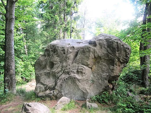 Kláštov Mountain, Vysoké Pole1.4 km SW
-
Suchý vrch [Újezd u Valašských Klobouk] Mountain, Vysoké Pole4.1 km SW
-
Vrchkopec [Lidečko] Mountain, Lidečko6.1 km E
-
Kobylinec Mountain, Vlachova Lhota6.6 km S
-
Dúbrava Mountain, Loučka6.9 km SW
-
Kopřivná Mountain, Všemina10 km NW
-
Cubek Mountain, Střelná11 km E
-
Rubaný Háj Mountain, Křekov11 km S
Sources & licences
Data last updated: · 2 independent sources