Aeroe
Located in Ærø Kommune, Region South Denmark Coordinates: 54°53′00″ N 10°20′00″ E
- Elevation
- 45 m
- above sea level
- Local time
- UTC+01:00
- Europe/Copenhagen · UTC+01:00
- Population
- 6,170
- 6.2K
About Aeroe
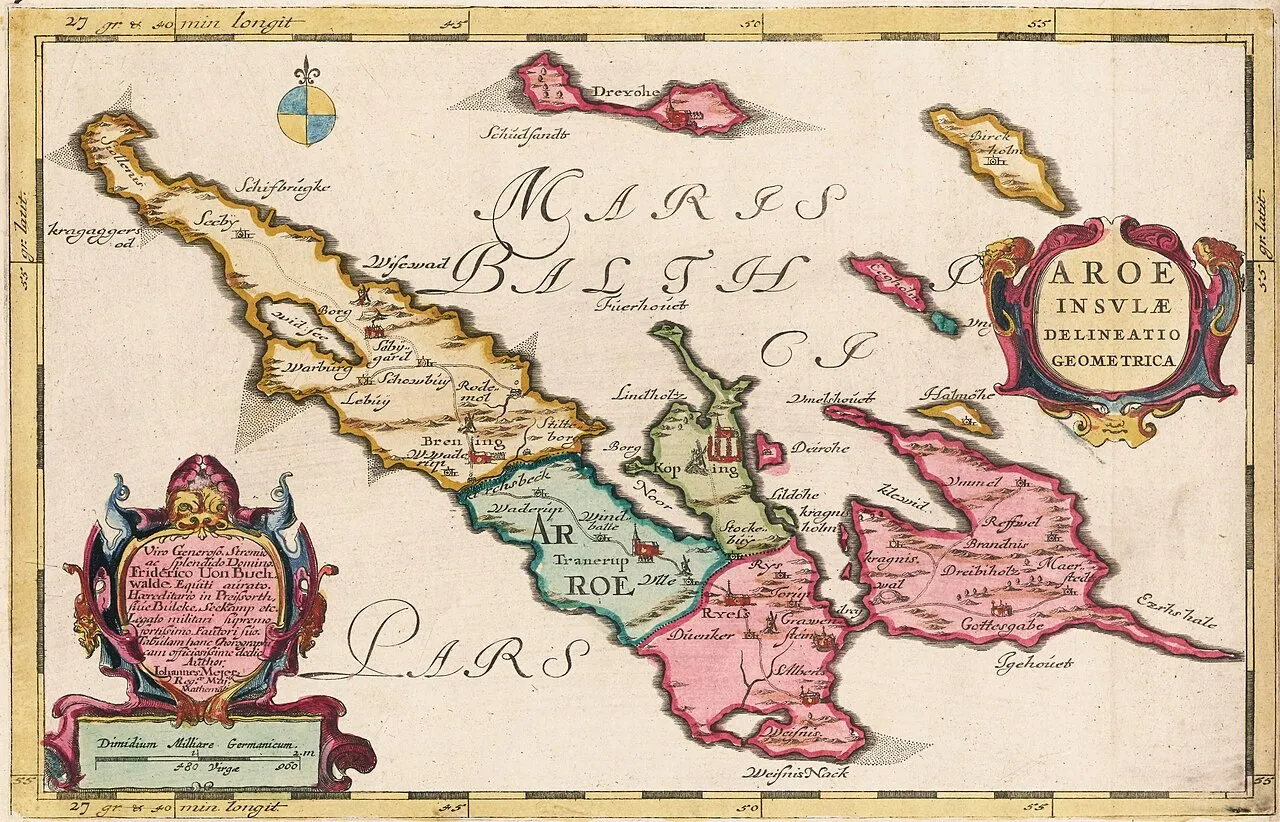
Aeroe is an island. Location: Ærø Kommune, Region South Denmark. Population: 6,170.
Ærø (Danish pronunciation: [ˈeːˌʁøˀ]) is one of the Danish Baltic Sea islands, and part of the Southern Denmark Region. Since 1 January 2006 all of Ærø has constituted a single municipality, known as Ærø Kommune. Before that date, there were two municipalities on the island: Ærøskøbing Kommune in the west and Marstal Kommune in the east. This merger was part of a reform of the public sector with the laws being effective as of 26 June 2005.
Read more on Wikipedia Text: Wikipedia contributors · CC BY-SA 4.0 · shortened
At a glance
- Length
- 30 km
- Area
- 88 km²
Source: Wikidata
In comparison
- 2 sights and natural places within 10 km Synneshøj, Vorbjerg
Climate of Aeroe
Best months for sightseeing: June–August.
| Month | Jan | Feb | Mar | Apr | May | Jun | Jul | Aug | Sep | Oct | Nov | Dec |
|---|---|---|---|---|---|---|---|---|---|---|---|---|
| Average high (°C) | 3° | 3° | 5° | 9° | 14° | 18° | 20° | 20° | 16° | 12° | 7° | 5° |
| Average low (°C) | -1° | -1° | 0° | 3° | 7° | 11° | 13° | 13° | 11° | 7° | 4° | 1° |
| Precipitation (mm) | 56 | 42 | 51 | 37 | 46 | 57 | 69 | 70 | 61 | 65 | 66 | 57 |
Monthly averages for 1970–2000 at about 18 km resolution, adjusted for elevation. Highlighted months are mild and relatively dry. Source: WorldClim 2.1 (CC BY 4.0).
Airports nearest to Aeroe
- Sønderborg Airport (SGD) Sønderborg 36 km
- Odense Hans Christian Andersen Airport (ODE) Odense 66 km
- Billund Airport (BLL) Billund 121 km
Straight-line distance; airports with scheduled flights only. Source: OurAirports (public domain).
Nearest towns and villages
Nearby attractions & nature
Everything nearby-
Synneshøj Mountain, Ærø Kommune1.9 km NW
-
Vorbjerg Mountain, Ærø Kommune5.8 km E
-
Halmø Island, Ærø Kommune10 km E
-
Lille Egholm Island, Ærø Kommune11 km E
-
Skovlandet Natural site, Ærø Kommune11 km E
-
Mejlholm Island, Svendborg Kommune15 km NE
-
Odden Island, Svendborg Kommune15 km NE
-
Bredholm Island, Langeland Kommune14 km E
Sources & licences
Data last updated: · 2 independent sources