Rudkøbing
Located in Langeland Kommune, Region South Denmark Coordinates: 54°56′11″ N 10°42′37″ E
- Population
- 4,521
- 4.5K
- Elevation
- 10 m
- above sea level
- Local time
- UTC+01:00
- Europe/Copenhagen · UTC+01:00
- Airports
- SGD Sønderborg Airport59 km
- ODE Odense Hans Christian Andersen Airport65 km
About Rudkøbing
Rudkøbing is a city. Location: Langeland Kommune, Region South Denmark. Population: 4,521. Elevation: 10 m.
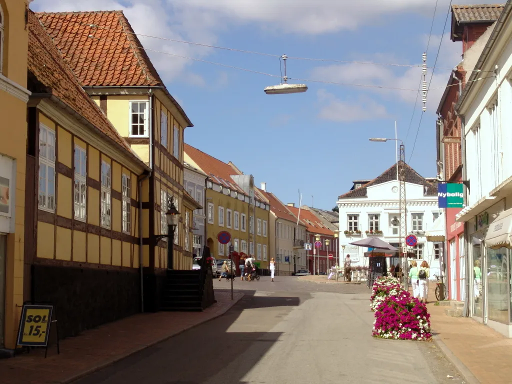
Rudkøbing is a town in Denmark, on the western coast of the island of Langeland. It is the seat of Langeland Municipality, in the Southern Denmark Region. The town is located 15 kilometres (9.3 mi) southeast of Svendborg and is connected to Siø through the Siøsund Bridge.
Source: Wikipedia · CC BY-SA 4.0
Photos of Rudkøbing
-

Jonadrews · CC BY-SA 4.0 -

Jonadrews · CC BY-SA 4.0 -

Toxophilus · CC BY-SA 4.0 -

Praeceptor · CC BY-SA 3.0 -

Peter Lorents Fangel · Public domain


Travel notes for Rudkøbing
From Wikivoyage
Langeland is an island in the South Funen Archipelago in southern Denmark, 50 kilometres from north to south, and home to about 12,000 people (2018). The island produces grain and is known as a recreational and wellness tourism area.
Understand+
Towns and villages:
1 Rudkøbing. The main town, with about 4500 inhabitants. Nice old town centre with small streets.
2 Spodsbjerg. A ferry harbour and beach on the east coast. Connected by ferry to Lolland.
3 Lohals.
4 Bagenkop.
Tourist information:
Langeland Tourism website
Get in+
Langeland is connected with bridges to Siø, Tåsinge, and Funen
By bus:
It takes around 30 minutes by bus from Svendborg to Rudkøbing with Fynbus lines 911-914 (912 stops at the ferry terminal). They leave around every 30 minutes during peak hours, and every hour in the evening.
By ferry:
1 Langelandslinjen Spodsbjerg-Tårs. Connects Langeland with Lolland 260 kr for a car. (updated Aug 2015)
2 Strynøfærgen. Connects Langeland with the small island Strynø 80 kr per passenger, 150 kr per car. (updated Aug 2015)
The port in Rudkøbing is open to both leisure sailors and commercial traffic, and there are regular ferries to Strynø and Marstal on Ærø. Look for Havnepladsen, 5900 Rudkøbing on your GPS if it doesn't include the harbour. Many buses stops at the ferry terminal as well.
3 Strynø (Strynø-Rudkøbing Færgefart), Kirkestrædet 1, Strynø, ☏ +45 62 51 51 00. 05:20-17:25. Passengers 70 kr, cars 140 kr.
4 Marstal (Ærøfærgerne), Vestergade 1A, Ærøskøbing, ☏ +45 62 52 40 00. 05:50-16:20. Passengers 104 kr, cars 227 kr.
Source: Wikivoyage · CC BY-SA 4.0 · abridged
Climate of Rudkøbing
Best months for sightseeingBest months for sightseeing: June–August.
This month · November
A cold month
Day 8° · Night 4° · Rain 63 mm
- Hottest month
- August (day 21°)
- Coldest month
- February (night -1°)
- Wettest month
- November (63 mm)
- Driest month
- February (32 mm)
Bars: average monthly low and high temperature. Below: precipitation. Monthly averages for 1970–2000 at about 18 km resolution, adjusted for elevation. Highlighted months are mild and relatively dry. Source: WorldClim 2.1 (CC BY 4.0).
Show values as a table
| Month | Jan | Feb | Mar | Apr | May | Jun | Jul | Aug | Sep | Oct | Nov | Dec |
|---|---|---|---|---|---|---|---|---|---|---|---|---|
| Average high (°C) | 3° | 3° | 6° | 10° | 15° | 18° | 21° | 21° | 17° | 12° | 8° | 4° |
| Average low (°C) | -1° | -1° | 1° | 3° | 8° | 11° | 13° | 14° | 11° | 8° | 4° | 1° |
| Precipitation (mm) | 45 | 32 | 35 | 35 | 42 | 51 | 60 | 54 | 55 | 55 | 63 | 48 |
How to get to Rudkøbing
The nearest airport is Sønderborg Airport (SGD), 59 km to the west as the crow flies. For international flights: Odense Hans Christian Andersen Airport (ODE) (65 km). The nearest large city is Odense, 55 km to the north.
Airports
- Sønderborg Airport (SGD) Sønderborg 59 kmwest
- Odense Hans Christian Andersen Airport (ODE) Odense 65 kmnorth
- Copenhagen Roskilde Airport (RKE) Roskilde 116 kmnortheast
Nearby large cities
- Odense Population: 180.9K 55 kmnorth
- Kiel Population: 252.7K 78 kmsouthwest
- Lübeck Population: 212.2K 119 kmsouth
- Rostock Population: 198.3K 132 kmsoutheast
- Aarhus Population: 285.3K 139 kmnorth
Straight-line distances; road distances are longer. Airport data: OurAirports.
Day trips from Rudkøbing
Within 100 km: 87 historic and cultural sites, 759 natural sites, 506 lakes, rivers and coasts.
0–25 km29 places
- Tåsinge Island 10 kmNW
- Aeroe Island 25 kmW
- Smørmosen Beach 12 kmN
- Slotø Island 25 kmSE
25–60 km107 places
- Als Island 51 kmW
- Fehmarn Island 59 kmSE
- Wormshöfter Noor Lake 54 kmSW
- Schwansener See Lake 58 kmSW
60–100 km1,216 places
- Sjælland Island 91 kmNE
- Falster Island 82 kmE
- Oxbek River 74 kmSW
- Spock River 94 kmSW
Straight-line distances.
Nearby attractions & nature
Everything nearby-
Lindø Island, Langeland Kommune6.4 km S
-
Oldenbjerg Mountain, Langeland Kommune6.6 km E
-
Vogterholm Island, Langeland Kommune7.8 km W
-
Bondeholm Island, Langeland Kommune8.4 km W
-
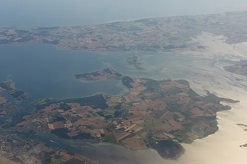 Tåsinge Island, Svendborg Kommune10 km NW
-
Ramshøj Mountain, Langeland Kommune12 km S
-
Bredholm Island, Langeland Kommune11 km W
-
Grensholm Island, Langeland Kommune11 km SW
Sources & licences
Data last updated: · 2 independent sources