Kolding Kommune
Located in Region South Denmark, Denmark Coordinates: 55°27′00″ N 9°27′29″ E
- Population
- 96,214
- 96.2K
- Elevation
- 50 m
- above sea level
- Local time
- UTC+01:00
- Europe/Copenhagen · UTC+01:00
- Places inside
- 14
- listed under Kolding Kommune
About Kolding Kommune
Kolding Kommune is a district. Location: Region South Denmark, Denmark. Population: 96,214.
In comparison
- Listed here: Village: 11, Attraction: 1, City: 1, Mountain: 1
Places in Kolding Kommune
14 places-
Kolding City61.6K
-
Vamdrup Village4.9K
-
Christiansfeld Village3K
-
Lunderskov Village2.7K
-
Sønder Bjert Village2.3K
-
Dons Village
-
Eltang Kirke Attraction
-
Højbjerg Mountain
-
Ødis Village
-
Sjølund Village
-
Skanderup Village
-
Sønder Stenderup Village
-
Taps Village
-
Viuf Village
Nearby attractions & nature
Everything nearby-
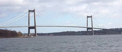 Little Belt Bridge Landmark, Region South Denmark20 km NE
-
Svinø Natural site, Middelfart Kommune21 km E
-
Elbo Dal Natural site, Fredericia Kommune18 km NE
-
Linderum Island, Haderslev Kommune24 km SE
Sources & licences
Data last updated: