Vejle Kommune
Located in Region South Denmark, Denmark Coordinates: 55°44′55″ N 9°24′15″ E
- Population
- 123,250
- 123.2K
- Elevation
- 92 m
- above sea level
- Local time
- UTC+01:00
- Europe/Copenhagen · UTC+01:00
- Places inside
- 18
- listed under Vejle Kommune
About Vejle Kommune
Vejle Kommune is a district. Location: Region South Denmark, Denmark. Population: 123,250.
In comparison
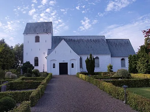
- 4 sights and natural places within 10 km Thyras Høj, Hover Kirke
- Listed here: Village: 9, Mountain: 5, Attraction: 1, City: 1
Places in Vejle Kommune
18 places-
Vejle City60.2K
-
Give Town5.2K
-
Jelling Village4K
-
Børkop Village3.6K
-
Egtved Village2.4K
-
Brejning Village2.2K
-
Bredsten Village1.9K
-
Andkær Village360
-
Bavnbjerg Mountain
-
Bredal Village
-
Givskud Village
-
Grejs Dal Natural site
-
Hathøj Mountain
-
Hover Kirke Attraction
-
Møllebjerg Mountain
-
Møllebjerg Mountain
-
Thyras Høj Mountain
-
Vandel Village
Nearby attractions & nature
Everything nearby-
Brohøj Mountain, Hedensted Kommune13 km E
-
Simmelbjerg Mountain, Billund Kommune19 km W
-
Brøndsø Banke Mountain, Billund Kommune22 km W
-
Brunbjerg Mountain, Billund Kommune23 km W
-
 Eltang Kirke Attraction, Kolding Kommune24 km S
-
Elbo Dal Natural site, Fredericia Kommune24 km SE
Sources & licences
Data last updated: