- Elevation
- 96 m
- above sea level
- Local time
- UTC+01:00
- Europe/Copenhagen · UTC+01:00
- Airports
- BLL Billund Airport15 km
- KRP Midtjyllands Airport / Air Base Karup56 km
About Givskud
Givskud is a village. Location: Vejle Kommune, Region South Denmark. Elevation: 96 m.
Givskud is a little town in southern Jutland with a population of 623 (1 January 2026). The town is located in Vejle Municipality in the Region of Southern Denmark. Other than Givskud Church it consisted of only a few farms, a school and a rectory in the 19th century. Later an inn was built. It was not until 1969 that the village really came into public attention.
Source: Wikipedia · CC BY-SA 4.0
Climate of Givskud
Best months for sightseeingBest months for sightseeing: June–August.
This month · November
A cold month
Day 7° · Night 2° · Rain 88 mm
- Hottest month
- August (day 20°)
- Coldest month
- February (night -4°)
- Wettest month
- November (88 mm)
- Driest month
- April (44 mm)
Bars: average monthly low and high temperature. Below: precipitation. Monthly averages for 1970–2000 at about 18 km resolution, adjusted for elevation. Highlighted months are mild and relatively dry. Source: WorldClim 2.1 (CC BY 4.0).
Show values as a table
| Month | Jan | Feb | Mar | Apr | May | Jun | Jul | Aug | Sep | Oct | Nov | Dec |
|---|---|---|---|---|---|---|---|---|---|---|---|---|
| Average high (°C) | 3° | 3° | 6° | 10° | 15° | 18° | 20° | 20° | 16° | 11° | 7° | 4° |
| Average low (°C) | -3° | -4° | -2° | 2° | 6° | 9° | 11° | 11° | 8° | 5° | 2° | -1° |
| Precipitation (mm) | 62 | 45 | 52 | 44 | 51 | 59 | 69 | 70 | 80 | 87 | 88 | 74 |
How to get to Givskud
The nearest airport is Billund Airport (BLL), 15 km to the southwest as the crow flies. The nearest large city is Aarhus, 66 km to the northeast.
Airports
- Billund Airport (BLL) Billund 15 kmsouthwest
- Midtjyllands Airport / Air Base Karup (KRP) Karup 56 kmnorth
- Esbjerg Airport (EBJ) Esbjerg 60 kmsouthwest
Nearby large cities
- Aarhus Population: 285.3K 66 kmnortheast
- Odense Population: 180.9K 80 kmsoutheast
- Aalborg Population: 142.9K 142 kmnorth
- Kiel Population: 252.7K 174 kmsouth
- Copenhagen Population: 1.2M 202 kmeast
Straight-line distances; road distances are longer. Airport data: OurAirports.
Day trips from Givskud
Within 100 km: 12 historic and cultural sites, 158 natural sites, 47 lakes, rivers and coasts.
0–25 km16 places
- Møllebjerg Mountain 9 kmSW
- Thyras Høj Mountain 9 kmSE
- Store Stendalhøj Mountain 23 kmNW
- Simmelbjerg Mountain 17 kmSW
25–60 km57 places
- Vorsø Kalv Island 40 kmE
- Ejlinge Island 58 kmSE
- Dræet Island 57 kmSE
- Borresknob Island 42 kmE
60–100 km144 places
- Als Island 99 kmS
- Fanø Island 74 kmSW
- Rindby Strand Beach 76 kmSW
- Taksensand Beach 98 kmSE
Straight-line distances.
Nearby attractions & nature
Everything nearby-
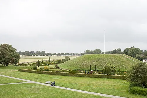 Thyras Høj Mountain, Vejle Kommune8.9 km SE
-
Møllebjerg Mountain, Vejle Kommune8.9 km SW
-
Grejs Dal Natural site, Vejle Kommune14 km SE
-
Bavnbjerg Mountain, Vejle Kommune15 km E
-
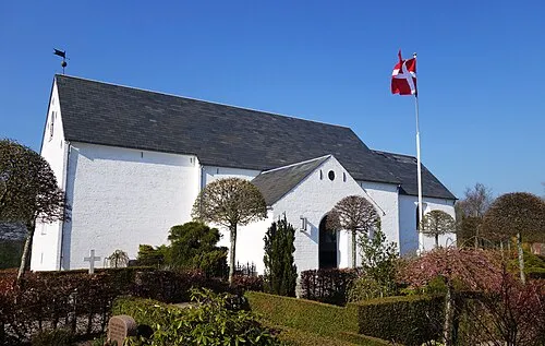 Hover Kirke Attraction, Vejle Kommune13 km SE
-
Møllebjerg Mountain, Vejle Kommune12 km NW
Sources & licences
Data last updated: · 2 independent sources