- Population
- 2,408
- 2.4K
- Elevation
- 61 m
- above sea level
- Local time
- UTC+01:00
- Europe/Copenhagen · UTC+01:00
- Airports
- BLL Billund Airport17 km
- EBJ Esbjerg Airport49 km
About Egtved
Egtved is a village. Location: Vejle Kommune, Region South Denmark. Population: 2,408. Elevation: 61 m.
Egtved is a village with a population of 2,408 (as of 1 January 2026) near Vejle, Denmark in Vejle municipality in the Danish Region of Southern Denmark. Nearby is Tørskind Gravel Pit, a sculpture park. The village has a Romanesque church built in 1170, to which a tower was added in 1863. The Egtved Runestone, found near the church in 1863, is now on display in the church.
Source: Wikipedia · CC BY-SA 4.0
Climate of Egtved
Best months for sightseeingBest months for sightseeing: June–August.
This month · November
A cold month
Day 7° · Night 2° · Rain 95 mm
- Hottest month
- August (day 20°)
- Coldest month
- February (night -3°)
- Wettest month
- November (95 mm)
- Driest month
- February (47 mm)
Bars: average monthly low and high temperature. Below: precipitation. Monthly averages for 1970–2000 at about 18 km resolution, adjusted for elevation. Highlighted months are mild and relatively dry. Source: WorldClim 2.1 (CC BY 4.0).
Show values as a table
| Month | Jan | Feb | Mar | Apr | May | Jun | Jul | Aug | Sep | Oct | Nov | Dec |
|---|---|---|---|---|---|---|---|---|---|---|---|---|
| Average high (°C) | 3° | 3° | 6° | 10° | 16° | 18° | 20° | 20° | 16° | 12° | 7° | 4° |
| Average low (°C) | -2° | -3° | -1° | 2° | 6° | 9° | 11° | 11° | 8° | 5° | 2° | -1° |
| Precipitation (mm) | 66 | 47 | 54 | 48 | 54 | 63 | 73 | 75 | 86 | 93 | 95 | 80 |
How to get to Egtved
The nearest airport is Billund Airport (BLL), 17 km to the northwest as the crow flies. The nearest large city is Odense, 73 km to the east.
Airports
- Billund Airport (BLL) Billund 17 kmnorthwest
- Esbjerg Airport (EBJ) Esbjerg 49 kmwest
- Odense Hans Christian Andersen Airport (ODE) Odense 66 kmeast
Nearby large cities
- Odense Population: 180.9K 73 kmeast
- Aarhus Population: 285.3K 83 kmnortheast
- Kiel Population: 252.7K 154 kmsouth
- Aalborg Population: 142.9K 164 kmnorth
- Copenhagen Population: 1.2M 205 kmeast
Straight-line distances; road distances are longer. Airport data: OurAirports.
Day trips from Egtved
Within 100 km: 35 historic and cultural sites, 220 natural sites, 83 lakes, rivers and coasts.
0–25 km12 places
- Møllebjerg Mountain 16 kmN
- Trindhøj Mountain 17 kmW
- Thyras Høj Mountain 17 kmNE
- Simmelbjerg Mountain 20 kmNW
25–60 km62 places
- Rævshalen Beach 53 kmSE
- Flovt Strand Beach 51 kmSE
- Vorsø Kalv Island 51 kmNE
- Linderum Island 45 kmSE
60–100 km264 places
- Als Island 80 kmSE
- Fanø Island 61 kmW
- Rindby Strand Beach 63 kmW
- Solitüde Beach 89 kmS
Straight-line distances.
Nearby attractions & nature
Everything nearby-
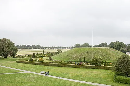 Thyras Høj Mountain, Vejle Kommune17 km NE
-
Grejs Dal Natural site, Vejle Kommune21 km NE
-
Bavnbjerg Mountain, Vejle Kommune24 km NE
-
Møllebjerg Mountain, Vejle Kommune16 km N
-
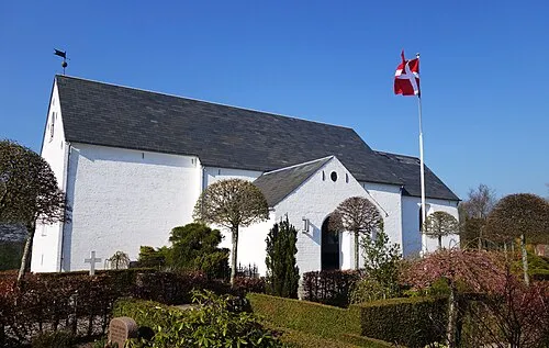 Hover Kirke Attraction, Vejle Kommune18 km NE
-
Brøndsø Banke Mountain, Billund Kommune17 km NW
Sources & licences
Data last updated: · 2 independent sources