- Population
- 12,652
- 12.7K
- Elevation
- 616 m
- above sea level
- Local time
- UTC+01:00
- Europe/Paris · UTC+01:00
- Places inside
- 2
- listed under Gex
- Airports
- GVA Geneva International Airport11 km
- NCY Annecy Meythet airport45 km
About Gex
Gex is a village. Location: Arrondissement of Gex, Ain. Population: 12,652. Elevation: 616 m. The best months to visit are June–August. The nearest airport is Geneva International Airport (11 km). Nearby sights include Petit Montrond and Le Colomby de Gex.
Photos of Gex
-
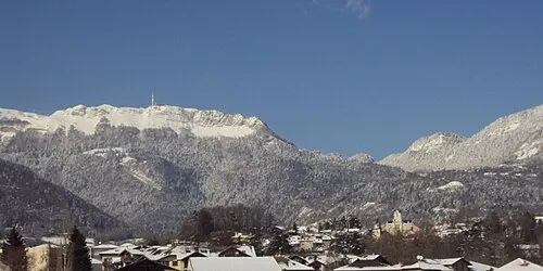
Petit Montrond Patrub01 · CC BY-SA 3.0

Climate of Gex
Best months for sightseeingBest months for sightseeing: June–August.
This month · November
A cold month
Day 8° · Night 1° · Rain 96 mm
- Hottest month
- July (day 24°)
- Coldest month
- January (night -3°)
- Wettest month
- September (103 mm)
- Driest month
- March (71 mm)
Bars: average monthly low and high temperature. Below: precipitation. Monthly averages for 1970–2000 at about 18 km resolution, adjusted for elevation. Highlighted months are mild and relatively dry. Source: WorldClim 2.1 (CC BY 4.0).
Show values as a table
| Month | Jan | Feb | Mar | Apr | May | Jun | Jul | Aug | Sep | Oct | Nov | Dec |
|---|---|---|---|---|---|---|---|---|---|---|---|---|
| Average high (°C) | 3° | 5° | 9° | 13° | 18° | 21° | 24° | 24° | 19° | 14° | 8° | 4° |
| Average low (°C) | -3° | -2° | 0° | 3° | 7° | 10° | 12° | 12° | 9° | 5° | 1° | -2° |
| Precipitation (mm) | 84 | 84 | 71 | 73 | 84 | 98 | 78 | 73 | 103 | 101 | 96 | 94 |
How to get to Gex
The nearest airport is Geneva International Airport (GVA), 11 km to the south as the crow flies. The nearest large city is Geneva, 16 km to the southeast.
Airports
- Geneva International Airport (GVA) Geneva 11 kmsouth
- Annecy Meythet airport (NCY) Annecy 45 kmsouth
- Chambéry Aix les Bains airport (CMF) Chambéry 78 kmsouth
Nearby large cities
- Geneva Population: 201.7K 16 kmsoutheast
- Lausanne Population: 139.1K 49 kmnortheast
- Besançon Population: 128.4K 102 kmnorth
- Villeurbanne Population: 131.4K 111 kmsouthwest
- Lyon Population: 520.8K 114 kmsouthwest
Straight-line distances; road distances are longer. Airport data: OurAirports.
Day trips from Gex
Within 100 km: 162 historic and cultural sites, 1,649 natural sites, 353 lakes, rivers and coasts.
0–25 km89 places
- Etang du Moulin de Vert Lake 17 kmS
- Etang du Moulin de Vert Lake 17 kmS
- Barrage du Rhône Lake 15 kmS
- La Barillette Mountain 12 kmNE
25–60 km450 places
- Lac de Joux Lake 39 kmNE
- Lake Leman Lake 34 kmE
- Lac Brenet Lake 43 kmNE
- Lac de Brêt Lake 59 kmE
60–100 km1,625 places
- Ile de Salagnon Island 65 kmE
- Ile d'Ogoz Island 90 kmNE
- Lake Neuchâtel Lake 91 kmNE
- Lac de la Gruyère Lake 88 kmNE
Straight-line distances.
Places in Gex
2 placesBar: population relative to the most populous place in this list.
Mountains & nature1
- Mont Rond · Mountain
Nearby attractions & nature
Everything nearby-
Petit Montrond Mountain, Mijoux4.1 km NW
-
Le Colomby de Gex Mountain, Échenevex5 km W
-
Crêt Mourex Mountain, Grilly3.8 km E
-
Grand Montrond Mountain, Mijoux4.2 km W
-
Observatoire de Genève Attraction, Canton of Vaud6.5 km SE
-
Les Voyrières Mountain, Crozet6.8 km SW
Sources & licences
Data last updated: