Forêt de Champfromier
Located in Ain, Auvergne-Rhône-Alpes Coordinates: 46°13′31″ N 5°48′58″ E
- Elevation
- 1,211 m
- above sea level
- Local time
- UTC+01:00
- Europe/Paris · UTC+01:00
- Airports
- GVA Geneva International Airport23 km
- NCY Annecy Meythet airport40 km
About Forêt de Champfromier
Forêt de Champfromier is a natural site. Location: Ain, Auvergne-Rhône-Alpes. The best months to visit are July–August. The nearest airport is Geneva International Airport (23 km). Nearby sights include Crêt de l'Auger and Le Crêt du Mont.
Climate of Forêt de Champfromier
Best months for sightseeingBest months for sightseeing: July–August.
This month · November
A wet month
Day 4° · Night -2° · Rain 122 mm
- Hottest month
- July (day 20°)
- Coldest month
- January (night -6°)
- Wettest month
- November (122 mm)
- Driest month
- August (88 mm)
Bars: average monthly low and high temperature. Below: precipitation. Monthly averages for 1970–2000 at about 18 km resolution, adjusted for elevation. Highlighted months are mild and relatively dry. Source: WorldClim 2.1 (CC BY 4.0).
Show values as a table
| Month | Jan | Feb | Mar | Apr | May | Jun | Jul | Aug | Sep | Oct | Nov | Dec |
|---|---|---|---|---|---|---|---|---|---|---|---|---|
| Average high (°C) | 0° | 1° | 5° | 8° | 13° | 17° | 20° | 19° | 15° | 10° | 4° | 1° |
| Average low (°C) | -6° | -5° | -3° | 0° | 4° | 7° | 9° | 9° | 6° | 3° | -2° | -4° |
| Precipitation (mm) | 107 | 104 | 91 | 96 | 111 | 114 | 91 | 88 | 115 | 116 | 122 | 117 |
How to get to Forêt de Champfromier
The nearest airport is Geneva International Airport (GVA), 23 km to the east as the crow flies. The nearest large city is Geneva, 26 km to the east.
Airports
- Geneva International Airport (GVA) Geneva 23 kmeast
- Annecy Meythet airport (NCY) Annecy 40 kmsoutheast
- Chambéry Aix les Bains airport (CMF) Chambéry 65 kmsouth
Nearby large cities
- Geneva Population: 201.7K 26 kmeast
- Lausanne Population: 139.1K 71 kmnortheast
- Villeurbanne Population: 131.4K 89 kmsouthwest
- Lyon Population: 520.8K 92 kmsouthwest
- Besançon Population: 128.4K 115 kmnorth
Straight-line distances; road distances are longer. Airport data: OurAirports.
Day trips from Forêt de Champfromier
Within 100 km: 194 historic and cultural sites, 1,215 natural sites, 310 lakes, rivers and coasts.
0–25 km65 places
- Etang du Moulin de Vert Lake 17 kmE
- Etang du Moulin de Vert Lake 17 kmE
- Barrage du Rhône Lake 18 kmE
- Laire River 14 kmSE
25–60 km382 places
- Lac de Joux Lake 59 kmNE
- Lake Leman Lake 56 kmNE
- Lac Aubonne Lake 53 kmNE
- Le Mont Risoux Mountain 49 kmNE
60–100 km1,272 places
- Parc de la Tête d'Or Natural site 90 kmSW
- Ile de Salagnon Island 86 kmE
- Lac de Fully Lake 99 kmE
- Lac Brenet Lake 63 kmNE
Straight-line distances.
Nearest towns and villages
-
Champfromier Village, Arrondissement of Nantua3.5 km S
-
Giron Village, Arrondissement of Nantua3.2 km W
-
Chézery-Forens Village, Arrondissement of Gex3.9 km E
-
Champfromier Village, Champfromier3.5 km S
-
Giron Village, Giron3.2 km W
-
Belleydoux Village, Arrondissement of Nantua4.3 km NW
Nearby attractions & nature
Everything nearby-
Crêt de l'Auger Mountain, Champfromier1.2 km SW
-
Le Crêt du Mont Mountain, Champfromier1.3 km SE
-
Haute Crête Mountain, Champfromier1.9 km E
-
Crétet Mountain, Champfromier2.4 km SE
-
Crêt Mathieu Mountain, Belleydoux3 km N
-
Crêt Chalam Mountain, Chézery-Forens4.5 km NE
-
Le Cruchon Mountain, Champfromier3.8 km SW
-
Le Raveyrot Mountain, Chézery-Forens4.8 km NE
More nature in France
-
Val Chézery Natural site, Ain4.8 km SE
-
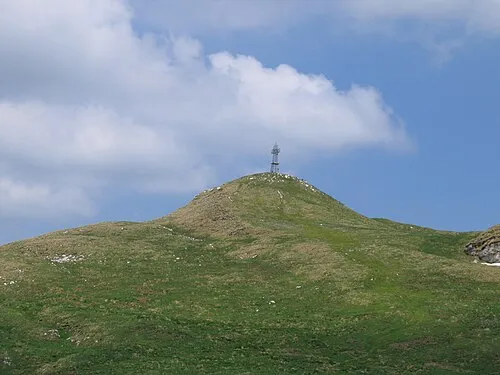 Le Reculet Mountain, Thoiry9.4 km E
-
Pierre de la Lune Mountain, Péron6.7 km E
-
Crêt Pelé Mountain, Montanges5.1 km SW
-
La Grotte Mountain, Thoiry8.3 km E
-
Forêt d'Échallon Natural site, Ain8.1 km W
Sources & licences
Data last updated: