Monts du Vivarais
Located in Ardèche, Auvergne-Rhône-Alpes Coordinates: 44°55′00″ N 4°15′00″ E
- Elevation
- 1,037 m
- above sea level
- Local time
- UTC+01:00
- Europe/Paris · UTC+01:00
- Airports
- GNB Grenoble Alpes Isère Airport98 km
- LYS Lyon Saint-Exupéry Airport111 km
About Monts du Vivarais
Monts du Vivarais is a mountain. Location: Ardèche, Auvergne-Rhône-Alpes. Elevation: 1,037 m. The best months to visit are July–August. The nearest airport is Grenoble Alpes Isère Airport (98 km). Nearby sights include Sommet de Graillouse and Roche de Borée.
Photos of Monts du Vivarais
-
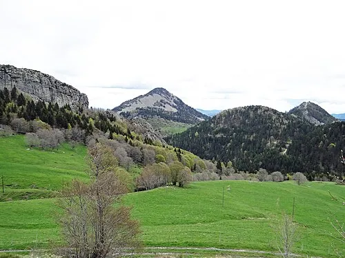
Rocher des Pradoux MOSSOT · CC BY-SA 4.0 -
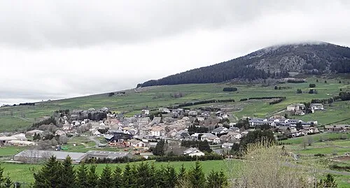
Mont d'Alambre MOSSOT · CC BY-SA 4.0 -
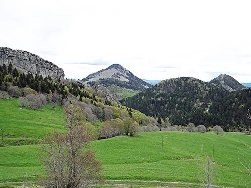
Suc de Sara MOSSOT · CC BY-SA 4.0 -
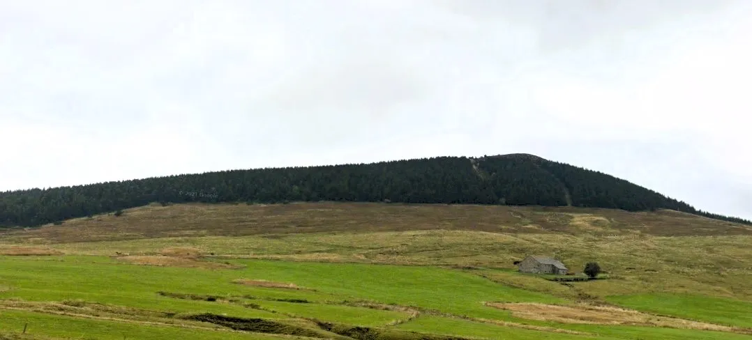
Chaulet Totozz43 · CC0


Climate of Monts du Vivarais
Best months for sightseeingBest months for sightseeing: July–August.
This month · November
A wet month
Day 7° · Night 1° · Rain 102 mm
- Hottest month
- July (day 22°)
- Coldest month
- January (night -2°)
- Wettest month
- October (129 mm)
- Driest month
- July (62 mm)
Bars: average monthly low and high temperature. Below: precipitation. Monthly averages for 1970–2000 at about 18 km resolution, adjusted for elevation. Highlighted months are mild and relatively dry. Source: WorldClim 2.1 (CC BY 4.0).
Show values as a table
| Month | Jan | Feb | Mar | Apr | May | Jun | Jul | Aug | Sep | Oct | Nov | Dec |
|---|---|---|---|---|---|---|---|---|---|---|---|---|
| Average high (°C) | 3° | 4° | 7° | 10° | 15° | 18° | 22° | 22° | 18° | 13° | 7° | 5° |
| Average low (°C) | -2° | -2° | -1° | 1° | 5° | 9° | 11° | 11° | 8° | 5° | 1° | -1° |
| Precipitation (mm) | 89 | 70 | 74 | 96 | 111 | 84 | 62 | 78 | 104 | 129 | 102 | 91 |
How to get to Monts du Vivarais
The nearest airport is Grenoble Alpes Isère Airport (GNB), 98 km to the northeast as the crow flies. For international flights: Lyon Saint-Exupéry Airport (LYS) (111 km). The nearest large city is Saint-Etienne, 59 km to the north.
Airports
- Grenoble Alpes Isère Airport (GNB) Grenoble 98 kmnortheast
- Lyon Saint-Exupéry Airport (LYS) Colombier-Saugnieu, Rhône 111 kmnortheast
- Avignon Caumont airport (AVN) Avignon 124 kmsoutheast
Nearby large cities
- Saint-Etienne Population: 176.3K 59 kmnorth
- Lyon Population: 520.8K 104 kmnortheast
- Villeurbanne Population: 131.4K 107 kmnortheast
- Grenoble Population: 158.6K 119 kmeast
- Nîmes Population: 148.2K 120 kmsouth
Straight-line distances; road distances are longer. Airport data: OurAirports.
Day trips from Monts du Vivarais
Within 100 km: 151 historic and cultural sites, 702 natural sites, 230 lakes, rivers and coasts.
0–25 km116 places
- Lac d'Issarlès Lake 18 kmSW
- La Courbe Mountain 19 kmS
- Mont Plaux Mountain 23 kmNW
- Rocher d'Aiglet Mountain 9 kmW
25–60 km318 places
- Alba-la-Romaine (Ardèche, France) -- Théâtre gallo-romain Historic site 48 kmSE
- Lac du Bouchet Lake 36 kmW
- Lac du barrage de Naussac Lake 40 kmSW
- Suc de Miceselle Mountain 31 kmW
60–100 km649 places
- Île de la Piboulette Island 98 kmS
- Îles Margeries Island 65 kmSE
- Île du Colombier Island 93 kmSE
- Réservoir de Couzon Lake 71 kmNE
Straight-line distances.
Nearest towns and villages
-
La Rochette Village, Arrondissement of Largentière0.7 km W
-
La Rochette Village, La Rochette0.7 km W
-
Borée Village, Arrondissement of Largentière2.2 km S
-
Liosac Village, La Rochette1.1 km N
-
Chauvy Village, Borée1.6 km E
-
Échamps Village, Borée1.7 km SE
Nearby attractions & nature
Everything nearby-
Sommet de Graillouse Mountain, La Rochette1.4 km E
-
Roche de Borée Mountain, Borée2.5 km SW
-
La Martelle Mountain, La Rochette1.9 km NW
-
La Gardette Mountain, Borée2 km SW
-
Roche du Château Mountain, Borée2.4 km SW
-
Suc de Touron Mountain, Borée3.8 km SW
-
Rocher de Gouleyou Mountain, Borée3.3 km SW
-
Serre du Truc Mountain, Borée3.6 km SW
More nature in France
-
Suc de Sara Mountain, Saint-Martial5.3 km SW
-
Rocher des Pradoux Mountain, Borée6.3 km SW
-
Suc de la Veine Mountain, Borée4.6 km S
-
Mont Mézenc Sud Mountain, Borée4.7 km W
-
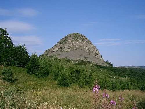 Gerbier de Jonc Mountain, Saint-Martial8.4 km S
-
Lestrat Mountain, Saint-Martial6 km SE
Sources & licences
Data last updated: · 2 independent sources