Bois de Saint-André
Located in Isère, Auvergne-Rhône-Alpes Coordinates: 45°23′56″ N 5°46′23″ E
- Elevation
- 974 m
- above sea level
- Local time
- UTC+01:00
- Europe/Paris · UTC+01:00
- Airports
- CMF Chambéry Aix les Bains airport28 km
- GNB Grenoble Alpes Isère Airport35 km
About Bois de Saint-André
Bois de Saint-André is a natural site. Location: Isère, Auvergne-Rhône-Alpes. The best months to visit are July–August. The nearest airport is Chambéry Aix les Bains airport (28 km). Nearby sights include L'Alienard and Bois Saint-Christophe.
Photos of Bois de Saint-André
-
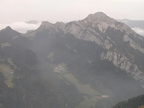
Grand Som No machine-readable author provided. Gemini1980 assumed · Public domain

Climate of Bois de Saint-André
Best months for sightseeingBest months for sightseeing: July–August.
This month · November
A wet month
Day 7° · Night 0° · Rain 119 mm
- Hottest month
- July (day 23°)
- Coldest month
- January (night -4°)
- Wettest month
- November (119 mm)
- Driest month
- July (75 mm)
Bars: average monthly low and high temperature. Below: precipitation. Monthly averages for 1970–2000 at about 18 km resolution, adjusted for elevation. Highlighted months are mild and relatively dry. Source: WorldClim 2.1 (CC BY 4.0).
Show values as a table
| Month | Jan | Feb | Mar | Apr | May | Jun | Jul | Aug | Sep | Oct | Nov | Dec |
|---|---|---|---|---|---|---|---|---|---|---|---|---|
| Average high (°C) | 3° | 4° | 8° | 11° | 16° | 20° | 23° | 23° | 18° | 13° | 7° | 4° |
| Average low (°C) | -4° | -3° | -1° | 1° | 6° | 9° | 11° | 11° | 8° | 4° | 0° | -3° |
| Precipitation (mm) | 92 | 89 | 91 | 91 | 105 | 102 | 75 | 80 | 111 | 115 | 119 | 100 |
How to get to Bois de Saint-André
The nearest airport is Chambéry Aix les Bains airport (CMF), 28 km to the north as the crow flies. The nearest large city is Grenoble, 25 km to the south.
Airports
- Chambéry Aix les Bains airport (CMF) Chambéry 28 kmnorth
- Grenoble Alpes Isère Airport (GNB) Grenoble 35 kmwest
- Annecy Meythet airport (NCY) Annecy 64 kmnortheast
Nearby large cities
- Grenoble Population: 158.6K 25 kmsouth
- Villeurbanne Population: 131.4K 81 kmnorthwest
- Lyon Population: 520.8K 82 kmnorthwest
- Geneva Population: 201.7K 94 kmnorth
- Saint-Etienne Population: 176.3K 108 kmwest
Straight-line distances; road distances are longer. Airport data: OurAirports.
Day trips from Bois de Saint-André
Within 100 km: 166 historic and cultural sites, 1,379 natural sites, 340 lakes, rivers and coasts.
0–25 km105 places
- St Alban Plage Beach 18 kmN
- Grande Île Island 16 kmN
- Petite Île Island 17 kmN
- Lake Paladru Lake 20 kmW
25–60 km520 places
- Lac Mort Lake 41 kmS
- Plage St Jorioz Beach 58 kmNE
- Lac du Vallon Lake 51 kmS
- Étang de Tabouret Lake 55 kmNW
60–100 km1,260 places
- Parc de la Tête d'Or Natural site 83 kmNW
- Etang du Moulin de Vert Lake 89 kmN
- Etang du Moulin de Vert Lake 89 kmN
- Barrage du Rhône Lake 91 kmN
Straight-line distances.
Nearest towns and villages
-
Saint-Laurent-du-Pont Village, Arrondissement of Grenoble3.3 km SW
-
Saint-Laurent-du-Pont Village, Saint-Laurent-du-Pont3.2 km W
-
Entre-deux-Guiers Village, Arrondissement of Grenoble4.1 km NW
-
Entre-Deux-Guiers Village, Entre-deux-Guiers3.9 km NW
-
Saint-Christophe-sur-Guiers Village, Arrondissement of Grenoble4.4 km N
-
Le Mas d'Aiguenoire Village, Entre-deux-Guiers1.4 km NW
Nearby attractions & nature
Everything nearby-
L'Alienard Mountain, Saint-Christophe-sur-Guiers2 km SE
-
Bois Saint-Christophe Natural site, Isère2.1 km N
-
Grand Som Mountain, Saint-Pierre-de-Chartreuse4.4 km SE
-
Dent de l'Ours Mountain, Saint-Pierre-dEntremont3.9 km E
-
Bois des Roches Rousses Natural site, Isère3.4 km E
-
Massif de la Chartreuse Mountain, Isère4 km S
-
La Suifière Mountain, Saint-Pierre-de-Chartreuse5 km SE
-
La Suiffière Mountain, Saint-Pierre-de-Chartreuse5 km SE
More nature in France
-
Sommet Charmant Mountain, Saint-Pierre-de-Chartreuse8.2 km S
-
Bec de la Scia Mountain, Saint-Pierre-de-Chartreuse8.5 km SE
-
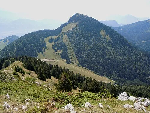 Bec Charvet Mountain, Saint-Pierre-de-Chartreuse12 km S
-
Dent de Crolles Mountain, Plateau-des-Petites-Roches12 km SE
-
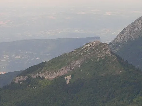 La Pinea Mountain, Sarcenas13 km S
-
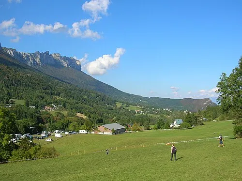 L'Aulpe du Seuil Mountain, Plateau-des-Petites-Roches11 km E
Sources & licences
Data last updated: