Crête de Samaroux
Located in Isère, Auvergne-Rhône-Alpes Coordinates: 44°45′00″ N 5°51′00″ E
- Elevation
- 2,235 m
- above sea level
- Local time
- UTC+01:00
- Europe/Paris · UTC+01:00
- Airports
- GNB Grenoble Alpes Isère Airport80 km
- CMF Chambéry Aix les Bains airport99 km
About Crête de Samaroux
Crête de Samaroux is a mountain. Location: Isère, Auvergne-Rhône-Alpes. Elevation: 2,235 m. The best months to visit are July–August. The nearest airport is Grenoble Alpes Isère Airport (80 km). Nearby sights include Tête de Lopet and Grande Tête de l'Obiou.
Photos of Crête de Samaroux
-
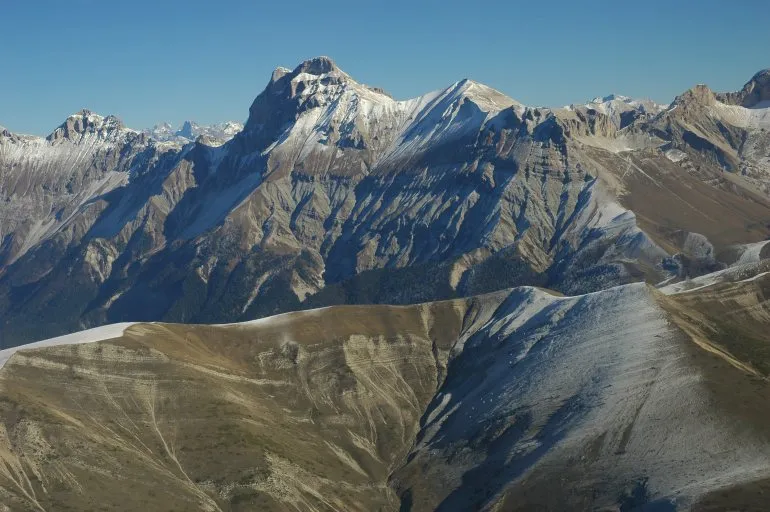
Grand Ferrand Wikimedia Commons · CC BY-SA 3.0 -
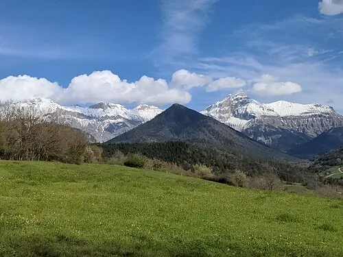
Le Menil Adrien BENOIT à la GUILLAUME · CC BY-SA 4.0


Climate of Crête de Samaroux
Best months for sightseeingBest months for sightseeing: July–August.
This month · November
A wet month
Day 1° · Night -7° · Rain 143 mm
- Hottest month
- July (day 16°)
- Coldest month
- January (night -10°)
- Wettest month
- November (143 mm)
- Driest month
- July (60 mm)
Bars: average monthly low and high temperature. Below: precipitation. Monthly averages for 1970–2000 at about 18 km resolution, adjusted for elevation. Highlighted months are mild and relatively dry. Source: WorldClim 2.1 (CC BY 4.0).
Show values as a table
| Month | Jan | Feb | Mar | Apr | May | Jun | Jul | Aug | Sep | Oct | Nov | Dec |
|---|---|---|---|---|---|---|---|---|---|---|---|---|
| Average high (°C) | -3° | -2° | 1° | 3° | 9° | 13° | 16° | 16° | 12° | 7° | 1° | -2° |
| Average low (°C) | -10° | -10° | -8° | -5° | -1° | 2° | 4° | 5° | 2° | -2° | -7° | -9° |
| Precipitation (mm) | 104 | 91 | 96 | 96 | 107 | 96 | 60 | 82 | 102 | 122 | 143 | 115 |
How to get to Crête de Samaroux
The nearest airport is Grenoble Alpes Isère Airport (GNB), 80 km to the northwest as the crow flies. The nearest large city is Grenoble, 49 km to the north.
Airports
- Grenoble Alpes Isère Airport (GNB) Grenoble 80 kmnorthwest
- Chambéry Aix les Bains airport (CMF) Chambéry 99 kmnorth
- Avignon Caumont airport (AVN) Avignon 120 kmsouthwest
Nearby large cities
- Grenoble Population: 158.6K 49 kmnorth
- Lyon Population: 520.8K 136 kmnorthwest
- Villeurbanne Population: 131.4K 136 kmnorthwest
- Saint-Etienne Population: 176.3K 138 kmnorthwest
- Aix-en-Provence Population: 146.8K 139 kmsouth
Straight-line distances; road distances are longer. Airport data: OurAirports.
Day trips from Crête de Samaroux
Within 100 km: 119 historic and cultural sites, 1,363 natural sites, 296 lakes, rivers and coasts.
0–25 km101 places
- Lac du Saulet Lake 10 kmNE
- Lac Gary Lake 21 kmNE
- Mont Simon Mountain 20 kmN
- Quigouret Mountain 22 kmSW
25–60 km691 places
- Lac Mort Lake 32 kmN
- Clapes River 57 kmSE
- Lac du Vallon Lake 29 kmNE
- Lake Pierre-Châtel Lake 25 kmN
60–100 km986 places
- St Alban Plage Beach 90 kmN
- Îles Margeries Island 100 kmW
- Grande Île Island 88 kmN
- Petite Île Island 89 kmN
Straight-line distances.
Nearest towns and villages
-
Saint-Disdier Village, Dévoluy4.3 km SE
-
Tréminis Village, Arrondissement of Grenoble6.4 km W
-
Villard-Joli Village, Dévoluy3.8 km SE
-
Pellafol Village, Arrondissement of Grenoble7 km NE
-
Truchières Village, Dévoluy4.1 km SE
-
Agnières-en-Dévoluy Village, Dévoluy6.7 km S
Nearby attractions & nature
Everything nearby-
Tête de Lopet Mountain, Isère2 km SW
-
Grande Tête de l'Obiou Mountain, Pellafol2.7 km N
-
Grand Ferrand Mountain, Dévoluy4.2 km SW
-
Le Rattier Mountain, Saint-Baudille-et-Pipet5.5 km W
-
Pic Grillon Mountain, Monestier-d'Ambel6.4 km E
-
Le Menil Mountain, Saint-Baudille-et-Pipet7.4 km W
-
Mont de Menil Mountain, Prébois7.6 km W
-
Bonnet de Calvin Mountain, Châtel-en-Trièves7.8 km NW
Sources & licences
Data last updated: · 2 independent sources