Pointe Baraccon de Chamois
Located in Savoy, Auvergne-Rhône-Alpes Coordinates: 45°13′00″ N 7°00′00″ E
- Elevation
- 2,128 m
- above sea level
- Local time
- UTC+01:00
- Europe/Paris · UTC+01:00
- Airports
- TRN Turin Airport51 km
- CUF Cuneo International Airport89 km
About Pointe Baraccon de Chamois
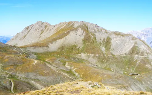
Pointe Baraccon de Chamois is a mountain. Location: Savoy, Auvergne-Rhône-Alpes. Elevation: 2,128 m. The best months to visit are July–August. The nearest airport is Turin Airport (51 km). Nearby sights include Roche Michel and Pointe du Chapeau.
Photos of Pointe Baraccon de Chamois
-
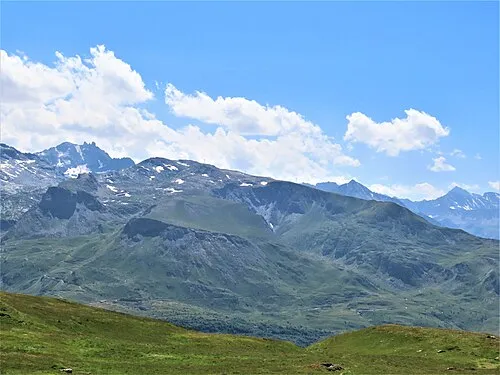
Pointe Droset Rémih · CC BY-SA 4.0 -
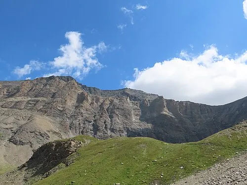
Pointe du Chapeau Rémih · CC BY-SA 4.0 -
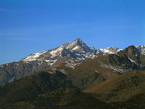
Rocciamelone Duvilar · CC BY-SA 3.0


Climate of Pointe Baraccon de Chamois
Best months for sightseeingBest months for sightseeing: July–August.
This month · November
A wet month
Day 3° · Night -3° · Rain 121 mm
- Hottest month
- August (day 16°)
- Coldest month
- February (night -7°)
- Wettest month
- November (121 mm)
- Driest month
- July (64 mm)
Bars: average monthly low and high temperature. Below: precipitation. Monthly averages for 1970–2000 at about 18 km resolution, adjusted for elevation. Highlighted months are mild and relatively dry. Source: WorldClim 2.1 (CC BY 4.0).
Show values as a table
| Month | Jan | Feb | Mar | Apr | May | Jun | Jul | Aug | Sep | Oct | Nov | Dec |
|---|---|---|---|---|---|---|---|---|---|---|---|---|
| Average high (°C) | -1° | -1° | 0° | 2° | 8° | 11° | 15° | 16° | 12° | 8° | 3° | 0° |
| Average low (°C) | -7° | -7° | -6° | -4° | 0° | 4° | 7° | 8° | 5° | 2° | -3° | -5° |
| Precipitation (mm) | 110 | 102 | 104 | 110 | 107 | 82 | 64 | 77 | 83 | 111 | 121 | 109 |
How to get to Pointe Baraccon de Chamois
The nearest airport is Turin Airport (TRN), 51 km to the east as the crow flies. The nearest large city is Grenoble, 101 km to the west.
Airports
- Turin Airport (TRN) Caselle Torinese (TO) 51 kmeast
- Cuneo International Airport (CUF) Levaldigi (CN) 89 kmsoutheast
- Chambéry Aix les Bains airport (CMF) Chambéry 99 kmnorthwest
Nearby large cities
- Grenoble Population: 158.6K 101 kmwest
- Geneva Population: 201.7K 128 kmnorthwest
- Lausanne Population: 139.1K 147 kmnorth
- Nice Population: 342.7K 170 kmsouth
- Villeurbanne Population: 131.4K 177 kmwest
Straight-line distances; road distances are longer. Airport data: OurAirports.
Day trips from Pointe Baraccon de Chamois
Within 100 km: 83 historic and cultural sites, 1,916 natural sites, 254 lakes, rivers and coasts.
0–25 km118 places
- Lac Rond Lake 25 kmNW
- Lac du Mont Cenis Lake 6 kmW
- Pointe de Méan-Martin Mountain 17 kmN
- Roc du Véfret Mountain 16 kmN
25–60 km524 places
- Lac des Vaches Lake 26 kmNW
- Lacs de la Tempête Lake 58 kmNW
- Lac de la Plagne Lake 32 kmN
- Lac de Néal Lake 55 kmSW
60–100 km1,611 places
- Lac Mort Lake 97 kmW
- Lac d'Émosson Lake 97 kmN
- Lac d'Orny Lake 88 kmN
- Lac de la Breye Lake 91 kmN
Straight-line distances.
Nearest towns and villages
-
Novalesa Municipality, Province of Turin3 km S
-
Moncenisio Municipality, Province of Turin1.9 km SW
-
Moncenisio Village, Moncenisio1.9 km SW
-
Novalesa Village, Novalesa3.1 km S
-
 Bar Cenisio Village, Venaus3.6 km SW
-
Sant'Anna Village, Novalesa3.9 km SE
Nearby attractions & nature
Everything nearby-
Roche Michel Mountain, Val-Cenis2.3 km NE
-
Pointe du Chapeau Mountain, Val-Cenis4.4 km N
-
Rocciamelone Mountain, Usseglio6.2 km E
-
Pointe Droset Mountain, Val-Cenis7.1 km W
-
Pointe de Ronce Mountain, Val-Cenis5.6 km N
-
Glacier de Rochemelon Natural site, Auvergne-Rhône-Alpes5.4 km E
-
Cime de Bard Mountain, Val-Cenis6 km SW
-
Lac du Mont Cenis Lake, Savoy5.8 km W
More nature in France
-
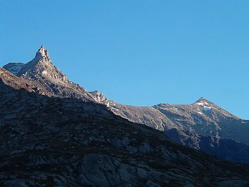 Rocca d'Ambin Mountain, Val-Cenis11 km SW
-
 Mont Froid Mountain, Val-Cenis13 km W
-
Glacier de l'Arcelle Neuve Natural site, Val-Cenis6.5 km NW
-
Pointe de la Petite Turra Mountain, Val-Cenis10 km NW
-
Signal du Petit-Mont-Cenis Mountain, Val-Cenis10 km W
-
Pointe de Soliet Mountain, Bessans8.5 km N
Sources & licences
Data last updated: · 2 independent sources