- Elevation
- 1,271 m
- above sea level
- Local time
- UTC+01:00
- Europe/Paris · UTC+01:00
- Airports
- CMF Chambéry Aix les Bains airport47 km
- GNB Grenoble Alpes Isère Airport70 km
About Torrent le Tepey
Torrent le Tepey is a river. Location: Savoy, Auvergne-Rhône-Alpes. The best months to visit are July–August. The nearest airport is Chambéry Aix les Bains airport (47 km). Nearby sights include Torrent des Villards and La Charmette de l'Ormet.
Photos of Torrent le Tepey
-
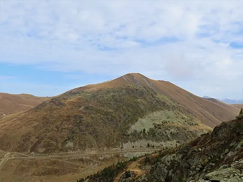
Pointe de l'Ouillon Rémih · CC BY-SA 4.0 -
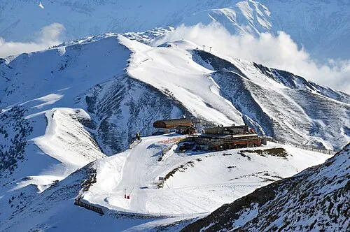
Le Grand Truc DimiTalen · CC0 -
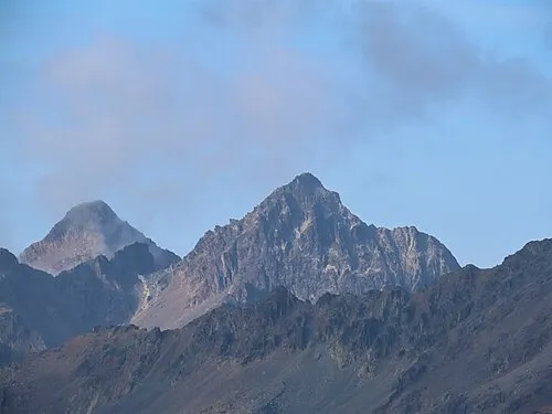
Puy Gris Rémih · CC BY-SA 4.0 -
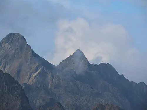
Pic de la Grand Valloire Rémih · CC BY-SA 4.0


Climate of Torrent le Tepey
Best months for sightseeingBest months for sightseeing: July–August.
This month · November
A wet month
Day 7° · Night 0° · Rain 149 mm
- Hottest month
- August (day 22°)
- Coldest month
- January (night -4°)
- Wettest month
- November (149 mm)
- Driest month
- July (78 mm)
Bars: average monthly low and high temperature. Below: precipitation. Monthly averages for 1970–2000 at about 18 km resolution, adjusted for elevation. Highlighted months are mild and relatively dry. Source: WorldClim 2.1 (CC BY 4.0).
Show values as a table
| Month | Jan | Feb | Mar | Apr | May | Jun | Jul | Aug | Sep | Oct | Nov | Dec |
|---|---|---|---|---|---|---|---|---|---|---|---|---|
| Average high (°C) | 3° | 4° | 6° | 9° | 14° | 18° | 22° | 22° | 18° | 13° | 7° | 4° |
| Average low (°C) | -4° | -4° | -2° | 1° | 5° | 8° | 11° | 11° | 8° | 5° | 0° | -3° |
| Precipitation (mm) | 127 | 118 | 110 | 109 | 117 | 105 | 78 | 90 | 103 | 129 | 149 | 138 |
How to get to Torrent le Tepey
The nearest airport is Chambéry Aix les Bains airport (CMF), 47 km to the northwest as the crow flies. The nearest large city is Grenoble, 41 km to the west.
Airports
- Chambéry Aix les Bains airport (CMF) Chambéry 47 kmnorthwest
- Grenoble Alpes Isère Airport (GNB) Grenoble 70 kmwest
- Annecy Meythet airport (NCY) Annecy 72 kmnorth
Nearby large cities
- Grenoble Population: 158.6K 41 kmwest
- Geneva Population: 201.7K 102 kmnorth
- Villeurbanne Population: 131.4K 117 kmnorthwest
- Lyon Population: 520.8K 119 kmnorthwest
- Lausanne Population: 139.1K 141 kmnorth
Straight-line distances; road distances are longer. Airport data: OurAirports.
Day trips from Torrent le Tepey
Within 100 km: 112 historic and cultural sites, 1,646 natural sites, 324 lakes, rivers and coasts.
0–25 km188 places
- Lac de la Motte Lake 11 kmW
- Le Grand Lac (Lac Bramant) Lake 10 kmS
- Lac Cottepens Lake 11 kmW
- Lac du Cos Lake 12 kmSW
25–60 km728 places
- Lac Mort Lake 44 kmSW
- St Alban Plage Beach 45 kmNW
- Grande Île Island 44 kmNW
- Petite Île Island 44 kmNW
60–100 km1,166 places
- Petit Lé Lake 99 kmNE
- Lacs de Fenêtre Lake 98 kmNE
- Lacs de Fenêtre Lake 98 kmNE
- Lac du Gd. St. Bernard Lake 99 kmNE
Straight-line distances.
Nearest towns and villages
-
Saint-Colomban-des-Villards Village, Arrondissement of Saint-Jean-de-Maurienne1.4 km NE
-
Saint-Colomban-des-Villards Village, Saint-Colomban-des-Villards1.5 km NE
-
La Chal Village, Saint-Colomban-des-Villards0.4 km SW
-
Valmaure Village, Saint-Colomban-des-Villards0.5 km W
-
Les Roches Village, Saint-Colomban-des-Villards1.1 km N
-
Saint-Alban-des-Villards Village, Arrondissement of Saint-Jean-de-Maurienne3.8 km NE
Nearby attractions & nature
Everything nearby-
Torrent des Villards River, Savoy0.6 km NW
-
La Charmette de l'Ormet Mountain, Saint-Colomban-des-Villards1.2 km SE
-
Le Grand Truc Mountain, Saint-Alban-des-Villards3.3 km E
-
Tête du Chaput Mountain, Saint-Colomban-des-Villards2.8 km SE
-
La Grande Verdette Mountain, Fontcouverte-la-Toussuire3.7 km SE
-
Tête de Bellard Mountain, Fontcouverte-la-Toussuire3.3 km S
-
Pointe de l'Ouillon Mountain, Saint-Sorlin-d'Arves4.9 km S
-
Puy Gris Mountain, Saint-Colomban-des-Villards5.4 km NW
Sources & licences
Data last updated: