Mont Lassois
Located in Vix, Arrondissement de Montbard Coordinates: 47°54′24″ N 4°31′52″ E
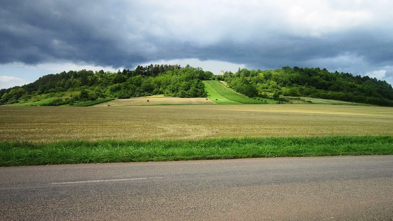
- Elevation
- 290 m
- above sea level
- Local time
- UTC+01:00
- Europe/Paris · UTC+01:00
- Airports
- XCR Chalons Vatry airport99 km
- DLE Dole Tavaux Airport118 km
About Mont Lassois
Mont Lassois is a mountain. Location: Vix, Arrondissement de Montbard. Elevation: 290 m.
Mont Lassois is a relevant outlier located in the commune of Vix, near Châtillon-sur-Seine in the north of Côte-d'Or. Dominating the upper Seine valley for approximately 100 m and crowned by a 12th century church, Saint-Marcel of Vix, classified as a historic monument, it is currently the subject of excavations and notable archaeological discoveries concerning the Hallstatt civilization.
Source: Wikipedia · CC BY-SA 4.0
Photos of Mont Lassois
-

Claude PIARD · CC BY-SA 4.0 -

Claude PIARD · CC BY-SA 4.0 -

Claude PIARD · CC BY-SA 4.0


Climate of Mont Lassois
Best months for sightseeingBest months for sightseeing: June–September.
This month · November
A cold month
Day 8° · Night 2° · Rain 76 mm
- Hottest month
- August (day 25°)
- Coldest month
- February (night -1°)
- Wettest month
- December (83 mm)
- Driest month
- April (61 mm)
Bars: average monthly low and high temperature. Below: precipitation. Monthly averages for 1970–2000 at about 18 km resolution, adjusted for elevation. Highlighted months are mild and relatively dry. Source: WorldClim 2.1 (CC BY 4.0).
Show values as a table
| Month | Jan | Feb | Mar | Apr | May | Jun | Jul | Aug | Sep | Oct | Nov | Dec |
|---|---|---|---|---|---|---|---|---|---|---|---|---|
| Average high (°C) | 5° | 6° | 10° | 13° | 17° | 20° | 24° | 25° | 20° | 15° | 8° | 6° |
| Average low (°C) | -1° | -1° | 2° | 3° | 7° | 10° | 13° | 12° | 9° | 7° | 2° | 0° |
| Precipitation (mm) | 75 | 71 | 62 | 61 | 81 | 78 | 61 | 62 | 73 | 76 | 76 | 83 |
Other places to visit in this season: June July August September
How to get to Mont Lassois
The nearest airport is Chalons Vatry airport (XCR), 99 km to the north as the crow flies. The nearest large city is Dijon, 75 km to the southeast.
Airports
- Chalons Vatry airport (XCR) Chalons en Champagne 99 kmnorth
- Dole Tavaux Airport (DLE) Dole 118 kmsoutheast
- Metz-Nancy-Lorraine Airport (ETZ) Goin 175 kmnortheast
Nearby large cities
- Dijon Population: 159.9K 75 kmsoutheast
- Besançon Population: 128.4K 134 kmsoutheast
- Nancy Population: 105.1K 150 kmnortheast
- Reims Population: 196.6K 156 kmnorth
- Marne La Vallée Population: 318.3K 174 kmnorthwest
Straight-line distances; road distances are longer. Airport data: OurAirports.
Day trips from Mont Lassois
Within 100 km: 155 historic and cultural sites, 599 natural sites, 167 lakes, rivers and coasts.
0–25 km89 places
- Étang de Marcenay Lake 10 kmW
- Étang Bailly Lake 10 kmW
- Mont Remin Mountain 24 kmE
- Bois du Roi Natural site 18 kmN
25–60 km351 places
- Étang de Ramerupt Lake 49 kmN
- Étang du Parc aux Pourceaux Lake 40 kmN
- Réservoir de la Mouche Lake 55 kmE
- Étang de la Morge des Champs Lake 43 kmN
60–100 km481 places
- Réservoir de Villegusien Lake 61 kmE
- Lac des Settons Lake 88 kmSW
- Étang Richebourg Lake 81 kmN
- Étang du Moyen Lake 75 kmN
Straight-line distances.
Nearest towns and villages
Nearby attractions & nature
Everything nearby-
Abbaye Saint-Pierre-et-Saint-Paul de Pothières Attraction, Pothières1.9 km N
-
Bois du Cruchot Natural site, Cote d'Or5 km N
-
Bois Jouard Natural site, Cote d'Or6.2 km NE
-
Bois Lainoire Natural site, Cote d'Or7.2 km N
-
Bois de Langres Natural site, Cote d'Or8.3 km E
-
Forêt Domaniale de Val du Puits Natural site, Cote d'Or8.4 km NE
-
Bois Momont Natural site, Cote d'Or8.6 km NE
-
Forêt de l'Hôpital Natural site, Cote d'Or8.6 km W
Sources & licences
Data last updated: · 2 independent sources