Arrondissement of Pontarlier
Located in Doubs, Bourgogne-Franche-Comté Coordinates: 46°59′21″ N 6°22′43″ E
- Population
- 119,068
- 119.1K
- Elevation
- 918 m
- above sea level
- Local time
- UTC+01:00
- Europe/Paris · UTC+01:00
- Places inside
- 143
- listed under Arrondissement of Pontarlier
- Airports
- DLE Dole Tavaux Airport73 km
- BRN Bern Airport86 km
About Arrondissement of Pontarlier
Arrondissement of Pontarlier is a municipality. Location: Doubs, Bourgogne-Franche-Comté. Population: 119,068. Elevation: 918 m. The best months to visit are July–August. The nearest airport is Dole Tavaux Airport (73 km). Nearby sights include Bois Montrivel and Drugeon.
Photos of Arrondissement of Pontarlier
-
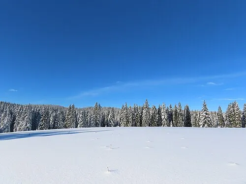
Le Mont Noir Rémih · CC BY-SA 4.0

Climate of Arrondissement of Pontarlier
Best months for sightseeingBest months for sightseeing: July–August.
This month · November
A wet month
Day 6° · Night 0° · Rain 125 mm
- Hottest month
- July (day 21°)
- Coldest month
- January (night -4°)
- Wettest month
- December (131 mm)
- Driest month
- March (99 mm)
Bars: average monthly low and high temperature. Below: precipitation. Monthly averages for 1970–2000 at about 18 km resolution, adjusted for elevation. Highlighted months are mild and relatively dry. Source: WorldClim 2.1 (CC BY 4.0).
Show values as a table
| Month | Jan | Feb | Mar | Apr | May | Jun | Jul | Aug | Sep | Oct | Nov | Dec |
|---|---|---|---|---|---|---|---|---|---|---|---|---|
| Average high (°C) | 2° | 3° | 7° | 10° | 15° | 18° | 21° | 21° | 17° | 12° | 6° | 3° |
| Average low (°C) | -4° | -3° | -1° | 1° | 5° | 8° | 11° | 11° | 8° | 4° | 0° | -2° |
| Precipitation (mm) | 115 | 113 | 99 | 102 | 118 | 125 | 108 | 107 | 114 | 114 | 125 | 131 |
How to get to Arrondissement of Pontarlier
The nearest airport is Dole Tavaux Airport (DLE), 73 km to the west as the crow flies. For international flights: Geneva International Airport (GVA) (86 km). The nearest large city is Besançon, 40 km to the northwest.
Airports
- Dole Tavaux Airport (DLE) Dole 73 kmwest
- Bern Airport (BRN) Bern 86 kmeast
- Geneva International Airport (GVA) Geneva 86 kmsouth
Nearby large cities
- Besançon Population: 128.4K 40 kmnorthwest
- Lausanne Population: 139.1K 56 kmsouth
- Bern Population: 121.6K 81 kmeast
- Geneva Population: 201.7K 89 kmsouth
- Dijon Population: 159.9K 110 kmwest
Straight-line distances; road distances are longer. Airport data: OurAirports.
Day trips from Arrondissement of Pontarlier
Within 100 km: 208 historic and cultural sites, 1,091 natural sites, 280 lakes, rivers and coasts.
0–25 km55 places
- Lac des Taillères Lake 15 kmE
- Aiguilles de Baulmes Mountain 23 kmS
- La Russillonne Mountain 25 kmSE
- Crêt du Cervelet Mountain 20 kmE
25–60 km275 places
- Sankt Petersinsel Island 59 kmE
- Lake Neuchâtel Lake 39 kmE
- Lake Murten Lake 54 kmE
- Lac de Joux Lake 39 kmS
60–100 km1,249 places
- Kleiner Bremgartenwald Mountain 80 kmE
- Ile de Salagnon Island 72 kmSE
- Ile d'Ogoz Island 64 kmSE
- Lake Wohlen Lake 72 kmE
Straight-line distances.
Arrondissement of Pontarlier and similar cities
Side by side with cities of similar size in the same country: population, elevation and climate.
| Measure | Arrondissement of Pontarlier | Orléans | Rouen | Metz |
|---|---|---|---|---|
| Population | 119.1K | 116.3K | 116.3K | 123.9K |
| Elevation | 918 m | 115 m | 21 m | 182 m |
| Summer day (hottest month) | 21° | 25° | 23° | 25° |
| Winter night (coldest month) | -4° | 1° | 2° | -1° |
| Annual rainfall | 1,371 mm | 641 mm | 724 mm | 776 mm |
| Best months | Jul–Aug | Jun–Sep | Jun–Aug | May–Sep |
| Distance | — | 352 km | 478 km | 237 km |
Climate values are 1970–2000 monthly averages; straight-line distance.
Places in Arrondissement of Pontarlier
143 places- 1 Pontarlier 17.3K
- 2 Morteau 7K
- 3 Valdahon 5.6K
- 4 Villers-le-Lac 4.9K
- 5 Les Fins 3.1K
- 6 Doubs 3K
- 7 Le Russey 2.3K
- 8 Levier 2.2K
- 9 Orchamps-Vennes 2.1K
- 10 Montlebon 2.1K
- 11 Frasne 2K
- 12 Jougne 1.8K
- 13 Gilley 1.6K
- 14 Vercel-Villedieu-le-Camp 1.6K
- 15 Les Premiers Sapins 1.6K
- 16 Étalans 1.5K
- 17 Grand'Combe-Châteleu 1.5K
- 18 Pierrefontaine-les-Varans 1.4K
- 19 Les Fourgs 1.3K
- 20 La Cluse-et-Mijoux 1.3K
- 21 Granges-Narboz 1.2K
- 22 Métabief 1.2K
- 23 Labergement-Sainte-Marie 1.2K
- 24 Mouthe 1.1K
- 25 Houtaud 1.1K
- 26 Chaffois 974
- 27 Avoudrey 900
- 28 La Rivière-Drugeon 893
- 29 Bonnétage 887
- 30 Les Hôpitaux-Neufs 885
- 31 Malbuisson 860
- 32 Montperreux 847
- 33 Arçon 839
- 34 Guyans-Vennes 822
- 35 Les Gras 811
- 36 Maisons-du-Bois-Lièvremont 788
- 37 Flangebouche 774
- 38 Les Combes 731
- 39 Oye-et-Pallet 731
- 40 Dommartin 694
- 41 Fournets-Luisans 684
- 42 Rochejean 676
- 43 Arc-sous-Cicon 670
- 44 Val-d'Usiers 670
- 45 Vuillecin 647
- 46 Épenoy 631
- 47 Les Fontenelles 567
- 48 Longevilles-Mont-d'Or 566
- 49 Vaux-et-Chantegrue 565
- 50 La Chaux 528
- 51 Chapelle-d'Huin 510
- 52 Loray 498
- 53 Fuans 492
- 54 La Chenalotte 487
- 55 Vernierfontaine 464
- 56 Le Bélieu 443
- 57 Les Hôpitaux-Vieux 441
- 58 Verrières-de-Joux 435
- 59 Remoray-Boujeons 429
- 60 Bulle 427
Bar: population relative to the most populous place in this list.
Nearby attractions & nature
Everything nearby-
Bois Montrivel Natural site, Doubs3.5 km N
-
Drugeon River, Doubs5.1 km S
-
Bornes Mountain, Auvergne-Rhône-Alpes6 km SE
-
Le Crêt Rond Mountain, Les Verrières9 km SE
-
Crêt Chedry Mountain, Les Verrières9.9 km SE
-
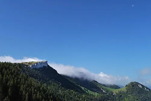 Le Chasseron Mountain, Bullet20 km SE
-
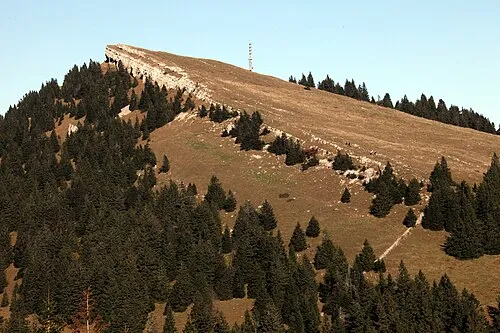 Petites Roches Mountain, Bullet20 km SE
-
Bois de la Bourgeoise Natural site, Doubs18 km SW
Sources & licences
Data last updated: