Crêt Chedry
Located in Les Verrières, Val-de-Travers District Coordinates: 46°54′55″ N 6°27′03″ E
- Elevation
- 1,170 m
- above sea level
- Local time
- UTC+01:00
- Europe/Zurich · UTC+01:00
- Airports
- DLE Dole Tavaux Airport79 km
- GVA Geneva International Airport80 km
About Crêt Chedry
Crêt Chedry is a mountain. Location: Les Verrières, Val-de-Travers District. Elevation: 1,170 m. The best months to visit are July–August. The nearest airport is Dole Tavaux Airport (79 km). Nearby sights include Le Crêt Rond and Bornes.
Climate of Crêt Chedry
Best months for sightseeingBest months for sightseeing: July–August.
This month · November
A wet month
Day 4° · Night -2° · Rain 125 mm
- Hottest month
- July (day 19°)
- Coldest month
- January (night -6°)
- Wettest month
- December (131 mm)
- Driest month
- March (99 mm)
Bars: average monthly low and high temperature. Below: precipitation. Monthly averages for 1970–2000 at about 18 km resolution, adjusted for elevation. Highlighted months are mild and relatively dry. Source: WorldClim 2.1 (CC BY 4.0).
Show values as a table
| Month | Jan | Feb | Mar | Apr | May | Jun | Jul | Aug | Sep | Oct | Nov | Dec |
|---|---|---|---|---|---|---|---|---|---|---|---|---|
| Average high (°C) | 0° | 1° | 5° | 8° | 13° | 16° | 19° | 19° | 15° | 10° | 4° | 1° |
| Average low (°C) | -6° | -5° | -3° | -1° | 4° | 7° | 9° | 9° | 6° | 3° | -2° | -4° |
| Precipitation (mm) | 115 | 113 | 99 | 102 | 118 | 125 | 108 | 107 | 114 | 114 | 125 | 131 |
How to get to Crêt Chedry
The nearest airport is Dole Tavaux Airport (DLE), 79 km to the west as the crow flies. For international flights: Geneva International Airport (GVA) (80 km). The nearest large city is Lausanne, 47 km to the south.
Airports
- Dole Tavaux Airport (DLE) Dole 79 kmwest
- Geneva International Airport (GVA) Geneva 80 kmsouth
- Bern Airport (BRN) Bern 80 kmeast
Nearby large cities
- Lausanne Population: 139.1K 47 kmsouth
- Besançon Population: 128.4K 50 kmnorthwest
- Bern Population: 121.6K 76 kmeast
- Geneva Population: 201.7K 83 kmsouth
- Basel Population: 177.6K 111 kmnortheast
Straight-line distances; road distances are longer. Airport data: OurAirports.
Day trips from Crêt Chedry
Within 100 km: 209 historic and cultural sites, 1,441 natural sites, 316 lakes, rivers and coasts.
0–25 km81 places
- Lac des Taillères Lake 11 kmNE
- Barrage du Day Lake 22 kmS
- Pré Cordey Lake 23 kmS
- Etang de Pré Bernard Lake 23 kmS
25–60 km287 places
- Sankt Petersinsel Island 55 kmE
- Ile d'Ogoz Island 55 kmSE
- Lake Neuchâtel Lake 32 kmE
- Lake Murten Lake 48 kmE
60–100 km1,598 places
- Kleiner Bremgartenwald Mountain 75 kmE
- Ile de Salagnon Island 62 kmSE
- Lake Wohlen Lake 67 kmE
- Schwarzsee Lake 69 kmSE
Straight-line distances.
Nearest towns and villages
-
Les Verrières Village, Les Verrières2.6 km SE
-
Verrières-de-Joux Village, Arrondissement of Pontarlier2 km S
-
Verrières-de-Joux Village, Verrières-de-Joux1.7 km S
-
Les Alliés Village, Arrondissement of Pontarlier3.7 km N
-
Bugny Village, Verrières-de-Joux1.7 km S
-
Les Alliés Village, Les Alliés3.7 km N
Nearby attractions & nature
Everything nearby-
Le Crêt Rond Mountain, Les Verrières1.5 km N
-
Bornes Mountain, Auvergne-Rhône-Alpes4.1 km N
-
Le Signal Mountain, Val-de-Travers5.4 km E
-
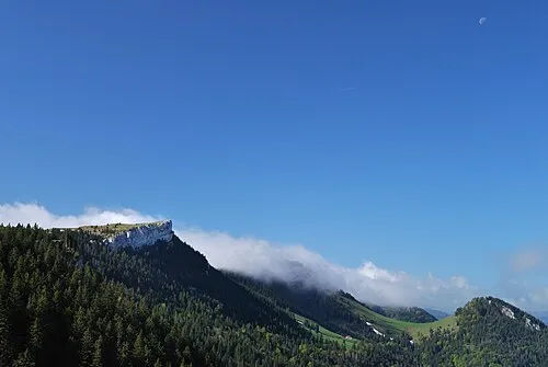 Le Chasseron Mountain, Bullet9.7 km SE
-
Roches Blanches Mountain, Sainte-Croix8.6 km SE
-
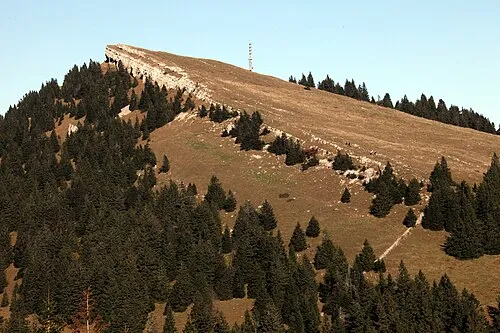 Petites Roches Mountain, Bullet9.9 km SE
-
Mont de la Maya Mountain, Sainte-Croix9.3 km SE
-
Haut de la Vy Mountain, Val-de-Travers9.6 km E
Sources & licences
Data last updated: