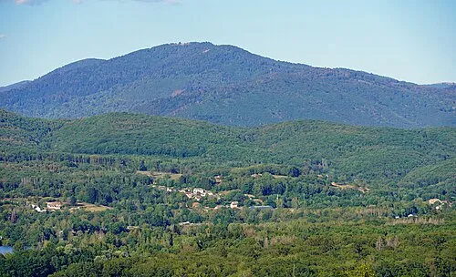
Bois de Filain
Located in Haute-Saône, Bourgogne-Franche-Comté Coordinates: 47°30′43″ N 6°09′23″ E
- Elevation
- 331 m
- above sea level
- Local time
- UTC+01:00
- Europe/Paris · UTC+01:00
- Airports
- DLE Dole Tavaux Airport76 km
- BSL EuroAirport Basel–Mulhouse–Freiburg103 km
About Bois de Filain
Bois de Filain is a natural site. Location: Haute-Saône, Bourgogne-Franche-Comté. The best months to visit are June–September. The nearest airport is Dole Tavaux Airport (76 km). Nearby sights include Linotte and Bois de la Charrière.
Climate of Bois de Filain
Best months for sightseeingBest months for sightseeing: June–September.
This month · November
A wet month
Day 9° · Night 2° · Rain 100 mm
- Hottest month
- July (day 24°)
- Coldest month
- January (night -2°)
- Wettest month
- November (100 mm)
- Driest month
- March (73 mm)
Bars: average monthly low and high temperature. Below: precipitation. Monthly averages for 1970–2000 at about 18 km resolution, adjusted for elevation. Highlighted months are mild and relatively dry. Source: WorldClim 2.1 (CC BY 4.0).
Show values as a table
| Month | Jan | Feb | Mar | Apr | May | Jun | Jul | Aug | Sep | Oct | Nov | Dec |
|---|---|---|---|---|---|---|---|---|---|---|---|---|
| Average high (°C) | 4° | 6° | 10° | 14° | 19° | 22° | 24° | 24° | 20° | 15° | 9° | 5° |
| Average low (°C) | -2° | -1° | 2° | 4° | 8° | 11° | 13° | 13° | 10° | 6° | 2° | 0° |
| Precipitation (mm) | 86 | 82 | 73 | 77 | 97 | 95 | 81 | 74 | 90 | 95 | 100 | 100 |
Other places to visit in this season: June July August September
How to get to Bois de Filain
The nearest airport is Dole Tavaux Airport (DLE), 76 km to the southwest as the crow flies. For international flights: EuroAirport Basel–Mulhouse–Freiburg (BSL) (103 km). The nearest large city is Besançon, 31 km to the south.
Airports
- Dole Tavaux Airport (DLE) Dole 76 kmsouthwest
- EuroAirport Basel–Mulhouse–Freiburg (BSL) Bâle / Mulhouse 103 kmeast
- Bern Airport (BRN) Bern 122 kmsoutheast
Nearby large cities
- Besançon Population: 128.4K 31 kmsouth
- Dijon Population: 159.9K 89 kmwest
- Mulhouse Population: 111.4K 92 kmeast
- Basel Population: 177.6K 107 kmeast
- Bern Population: 121.6K 116 kmsoutheast
Straight-line distances; road distances are longer. Airport data: OurAirports.
Day trips from Bois de Filain
Within 100 km: 207 historic and cultural sites, 664 natural sites, 178 lakes, rivers and coasts.
0–25 km11 places
- Bois de Saint-Gand Natural site 25 kmW
- Bois du Grand Val Natural site 20 kmSE
- Bois de la Charrière Natural site 14 kmSW
- Scey River 22 kmE
25–60 km174 places
- Préhisto-Parc de Réclère Natural site 60 kmE
- étang des Roseaux Lake 59 kmNE
- Mont d'Olivotte Mountain 52 kmNW
- Mont Olivot Mountain 53 kmSE
60–100 km864 places
- Sankt Petersinsel Island 89 kmSE
- Lake Neuchâtel Lake 85 kmSE
- Lake Murten Lake 95 kmSE
- Lac de Joux Lake 97 kmS
Straight-line distances.
Nearest towns and villages
-
Filain Village, Arrondissement of Vesoul2.2 km E
-
Authoison Village, Arrondissement of Vesoul2.6 km S
-
Filain Village, Filain2.1 km E
-
Authoison Village, Authoison2.7 km S
-
Vy-lès-Filain Village, Arrondissement of Vesoul3 km E
-
Vy-lès-Filain Village, Vy-lès-Filain3 km E
Nearby attractions & nature
Everything nearby-
Linotte River, Haute-Saône7.9 km SE
-
Bois de la Charrière Natural site, Haute-Saône14 km SW
-
Bois de Saint-Gand Natural site, Haute-Saône25 km W
-
Bois du Grand Val Natural site, Doubs20 km SE
-
Colombine River, Haute-Saône12 km N
-
Durgeon River, Haute-Saône18 km NW
-
Lauzin River, Haute-Saône20 km E
-
Buthiers River, Haute-Saône21 km SW
More nature in France
-
Mont Jarroz Mountain, Adelans-et-le-Val-de-Bithaine26 km NE
-
Bois de Confracourt Natural site, Haute-Saône26 km NW
-
Bois de la Raie Natural site, Haute-Saône31 km N
-
 La Planche des Belles Filles Mountain, Plancher-les-Mines54 km NE
-
Bois de Plumont Natural site, Haute-Saône27 km SW
-
Bois de Vauconcourt Natural site, Haute-Saône28 km NW
Sources & licences
Data last updated: