Arrondissement of Belfort
Located in Territoire de Belfort, Bourgogne-Franche-Comté Coordinates: 47°38′29″ N 6°55′12″ E
- Population
- 140,082
- 140.1K
- Elevation
- 366 m
- above sea level
- Local time
- UTC+01:00
- Europe/Paris · UTC+01:00
- Places inside
- 101
- listed under Arrondissement of Belfort
- Airports
- BSL EuroAirport Basel–Mulhouse–Freiburg45 km
- BRN Bern Airport92 km
About Arrondissement of Belfort
Arrondissement of Belfort is a municipality. Location: Territoire de Belfort, Bourgogne-Franche-Comté. Population: 140,082. Elevation: 366 m. The best months to visit are June–September. The nearest airport is EuroAirport Basel–Mulhouse–Freiburg (45 km). Nearby sights include Fort de la Miotte and Le Lion de Belfort.
Photos of Arrondissement of Belfort
-
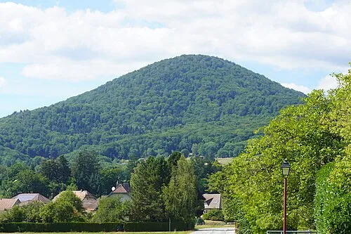
Le Fayé A.BourgeoisP · CC BY-SA 4.0 -
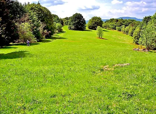
Baerenkopf Espirat · CC BY-SA 4.0 -
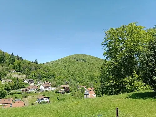
Mont Ordon-Verrier Rémih · CC BY-SA 4.0


Climate of Arrondissement of Belfort
Best months for sightseeingBest months for sightseeing: June–September.
This month · November
A cold month
Day 8° · Night 1° · Rain 91 mm
- Hottest month
- July (day 24°)
- Coldest month
- January (night -2°)
- Wettest month
- December (95 mm)
- Driest month
- March (66 mm)
Bars: average monthly low and high temperature. Below: precipitation. Monthly averages for 1970–2000 at about 18 km resolution, adjusted for elevation. Highlighted months are mild and relatively dry. Source: WorldClim 2.1 (CC BY 4.0).
Show values as a table
| Month | Jan | Feb | Mar | Apr | May | Jun | Jul | Aug | Sep | Oct | Nov | Dec |
|---|---|---|---|---|---|---|---|---|---|---|---|---|
| Average high (°C) | 4° | 6° | 10° | 13° | 18° | 22° | 24° | 24° | 20° | 14° | 8° | 5° |
| Average low (°C) | -2° | -2° | 1° | 3° | 8° | 11° | 13° | 12° | 9° | 6° | 1° | -1° |
| Precipitation (mm) | 82 | 78 | 66 | 67 | 89 | 87 | 78 | 72 | 82 | 83 | 91 | 95 |
Other places to visit in this season: June July August September
How to get to Arrondissement of Belfort
The nearest airport is EuroAirport Basel–Mulhouse–Freiburg (BSL), 45 km to the east as the crow flies. The nearest large city is Mulhouse, 33 km to the east.
Airports
- EuroAirport Basel–Mulhouse–Freiburg (BSL) Bâle / Mulhouse 45 kmeast
- Bern Airport (BRN) Bern 92 kmsoutheast
- Strasbourg Airport (SXB) Strasbourg 113 kmnortheast
Nearby large cities
- Mulhouse Population: 111.4K 33 kmeast
- Basel Population: 177.6K 50 kmeast
- Freiburg im Breisgau Population: 237.5K 80 kmnortheast
- Besançon Population: 128.4K 81 kmsouthwest
- Bern Population: 121.6K 87 kmsoutheast
Straight-line distances; road distances are longer. Airport data: OurAirports.
Day trips from Arrondissement of Belfort
Within 100 km: 375 historic and cultural sites, 1,053 natural sites, 302 lakes, rivers and coasts.
0–25 km120 places
- Pisciculture Lake 24 kmSE
- Pisciculture Lake 24 kmSE
- Lac d'Alfeld Lake 20 kmN
- lac des Perches - Sternsee Lake 23 kmN
25–60 km496 places
- Etang de la Gruère Lake 46 kmS
- Etangs Rougeat Lake 27 kmSE
- Barrage de Biaufond Lake 53 kmS
- Lac Tabeillon Lake 41 kmS
60–100 km1,114 places
- Kleiner Bremgartenwald Mountain 84 kmSE
- Sankt Petersinsel Island 66 kmS
- Lake Wohlen Lake 81 kmS
- Lake Neuchâtel Lake 80 kmS
Straight-line distances.
Arrondissement of Belfort and similar cities
Side by side with cities of similar size in the same country: population, elevation and climate.
| Measure | Arrondissement of Belfort | Limoges | Tours | Paris 11 Popincourt |
|---|---|---|---|---|
| Population | 140.1K | 141.2K | 141.6K | 138.2K |
| Elevation | 366 m | 309 m | 52 m | 43 m |
| Summer day (hottest month) | 24° | 24° | 25° | 25° |
| Winter night (coldest month) | -2° | 2° | 2° | 2° |
| Annual rainfall | 970 mm | 1,003 mm | 676 mm | 641 mm |
| Best months | Jun–Sep | Jun–Sep | Jun–Sep | May–Sep |
| Distance | — | 478 km | 469 km | 363 km |
Climate values are 1970–2000 monthly averages; straight-line distance.
Places in Arrondissement of Belfort
101 places- 1 Belfort 49K
- 2 Delle 5.7K
- 3 Valdoie 5.3K
- 4 Beaucourt 5K
- 5 Bavilliers 4.8K
- 6 Offemont 4K
- 7 Danjoutin 3.7K
- 8 Essert 3.3K
- 9 Giromagny 3.1K
- 10 Grandvillars 3K
- 11 Châtenois-les-Forges 2.7K
- 12 Évette-Salbert 2.1K
- 13 Cravanche 2K
- 14 Bourogne 1.9K
- 15 Chèvremont 1.6K
- 16 Étueffont 1.5K
- 17 Rougemont-le-Château 1.5K
- 18 Méziré 1.4K
- 19 Joncherey 1.3K
- 20 Meroux-Moval 1.3K
- 21 Trévenans 1.2K
- 22 Bessoncourt 1.2K
- 23 Andelnans 1.2K
- 24 Montreux-Château 1.2K
- 25 Pérouse 1.2K
- 26 Lepuix 1.2K
- 27 Chaux 1.1K
- 28 Morvillars 1.1K
- 29 Roppe 1K
- 30 Rougegoutte 983
- 31 Éloie 951
- 32 Vézelois 951
- 33 Foussemagne 923
- 34 Sermamagny 832
- 35 Réchésy 796
- 36 Fêche-l'Église 780
- 37 Denney 767
- 38 Vescemont 760
- 39 Lachapelle-sous-Chaux 730
- 40 Dorans 729
- 41 Sevenans 706
- 42 Saint-Germain-le-Châtelet 645
- 43 Vétrigne 636
- 44 Anjoutey 610
- 45 Fontaine 607
- 46 Lachapelle-sous-Rougemont 588
- 47 Faverois 576
- 48 Grosmagny 535
- 49 Boron 473
- 50 Auxelles-Bas 466
- 51 Phaffans 457
- 52 Argiésans 454
- 53 Froidefontaine 454
- 54 Florimont 451
- 55 Suarce 442
- 56 Courtelevant 434
- 57 Lebetain 428
- 58 Saint-Dizier-l'Évêque 426
- 59 Montbouton 406
- 60 Bermont 397
Bar: population relative to the most populous place in this list.
Nearby attractions & nature
Everything nearby-
Fort de la Miotte Historic site, Bourgogne-Franche-Comté3.4 km W
-
Le Lion de Belfort Landmark, Bourgogne-Franche-Comté4.2 km W
-
Écrevisse River, Territoire de Belfort7.3 km SE
-
Saint-Nicolas River, Bourgogne-Franche-Comté6.8 km SE
-
Fort du Salbert Historic site, Bourgogne-Franche-Comté8.1 km W
-
Rhôme River, Bourgogne-Franche-Comté8.3 km NW
-
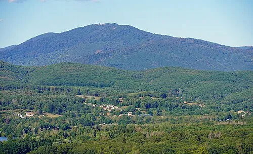 La Planche des Belles Filles Mountain, Plancher-les-Mines18 km NW
-
Suarcine River, Bourgogne-Franche-Comté9 km E
Sources & licences
Data last updated: