Kerdalaës
Located in Bourg-Blanc, Arrondissement de Brest Coordinates: 48°31′16″ N 4°30′00″ W
- Elevation
- 59 m
- above sea level
- Local time
- UTC+01:00
- Europe/Paris · UTC+01:00
- Airports
- BES Brest Bretagne airport10 km
- GCI Guernsey Airport172 km
About Kerdalaës
Kerdalaës is a village. Location: Bourg-Blanc, Arrondissement de Brest. Elevation: 59 m. The best months to visit are June–September. The nearest airport is Brest Bretagne airport (10 km). Nearby sights include Église Saint-Pierre and Église Saint-Gouescat.
Climate of Kerdalaës
Best months for sightseeingBest months for sightseeing: June–September.
This month · November
A wet month
Day 12° · Night 7° · Rain 118 mm
- Hottest month
- August (day 20°)
- Coldest month
- February (night 5°)
- Wettest month
- December (135 mm)
- Driest month
- July (46 mm)
Bars: average monthly low and high temperature. Below: precipitation. Monthly averages for 1970–2000 at about 18 km resolution, adjusted for elevation. Highlighted months are mild and relatively dry. Source: WorldClim 2.1 (CC BY 4.0).
Show values as a table
| Month | Jan | Feb | Mar | Apr | May | Jun | Jul | Aug | Sep | Oct | Nov | Dec |
|---|---|---|---|---|---|---|---|---|---|---|---|---|
| Average high (°C) | 9° | 10° | 11° | 12° | 15° | 18° | 19° | 20° | 18° | 15° | 12° | 10° |
| Average low (°C) | 5° | 5° | 6° | 6° | 9° | 11° | 13° | 13° | 12° | 10° | 7° | 6° |
| Precipitation (mm) | 132 | 111 | 91 | 74 | 65 | 52 | 46 | 57 | 83 | 110 | 118 | 135 |
Other places to visit in this season: June July August September
How to get to Kerdalaës
The nearest airport is Brest Bretagne airport (BES), 10 km to the southeast as the crow flies. The nearest large city is Brest, 15 km to the south.
Airports
- Brest Bretagne airport (BES) Brest 10 kmsoutheast
- Guernsey Airport (GCI) Saint Peter Port 172 kmnortheast
- Jersey Airport (JER) St. Peter 186 kmnortheast
Nearby large cities
- Brest Population: 144.9K 15 kmsouth
- Plymouth Population: 260.2K 207 kmnorth
- Rennes Population: 227.8K 214 kmeast
- Exeter Population: 130.7K 255 kmnorth
- Nantes Population: 325.1K 264 kmsoutheast
Straight-line distances; road distances are longer. Airport data: OurAirports.
Day trips from Kerdalaës
Within 100 km: 196 historic and cultural sites, 108 natural sites, 189 lakes, rivers and coasts.
0–25 km112 places
- Plage du Trez-Hir Beach 25 kmSW
- Plage des trois curés Beach 25 kmSW
- Plage de Sainte Anne Beach 24 kmSW
- Plage du Cosquer Beach 23 kmSW
25–60 km196 places
- Île de Quéménès Island 34 kmSW
- Plage de Bertheaume Beach 25 kmSW
- Grève du Vaéré Beach 28 kmSW
- La grève bleue Beach 28 kmSW
60–100 km185 places
- Île Grande Island 75 kmNE
- Kastell Koad Freg Historic site 82 kmE
- Kastell Tonkedeg Historic site 82 kmE
- Île aux Rats Island 78 kmS
Straight-line distances.
Nearby attractions & nature
Everything nearby-
Église Saint-Pierre Attraction, Plouguin7.3 km W
-
Église Saint-Gouescat Attraction, Tréouergat8.1 km W
-
Manoir d'Enez Rouz Attraction, Tréouergat8.3 km W
-
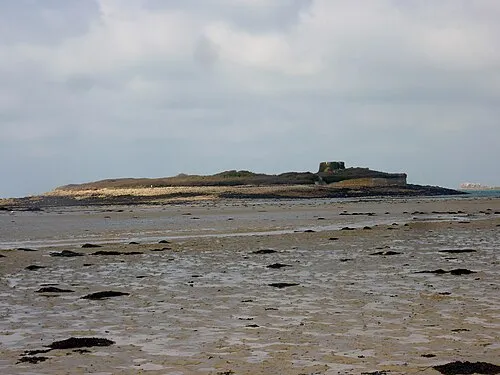 Île Cézon Island, Landéda11 km NW
-
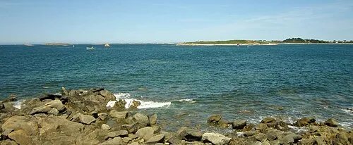 Île Garo Island, Brittany Region11 km NW
-
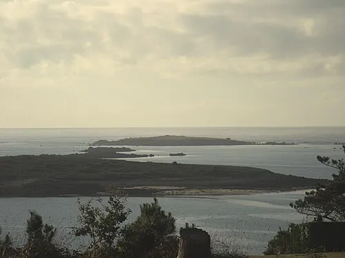 Île Guennoc Island, Brittany Region13 km NW
Sources & licences
Data last updated: