Fort de Bertheaume
Located in Finistère, Brittany Region Coordinates: 48°20′13″ N 4°41′51″ W
- Local time
- UTC+01:00
- Europe/Paris · UTC+01:00
- Elevation
- 37 m
- above sea level
- Airports
- BES Brest Bretagne airport24 km
- GCI Guernsey Airport196 km
About Fort de Bertheaume
Fort de Bertheaume is a historic site. Location: Finistère, Brittany Region.
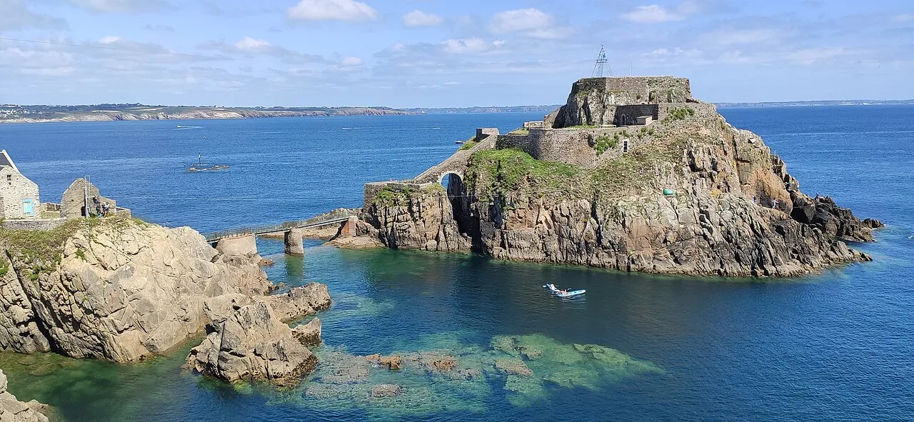
Fort de Bertheaume is a fort in Plougonvelin, in the Department of Finistère, France, in the cultural region of Brittany. It is located on a tidal island that nowadays connects to the mainland via a footbridge. The fort sits well above sea level, and its steep cliffs have rendered it easily defended for centuries. Since the 17th century, the fort's role has been to monitor the Goulet de Brest, the straits of Brest.
Source: Wikipedia · CC BY-SA 4.0
Photos of Fort de Bertheaume
-

G.Mannaerts · CC BY-SA 4.0 -

Eugène Isabey · Public domain -

Pom' · CC BY-SA 2.0 -

JackyM59 · CC BY-SA 4.0 -

Fab5669 · CC BY-SA 4.0


Climate of Fort de Bertheaume
Best months for sightseeingBest months for sightseeing: June–September.
This month · November
A wet month
Day 13° · Night 8° · Rain 122 mm
- Hottest month
- August (day 20°)
- Coldest month
- February (night 5°)
- Wettest month
- December (136 mm)
- Driest month
- July (45 mm)
Bars: average monthly low and high temperature. Below: precipitation. Monthly averages for 1970–2000 at about 18 km resolution, adjusted for elevation. Highlighted months are mild and relatively dry. Source: WorldClim 2.1 (CC BY 4.0).
Show values as a table
| Month | Jan | Feb | Mar | Apr | May | Jun | Jul | Aug | Sep | Oct | Nov | Dec |
|---|---|---|---|---|---|---|---|---|---|---|---|---|
| Average high (°C) | 10° | 10° | 11° | 12° | 15° | 18° | 19° | 20° | 18° | 15° | 13° | 11° |
| Average low (°C) | 6° | 5° | 6° | 7° | 9° | 11° | 13° | 13° | 12° | 10° | 8° | 7° |
| Precipitation (mm) | 134 | 111 | 92 | 71 | 64 | 52 | 45 | 58 | 83 | 108 | 122 | 136 |
Other places to visit in this season: June July August September
How to get to Fort de Bertheaume
The nearest airport is Brest Bretagne airport (BES), 24 km to the northeast as the crow flies. The nearest large city is Brest, 17 km to the east.
Airports
- Brest Bretagne airport (BES) Brest 24 kmnortheast
- Guernsey Airport (GCI) Saint Peter Port 196 kmnortheast
- Jersey Airport (JER) St. Peter 208 kmnortheast
Nearby large cities
- Brest Population: 144.9K 17 kmeast
- Rennes Population: 227.8K 226 kmeast
- Plymouth Population: 260.2K 230 kmnorth
- Nantes Population: 325.1K 266 kmsoutheast
- Exeter Population: 130.7K 279 kmnorth
Straight-line distances; road distances are longer. Airport data: OurAirports.
Day trips from Fort de Bertheaume
Within 100 km: 180 historic and cultural sites, 101 natural sites, 166 lakes, rivers and coasts.
0–25 km115 places
- Île de Quéménès Island 16 kmW
- Plage du Trez-Hir Beach 1 kmNW
- Plage de Bertheaume Beach 1 kmNW
- Plage des trois curés Beach 1 kmN
25–60 km151 places
- Plage de Kermabec Beach 56 kmSE
- Plage de Penhors Beach 49 kmSE
- Plage de Guendrez Beach 42 kmSE
- Plage du Ris Beach 40 kmSE
60–100 km181 places
- Île Grande Island 98 kmNE
- Île aux Rats Island 66 kmSE
- Moros River 78 kmSE
- Plages de Trévignon Beach 85 kmSE
Straight-line distances.
Nearby attractions & nature
Everything nearby-
Église Saint Gwenaël Attraction, Plougonvelin1.7 km W
-
Plage de Bertheaume Beach, Plougonvelin0.4 km NW
-
Complexe sportif de Plougonvelin Landmark, Plougonvelin2.2 km W
-
Anse de Poulizan Natural site, Plougonvelin0.6 km SW
-
Plage des trois curés Beach, Plougonvelin0.7 km N
-
Plage du Trez-Hir Beach, Plougonvelin1.1 km NW
-
Anse de Bertheaume Natural site, Brittany Region1.4 km NE
-
Plage de Sainte Anne Beach, Plougonvelin1.8 km N
Nearest towns and villages
-
Plougonvelin Village, Arrondissement de Brest1.2 km NW
-
Plougonvelin Village, Plougonvelin1.6 km W
-
Keruzas Village, Plougonvelin1.3 km W
-
Le Trez Hir Village, Plougonvelin1.3 km NW
More sights in Finistère
-
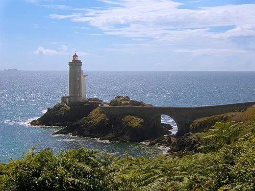 Phare du Petit Minou Landmark, Plouzané6.2 km E
-
Chapelle Notre-Dame-des-Grâces Attraction, Plougonvelin5.4 km W
-
Phare de Saint-Mathieu Landmark, Plougonvelin5.5 km W
-
Abbaye Saint-Mathieu de Fine-Terre Attraction, Plougonvelin5.5 km W
-
Phare de Kermorvan Landmark, Le Conquet7.4 km W
-
Toulinguet Lighthouse Landmark, Camaret-sur-Mer8.1 km SE
Sources & licences
Data last updated: · 2 independent sources