- Elevation
- 65 m
- above sea level
- Local time
- UTC+01:00
- Europe/Paris · UTC+01:00
- Airports
- BES Brest Bretagne airport47 km
- RNS Rennes-Saint-Jacques Airport209 km
About Kerbuzulic
Kerbuzulic is a village. Location: Finistère, Brittany Region. Elevation: 65 m. The best months to visit are June–September. The nearest airport is Brest Bretagne airport (47 km). Nearby sights include Goyen and Église Notre-Dame de Roscudon.
Climate of Kerbuzulic
Best months for sightseeingBest months for sightseeing: June–September.
This month · November
A wet month
Day 12° · Night 8° · Rain 129 mm
- Hottest month
- August (day 20°)
- Coldest month
- February (night 5°)
- Wettest month
- January (132 mm)
- Driest month
- July (43 mm)
Bars: average monthly low and high temperature. Below: precipitation. Monthly averages for 1970–2000 at about 18 km resolution, adjusted for elevation. Highlighted months are mild and relatively dry. Source: WorldClim 2.1 (CC BY 4.0).
Show values as a table
| Month | Jan | Feb | Mar | Apr | May | Jun | Jul | Aug | Sep | Oct | Nov | Dec |
|---|---|---|---|---|---|---|---|---|---|---|---|---|
| Average high (°C) | 10° | 10° | 11° | 13° | 15° | 18° | 20° | 20° | 18° | 15° | 12° | 11° |
| Average low (°C) | 5° | 5° | 6° | 7° | 9° | 12° | 13° | 14° | 12° | 10° | 8° | 6° |
| Precipitation (mm) | 132 | 106 | 89 | 66 | 65 | 51 | 43 | 57 | 79 | 99 | 129 | 131 |
Other places to visit in this season: June July August September
How to get to Kerbuzulic
The nearest airport is Brest Bretagne airport (BES), 47 km to the north as the crow flies. The nearest large city is Brest, 40 km to the north.
Airports
- Brest Bretagne airport (BES) Brest 47 kmnorth
- Rennes-Saint-Jacques Airport (RNS) Saint-Jacques-de-la-Lande, Ille-et-Vilaine 209 kmeast
- Guernsey Airport (GCI) Saint Peter Port 211 kmnortheast
Nearby large cities
- Brest Population: 144.9K 40 kmnorth
- Rennes Population: 227.8K 213 kmeast
- Nantes Population: 325.1K 242 kmeast
- Plymouth Population: 260.2K 262 kmnorth
- Angers Population: 168.3K 305 kmeast
Straight-line distances; road distances are longer. Airport data: OurAirports.
Day trips from Kerbuzulic
Within 100 km: 199 historic and cultural sites, 109 natural sites, 174 lakes, rivers and coasts.
0–25 km34 places
- Plage de Kermabec Beach 21 kmSE
- Plage de Penhors Beach 14 kmSE
- Plage de Guendrez Beach 6 kmSE
- Plage du Ris Beach 18 kmE
25–60 km236 places
- Île de Quéménès Island 47 kmNW
- Plage du Trez-Hir Beach 37 kmN
- Île aux Rats Island 33 kmSE
- Moros River 50 kmE
60–100 km212 places
- Île de Groix Island 92 kmSE
- Plage de Kerguélen Beach 92 kmSE
- Plage de Toulhars Beach 94 kmE
- Plage de Larmor Beach 94 kmSE
Straight-line distances.
Nearby attractions & nature
Everything nearby-
Goyen River, Finistère2.5 km S
-
Église Notre-Dame de Roscudon Attraction, Pont-Croix3.4 km E
-
Église Saint-Goulven Attraction, Goulien5.1 km NW
-
Étang de Poulguidou Lake, Finistère6.5 km E
-
Plage de Guendrez Beach, Plouhinec6.2 km SE
-
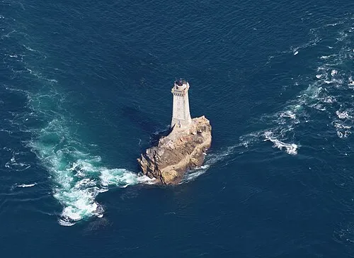 La Vieille Landmark, Finistère17 km W
Sources & licences
Data last updated: