Bois de Gâtine
Located in Ille-et-Vilaine, Brittany Region Coordinates: 48°26′00″ N 1°24′00″ W
- Elevation
- 114 m
- above sea level
- Local time
- UTC+01:00
- Europe/Paris · UTC+01:00
- Airports
- RNS Rennes-Saint-Jacques Airport47 km
- JER Jersey Airport104 km
About Bois de Gâtine
Bois de Gâtine is a natural site. Location: Ille-et-Vilaine, Brittany Region. The best months to visit are June–September. The nearest airport is Rennes-Saint-Jacques Airport (47 km). Nearby sights include Loisance and Tronçon.
Climate of Bois de Gâtine
Best months for sightseeingBest months for sightseeing: June–September.
This month · November
A cold month
Day 11° · Night 5° · Rain 84 mm
- Hottest month
- August (day 23°)
- Coldest month
- February (night 2°)
- Wettest month
- November (84 mm)
- Driest month
- July (47 mm)
Bars: average monthly low and high temperature. Below: precipitation. Monthly averages for 1970–2000 at about 18 km resolution, adjusted for elevation. Highlighted months are mild and relatively dry. Source: WorldClim 2.1 (CC BY 4.0).
Show values as a table
| Month | Jan | Feb | Mar | Apr | May | Jun | Jul | Aug | Sep | Oct | Nov | Dec |
|---|---|---|---|---|---|---|---|---|---|---|---|---|
| Average high (°C) | 8° | 9° | 11° | 13° | 17° | 20° | 22° | 23° | 20° | 16° | 11° | 9° |
| Average low (°C) | 2° | 2° | 4° | 5° | 8° | 11° | 13° | 13° | 11° | 8° | 5° | 3° |
| Precipitation (mm) | 71 | 58 | 56 | 53 | 67 | 49 | 47 | 47 | 60 | 75 | 84 | 75 |
Other places to visit in this season: June July August September
How to get to Bois de Gâtine
The nearest airport is Rennes-Saint-Jacques Airport (RNS), 47 km to the southwest as the crow flies. The nearest large city is Rennes, 41 km to the southwest.
Airports
- Rennes-Saint-Jacques Airport (RNS) Saint-Jacques-de-la-Lande, Ille-et-Vilaine 47 kmsouthwest
- Jersey Airport (JER) St. Peter 104 kmnorthwest
- Caen Carpiquet airport (CFR) Caen 108 kmnortheast
Nearby large cities
- Rennes Population: 227.8K 41 kmsouthwest
- Caen Population: 110.6K 113 kmnortheast
- Angers Population: 168.3K 124 kmsoutheast
- Le Mans Population: 144.5K 128 kmeast
- Nantes Population: 325.1K 136 kmsouth
Straight-line distances; road distances are longer. Airport data: OurAirports.
Day trips from Bois de Gâtine
Within 100 km: 143 historic and cultural sites, 125 natural sites, 183 lakes, rivers and coasts.
0–25 km29 places
- Mont-Saint-Michel Beach 24 kmN
- Étang de Boulet Lake 20 kmSW
- Forêt de Ville Cartier Natural site 13 kmW
- Forêt de Sevailles Natural site 24 kmS
25–60 km171 places
- Plage du Mole Beach 52 kmNW
- Plage de l'Éventail Beach 52 kmNW
- Plage Verger Beach 46 kmNW
- Île des Rimains Island 42 kmNW
60–100 km251 places
- Le Grand Pourier Island 85 kmW
- Île des Ehbiens Island 62 kmW
- Île Agot Island 61 kmW
- Étang de la Taberge Lake 84 kmS
Straight-line distances.
Nearest towns and villages
-
Arrondissement of Fougères-Vitré Municipality, Ille-et-Vilaine5.3 km E
-
Maen Roch Village, Arrondissement of Fougères-Vitré3.5 km SE
-
Coglès Village, Les Portes du Coglais3.8 km NE
-
Saint-Brice-en-Coglès Village, Maen Roch3.5 km SE
-
La Selle-en-Coglès Village, Les Portes du Coglais4.1 km E
-
Tremblay Village, Val-Couesnon5.7 km W
Nearby attractions & nature
Everything nearby-
Loisance River, Ille-et-Vilaine7.5 km NW
-
Tronçon River, Ille-et-Vilaine8.2 km NW
-
Guerge River, Ille-et-Vilaine9.7 km NW
-
Forêt de Ville Cartier Natural site, Ille-et-Vilaine13 km W
-
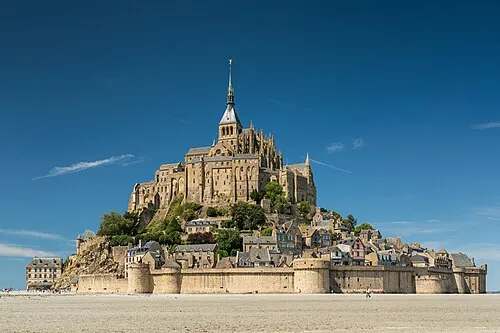 Mont Saint-Michel Island, Manche24 km N
-
Minette River, Ille-et-Vilaine11 km SW
-
Forêt de Haute Sève Natural site, Ille-et-Vilaine18 km S
-
Forêt de Fougères Natural site, Ille-et-Vilaine18 km E
Sources & licences
Data last updated: