Fort National
Located in Ille-et-Vilaine, Brittany Region Coordinates: 48°39′18″ N 2°01′24″ W
- Local time
- UTC+01:00
- Europe/Paris · UTC+01:00
- Elevation
- 2 m
- above sea level
- Airports
- JER Jersey Airport63 km
- RNS Rennes-Saint-Jacques Airport69 km
About Fort National
Fort National is a historic site. Location: Ille-et-Vilaine, Brittany Region.
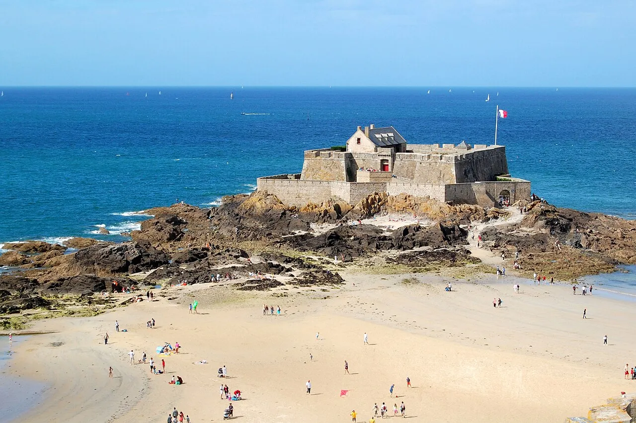
Fort National is a fort on a tidal island a few hundred metres off the walled city of Saint-Malo. The great military architect Vauban had it built in 1689 to protect Saint-Malo's port. The fort was originally called Fort Royal. In 1789 the fort's name became Fort d'Îlette or Républicain, then Fort Impérial and, after 1870, Fort National.
Source: Wikipedia · CC BY-SA 4.0
At a glance
- Built
- 1689
- Architect
- Sébastien Le Prestre de Vauban
- Heritage designation
- classified historical monument
- Official website
- fortnational.com
Source: Wikidata
Photos of Fort National
-

Мирослав Видрак · CC BY-SA 4.0 -

Bihbam · CC BY-SA 4.0 -

RAIL P · CC0 -

RAIL P · CC0 -

W. Bulach · CC BY-SA 4.0


Climate of Fort National
Best months for sightseeingBest months for sightseeing: June–September.
This month · November
Outside the best season
Day 12° · Night 7° · Rain 93 mm
- Hottest month
- August (day 23°)
- Coldest month
- January (night 4°)
- Wettest month
- November (93 mm)
- Driest month
- July (43 mm)
Bars: average monthly low and high temperature. Below: precipitation. Monthly averages for 1970–2000 at about 18 km resolution, adjusted for elevation. Highlighted months are mild and relatively dry. Source: WorldClim 2.1 (CC BY 4.0).
Show values as a table
| Month | Jan | Feb | Mar | Apr | May | Jun | Jul | Aug | Sep | Oct | Nov | Dec |
|---|---|---|---|---|---|---|---|---|---|---|---|---|
| Average high (°C) | 9° | 10° | 12° | 14° | 17° | 20° | 22° | 23° | 20° | 16° | 12° | 10° |
| Average low (°C) | 4° | 4° | 5° | 7° | 10° | 12° | 14° | 15° | 13° | 10° | 7° | 5° |
| Precipitation (mm) | 83 | 66 | 63 | 54 | 59 | 47 | 43 | 44 | 63 | 80 | 93 | 87 |
Other places to visit in this season: June July August September
How to get to Fort National
The nearest airport is Jersey Airport (JER), 63 km to the north as the crow flies. The nearest large city is Rennes, 66 km to the southeast.
Airports
- Jersey Airport (JER) St. Peter 63 kmnorth
- Rennes-Saint-Jacques Airport (RNS) Saint-Jacques-de-la-Lande, Ille-et-Vilaine 69 kmsouth
- Guernsey Airport (GCI) Saint Peter Port 97 kmnorthwest
Nearby large cities
- Rennes Population: 227.8K 66 kmsoutheast
- Caen Population: 110.6K 136 kmnortheast
- Nantes Population: 325.1K 164 kmsouth
- Angers Population: 168.3K 171 kmsoutheast
- Le Mans Population: 144.5K 180 kmsoutheast
Straight-line distances; road distances are longer. Airport data: OurAirports.
Day trips from Fort National
Within 100 km: 145 historic and cultural sites, 87 natural sites, 174 lakes, rivers and coasts.
0–25 km76 places
- Plage du Mole Beach 1 kmSW
- Plage de l'Éventail Beach 1 kmE
- Plage Verger Beach 12 kmNE
- Île des Rimains Island 15 kmE
25–60 km74 places
- Mont-Saint-Michel Beach 38 kmE
- Plage des Rosaires Beach 55 kmW
- Le Grand Pourier Island 34 kmW
- Grande Île Island 28 kmNE
60–100 km256 places
- Ollonde River 79 kmN
- Trieux River 80 kmW
- Kermagen Plage Beach 85 kmW
- Plage de Sciotot Beach 94 kmN
Straight-line distances.
Nearby attractions & nature
Everything nearby-
National Fort Historic site, Saint-Malo<0.1 km E
-
Saint-Malo Castle Historic site, Saint-Malo0.4 km S
-
Queen Bastion Historic site, Saint-Malo0.4 km SW
-
St. Vincent Gate Historic site, Saint-Malo0.5 km S
-
Bidouane Tower Historic site, Saint-Malo0.6 km SW
-
Champs-Vauvert Cavalier Historic site, Saint-Malo0.6 km SW
-
Big Gate Historic site, Saint-Malo0.7 km S
-
Our Lady Tower Historic site, Saint-Malo0.7 km SW
Nearest towns and villages
-
Saint-Malo Village, Arrondissement of Saint-Malo1.4 km SE
-
St-Malo Town, Saint-Malo1.4 km SE
-
Dinard Village, Arrondissement of Saint-Malo3.8 km SW
-
Intra Muros Village, Saint-Malo0.7 km S
Sources & licences
Data last updated: · 2 independent sources