la Guiche
Located in Ranrupt, Arrondissement of Molsheim Coordinates: 48°22′15″ N 7°12′50″ E
- Elevation
- 753 m
- above sea level
- Local time
- UTC+01:00
- Europe/Paris · UTC+01:00
- Airports
- SXB Strasbourg Airport36 km
- FKB Karlsruhe Baden-Baden Airport78 km
About la Guiche
la Guiche is a mountain. Location: Ranrupt, Arrondissement of Molsheim. Elevation: 753 m. The best months to visit are June–August. The nearest airport is Strasbourg Airport (36 km). Nearby sights include la Petite Guiche and Rude Hausse.
Photos of la Guiche
-
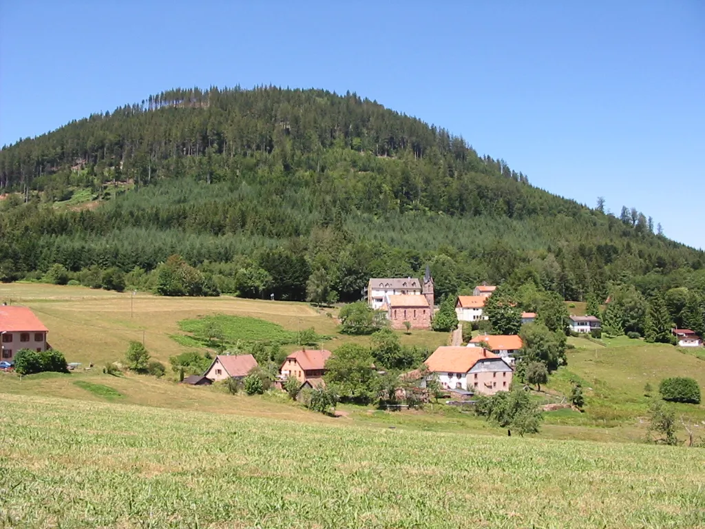
Climont No machine-readable author provided. Cham assumed · CC BY 2.5 -
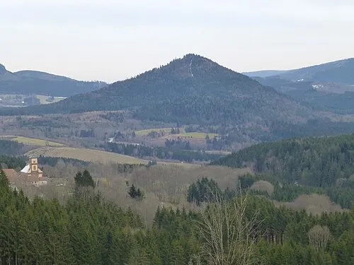
Le Voyemont Ji-Elle · CC BY-SA 3.0


Climate of la Guiche
Best months for sightseeingBest months for sightseeing: June–August.
This month · November
A wet month
Day 5° · Night 0° · Rain 100 mm
- Hottest month
- July (day 20°)
- Coldest month
- January (night -3°)
- Wettest month
- December (109 mm)
- Driest month
- April (77 mm)
Bars: average monthly low and high temperature. Below: precipitation. Monthly averages for 1970–2000 at about 18 km resolution, adjusted for elevation. Highlighted months are mild and relatively dry. Source: WorldClim 2.1 (CC BY 4.0).
Show values as a table
| Month | Jan | Feb | Mar | Apr | May | Jun | Jul | Aug | Sep | Oct | Nov | Dec |
|---|---|---|---|---|---|---|---|---|---|---|---|---|
| Average high (°C) | 2° | 3° | 6° | 10° | 15° | 17° | 20° | 20° | 16° | 11° | 5° | 3° |
| Average low (°C) | -3° | -3° | -1° | 2° | 6° | 9° | 11° | 11° | 8° | 4° | 0° | -2° |
| Precipitation (mm) | 88 | 85 | 79 | 77 | 104 | 103 | 94 | 80 | 85 | 95 | 100 | 109 |
How to get to la Guiche
The nearest airport is Strasbourg Airport (SXB), 36 km to the northeast as the crow flies. The nearest large city is Strasbourg, 46 km to the northeast.
Airports
- Strasbourg Airport (SXB) Strasbourg 36 kmnortheast
- Karlsruhe Baden-Baden Airport (FKB) Rheinmünster 78 kmnortheast
- EuroAirport Basel–Mulhouse–Freiburg (BSL) Bâle / Mulhouse 89 kmsouth
Nearby large cities
- Strasbourg Population: 274.8K 46 kmnortheast
- Freiburg im Breisgau Population: 237.5K 63 kmsoutheast
- Mulhouse Population: 111.4K 69 kmsouth
- Nancy Population: 105.1K 84 kmnorthwest
- Basel Population: 177.6K 94 kmsouth
Straight-line distances; road distances are longer. Airport data: OurAirports.
Day trips from la Guiche
Within 100 km: 409 historic and cultural sites, 1,857 natural sites, 376 lakes, rivers and coasts.
0–25 km217 places
- lac de la Maix Lake 16 kmNW
- Lac de Pierre-Percée Lake 24 kmNW
- Tête du Violu Mountain 17 kmS
- Montagne d'Ormont Mountain 17 kmW
25–60 km551 places
- Unditz River 48 kmE
- Matschelsee Lake 45 kmE
- Tunisee Lake 56 kmSE
- Limberg Mountain 38 kmSE
60–100 km1,874 places
- Rheinhafen Kleinhüningen Lake 92 kmS
- Neuer Teich Lake 93 kmS
- Möhlin Bach River 100 kmSE
- Ergolz River 100 kmS
Straight-line distances.
Nearest towns and villages
-
Steige Village, Steige1.8 km SE
-
Steige Village, Arrondissement of Sélestat-Erstein2.1 km SE
-
Ranrupt Village, Ranrupt1.2 km NW
-
Colroy-la-Roche Village, Arrondissement of Molsheim3.2 km NW
-
Colroy-la-Roche Village, Colroy-la-Roche3.4 km NW
-
Maisonsgoutte Village, Arrondissement of Sélestat-Erstein4.1 km SE
Nearby attractions & nature
Everything nearby-
la Petite Guiche Mountain, Ranrupt0.8 km SW
-
Rude Hausse Mountain, Ranrupt2.1 km W
-
Le Housserat Mountain, Ranrupt2.1 km N
-
Roffling Mountain, Breitenbach2.9 km E
-
Climont Mountain, Urbeis3.7 km SW
-
Schirgoutte Mountain, Bellefosse3 km NE
-
le Grand Sapin Mountain, Urbeis2.6 km S
-
le Mont Mountain, Urbeis3.1 km S
Sources & licences
Data last updated: