Herbitzheim
Located in Arrondissement of Saverne, Bas-Rhin Coordinates: 49°00′53″ N 7°05′03″ E
- Population
- 1,851
- 1.9K
- Elevation
- 222 m
- above sea level
- Local time
- UTC+01:00
- Europe/Paris · UTC+01:00
- Places inside
- 2
- listed under Herbitzheim
- Airports
- SCN Saarbrücken Airport22 km
- ETZ Metz-Nancy-Lorraine Airport61 km
About Herbitzheim
Herbitzheim is a village. Location: Arrondissement of Saverne, Bas-Rhin. Population: 1,851. Elevation: 222 m. The best months to visit are June–September. The nearest airport is Saarbrücken Airport (22 km). Nearby sights include Albe and Forêt de Sarralbe.
Climate of Herbitzheim
Best months for sightseeingBest months for sightseeing: June–September.
This month · November
A cold month
Day 8° · Night 2° · Rain 81 mm
- Hottest month
- July (day 24°)
- Coldest month
- January (night -1°)
- Wettest month
- December (92 mm)
- Driest month
- April (56 mm)
Bars: average monthly low and high temperature. Below: precipitation. Monthly averages for 1970–2000 at about 18 km resolution, adjusted for elevation. Highlighted months are mild and relatively dry. Source: WorldClim 2.1 (CC BY 4.0).
Show values as a table
| Month | Jan | Feb | Mar | Apr | May | Jun | Jul | Aug | Sep | Oct | Nov | Dec |
|---|---|---|---|---|---|---|---|---|---|---|---|---|
| Average high (°C) | 4° | 6° | 10° | 14° | 19° | 22° | 24° | 24° | 19° | 14° | 8° | 5° |
| Average low (°C) | -1° | -1° | 2° | 4° | 8° | 11° | 13° | 13° | 9° | 6° | 2° | 0° |
| Precipitation (mm) | 71 | 65 | 64 | 56 | 75 | 74 | 69 | 58 | 66 | 78 | 81 | 92 |
Other places to visit in this season: June July August September
How to get to Herbitzheim
The nearest airport is Saarbrücken Airport (SCN), 22 km to the north as the crow flies. For international flights: Strasbourg Airport (SXB) (66 km). The nearest large city is Saarbrücken, 25 km to the north.
Airports
- Saarbrücken Airport (SCN) Saarbrücken 22 kmnorth
- Metz-Nancy-Lorraine Airport (ETZ) Goin 61 kmwest
- Strasbourg Airport (SXB) Strasbourg 66 kmsoutheast
Nearby large cities
- Saarbrücken Population: 183K 25 kmnorth
- Metz Population: 123.9K 68 kmwest
- Strasbourg Population: 274.8K 68 kmsoutheast
- Nancy Population: 105.1K 76 kmsouthwest
- Trier Population: 100.1K 89 kmnorth
Straight-line distances; road distances are longer. Airport data: OurAirports.
Day trips from Herbitzheim
Within 100 km: 396 historic and cultural sites, 2,225 natural sites, 487 lakes, rivers and coasts.
0–25 km78 places
- Sonnenberg Mountain 21 kmN
- Kahler Berg Mountain 25 kmNE
- Hannocksberg Mountain 18 kmNE
- Halberg Mountain 23 kmN
25–60 km1,074 places
- Ottweiler Wingertsweier Lake 45 kmN
- Bomberg Mountain 48 kmN
- Zündelsberg Mountain 48 kmE
- Zöllerberg Mountain 53 kmE
60–100 km1,956 places
- Sauer River 90 kmNW
- Mont Saint-Jean Mountain 91 kmNW
- Syre River 87 kmNW
- Pétrusse River 96 kmNW
Straight-line distances.
Places in Herbitzheim
2 placesBar: population relative to the most populous place in this list.
Cities & villages1
- Saint-Michel · Village
Nearby attractions & nature
Everything nearby-
Albe River, Moselle3.9 km W
-
Forêt de Sarralbe Natural site, Moselle5.8 km W
-
Rose River, Moselle7 km SW
-
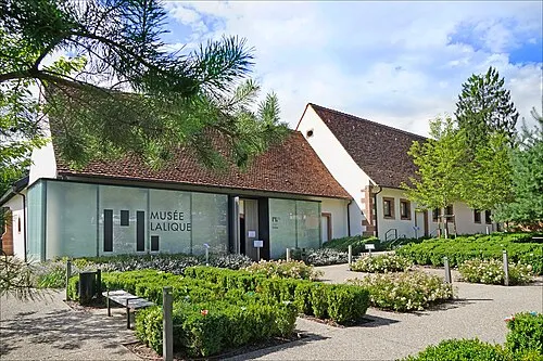 Musée Lalique Museum, Grand Est23 km SE
-
Buchholz Mountain, Nousseviller-Saint-Nabor16 km NW
-
Seyberg Mountain, Nousseviller-Saint-Nabor16 km NW
Sources & licences
Data last updated: