Etaples Military Cemetary
Located in Hauts-de-France, France Coordinates: 50°31′58″ N 1°37′28″ E
- Elevation
- 18 m
- above sea level
- Local time
- UTC+01:00
- Europe/Paris · UTC+01:00
- Airports
- LIL Lille Airport105 km
- OST Ostend-Bruges International Airport115 km
About Etaples Military Cemetary
Etaples Military Cemetary is a natural site. Location: Hauts-de-France, France. The best months to visit are June–September. The nearest airport is Lille Airport (105 km). Nearby sights include Baie d'Étaples and Canche River.
Climate of Etaples Military Cemetary
Best months for sightseeingBest months for sightseeing: June–September.
This month · November
A cold month
Day 10° · Night 6° · Rain 85 mm
- Hottest month
- August (day 21°)
- Coldest month
- February (night 3°)
- Wettest month
- November (85 mm)
- Driest month
- April (37 mm)
Bars: average monthly low and high temperature. Below: precipitation. Monthly averages for 1970–2000 at about 18 km resolution, adjusted for elevation. Highlighted months are mild and relatively dry. Source: WorldClim 2.1 (CC BY 4.0).
Show values as a table
| Month | Jan | Feb | Mar | Apr | May | Jun | Jul | Aug | Sep | Oct | Nov | Dec |
|---|---|---|---|---|---|---|---|---|---|---|---|---|
| Average high (°C) | 7° | 7° | 10° | 12° | 16° | 18° | 21° | 21° | 19° | 15° | 10° | 8° |
| Average low (°C) | 3° | 3° | 5° | 6° | 10° | 13° | 15° | 15° | 13° | 10° | 6° | 4° |
| Precipitation (mm) | 58 | 45 | 41 | 37 | 42 | 41 | 43 | 49 | 59 | 67 | 85 | 61 |
Other places to visit in this season: June July August September
How to get to Etaples Military Cemetary
The nearest airport is Lille Airport (LIL), 105 km to the east as the crow flies. The nearest large city is Amiens, 85 km to the southeast.
Airports
- Lille Airport (LIL) Lesquin 105 kmeast
- Ostend-Bruges International Airport (OST) Oostende 115 kmnortheast
- Beauvais-Tillé airport (BVA) Beauvais 125 kmsouth
Nearby large cities
- Amiens Population: 143.1K 85 kmsoutheast
- Saint Peters Population: 125.4K 94 kmnorth
- Eastbourne Population: 101.7K 98 kmwest
- Lille Population: 238.7K 102 kmeast
- Maidstone Population: 107.6K 113 kmnorthwest
Straight-line distances; road distances are longer. Airport data: OurAirports.
Day trips from Etaples Military Cemetary
Within 100 km: 164 historic and cultural sites, 142 natural sites, 126 lakes, rivers and coasts.
0–25 km39 places
- Plage Saint-Gabriel Beach 5 kmNW
- Plage de Fort-Mahon Beach 23 kmS
- Plage des Bains Beach 22 kmN
- Plage d'Equihen Beach 14 kmN
25–60 km84 places
- Plage du Cap Blanc-Nez Beach 44 kmN
- Mont d'Hubert Mountain 44 kmN
- Camp de César Mountain 39 kmN
- Cap Blanc-Nez Natural site 44 kmN
60–100 km309 places
- Camber Sands Beach 74 kmNW
- Sunny Sands Beach 68 kmNW
- Hastings Beach Beach 83 kmNW
- Isle of Oxney Island 82 kmNW
Straight-line distances.
Nearest towns and villages
-
Étaples Village, Arrondissement of Montreuil2 km SE
-
Étaples Town, Étaples1.4 km SE
-
Le Touquet-Paris-Plage Village, Arrondissement of Montreuil2.9 km W
-
Camiers Village, Arrondissement of Montreuil3.8 km N
-
Lefaux Village, Arrondissement of Montreuil2.7 km NE
-
Le Blanc Pavé Village, Étaples1 km SE
Nearby attractions & nature
Everything nearby-
Baie d'Étaples Natural site, Hauts-de-France2.9 km W
-
Canche River River, Hauts-de-France1.5 km W
-
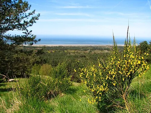 Mont Saint-Frieux Mountain, Neufchâtel-Hardelot8.7 km N
-
Plage Saint-Gabriel Beach, Camiers4.8 km NW
-
Les Dunes Natural site, Hauts-de-France7.2 km N
-
Mont Violette Mountain, Nesles10 km N
-
Dordogne River, Hauts-de-France7.2 km SE
-
Forêt d'Hardelot Natural site, Hauts-de-France12 km N
Sources & licences
Data last updated: