- Population
- 580
- 580
- Elevation
- 36 m
- above sea level
- Local time
- UTC+01:00
- Europe/Paris · UTC+01:00
- Places inside
- 1
- listed under Rivecourt
- Airports
- CDG Charles de Gaulle International Airport40 km
- BVA Beauvais-Tillé airport47 km
About Rivecourt
Rivecourt is a village. Location: Arrondissement of Compiègne, Oise. Population: 580. Elevation: 36 m. The best months to visit are June–September. The nearest airport is Charles de Gaulle International Airport (40 km). Nearby sights include Ru du Goderu and Automne.
Climate of Rivecourt
Best months for sightseeingBest months for sightseeing: June–September.
This month · November
A cold month
Day 10° · Night 4° · Rain 54 mm
- Hottest month
- August (day 24°)
- Coldest month
- February (night 1°)
- Wettest month
- June (59 mm)
- Driest month
- February (44 mm)
Bars: average monthly low and high temperature. Below: precipitation. Monthly averages for 1970–2000 at about 18 km resolution, adjusted for elevation. Highlighted months are mild and relatively dry. Source: WorldClim 2.1 (CC BY 4.0).
Show values as a table
| Month | Jan | Feb | Mar | Apr | May | Jun | Jul | Aug | Sep | Oct | Nov | Dec |
|---|---|---|---|---|---|---|---|---|---|---|---|---|
| Average high (°C) | 6° | 7° | 11° | 14° | 18° | 21° | 23° | 24° | 20° | 15° | 10° | 7° |
| Average low (°C) | 1° | 1° | 3° | 5° | 8° | 11° | 13° | 13° | 10° | 7° | 4° | 2° |
| Precipitation (mm) | 52 | 44 | 48 | 46 | 58 | 59 | 54 | 48 | 55 | 57 | 54 | 59 |
Other places to visit in this season: June July August September
How to get to Rivecourt
The nearest airport is Charles de Gaulle International Airport (CDG), 40 km to the south as the crow flies. The nearest large city is Argenteuil, 57 km to the southwest.
Airports
- Charles de Gaulle International Airport (CDG) Paris (Roissy-en-France, Val-d'Oise) 40 kmsouth
- Beauvais-Tillé airport (BVA) Beauvais 47 kmwest
- Paris-Orly Airport (ORY) Paris (Orly, Val-de-Marne) 74 kmsouth
Nearby large cities
- Argenteuil Population: 101.5K 57 kmsouthwest
- Marne La Vallée Population: 318.3K 57 kmsouth
- Montreuil Population: 111.2K 58 kmsouth
- Paris 19 Buttes-Chaumont Population: 178.7K 58 kmsouthwest
- Paris 18 Buttes-Montmartre Population: 183.1K 58 kmsouthwest
Straight-line distances; road distances are longer. Airport data: OurAirports.
Day trips from Rivecourt
Within 100 km: 602 historic and cultural sites, 201 natural sites, 179 lakes, rivers and coasts.
0–25 km54 places
- Étang du Désert Lake 24 kmS
- Mont du Tremble Mountain 14 kmNE
- Mont Saint-Marc Mountain 16 kmE
- Mont Pagnotte Mountain 10 kmSW
25–60 km224 places
- Île de Pothuis Island 56 kmSW
- Étang de Péreuse Lake 54 kmSE
- Étang de l'Épine Lake 26 kmS
- Lac d'Enghien Lake 53 kmSW
60–100 km704 places
- Île Saint-Louis Island 62 kmSW
- Île de la Cité Island 62 kmSW
- Île du Pont Island 62 kmSW
- Île de Puteaux Island 64 kmSW
Straight-line distances.
Places in Rivecourt
1 placeBar: population relative to the most populous place in this list.
Nearby attractions & nature
Everything nearby-
Ru du Goderu River, Oise1.6 km S
-
Automne River, Oise3.3 km S
-
Abbaye de Royallieu Historic site, Compiègne7.5 km NE
-
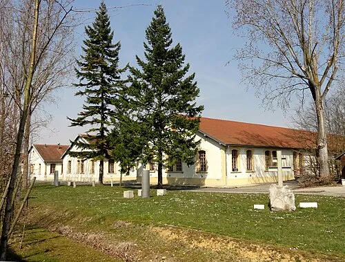 Police Custody Camp Compiègne Historic site, Compiègne10 km NE
-
Artothèque de Compiègne Museum, Compiègne8.5 km NE
-
Forêt de Rémy Natural site, Oise9.2 km NW
Sources & licences
Data last updated: