Courset
Located in Arrondissement de Boulogne-sur-Mer, Pas-de-Calais Coordinates: 50°38′47″ N 1°50′28″ E
- Population
- 517
- 517
- Elevation
- 153 m
- above sea level
- Local time
- UTC+01:00
- Europe/Paris · UTC+01:00
- Places inside
- 4
- listed under Courset
- Airports
- LIL Lille Airport90 km
- OST Ostend-Bruges International Airport95 km
About Courset
Courset is a village. Location: Arrondissement de Boulogne-sur-Mer, Pas-de-Calais. Population: 517. Elevation: 153 m. The best months to visit are June–September. The nearest airport is Lille Airport (90 km). Nearby sights include Mont Violette and Mont Saint-Frieux.
Climate of Courset
Best months for sightseeingBest months for sightseeing: June–September.
This month · November
A cold month
Day 9° · Night 5° · Rain 87 mm
- Hottest month
- August (day 20°)
- Coldest month
- February (night 1°)
- Wettest month
- November (87 mm)
- Driest month
- April (47 mm)
Bars: average monthly low and high temperature. Below: precipitation. Monthly averages for 1970–2000 at about 18 km resolution, adjusted for elevation. Highlighted months are mild and relatively dry. Source: WorldClim 2.1 (CC BY 4.0).
Show values as a table
| Month | Jan | Feb | Mar | Apr | May | Jun | Jul | Aug | Sep | Oct | Nov | Dec |
|---|---|---|---|---|---|---|---|---|---|---|---|---|
| Average high (°C) | 6° | 6° | 9° | 11° | 15° | 17° | 20° | 20° | 18° | 14° | 9° | 7° |
| Average low (°C) | 2° | 1° | 3° | 5° | 8° | 11° | 13° | 13° | 11° | 8° | 5° | 3° |
| Precipitation (mm) | 62 | 49 | 50 | 47 | 51 | 53 | 52 | 55 | 68 | 74 | 87 | 68 |
Other places to visit in this season: June July August September
How to get to Courset
The nearest airport is Lille Airport (LIL), 90 km to the east as the crow flies. The nearest large city is Saint Peters, 85 km to the north.
Airports
- Lille Airport (LIL) Lesquin 90 kmeast
- Ostend-Bruges International Airport (OST) Oostende 95 kmnortheast
- London Southend Airport (SEN) Southend-on-Sea, Essex 130 kmnorthwest
Nearby large cities
- Saint Peters Population: 125.4K 85 kmnorth
- Lille Population: 238.7K 86 kmeast
- Amiens Population: 143.1K 89 kmsouth
- Eastbourne Population: 101.7K 111 kmwest
- Bruges Population: 118.5K 116 kmnortheast
Straight-line distances; road distances are longer. Airport data: OurAirports.
Day trips from Courset
Within 100 km: 195 historic and cultural sites, 142 natural sites, 180 lakes, rivers and coasts.
0–25 km53 places
- Plage Saint-Gabriel Beach 20 kmSW
- Plage des Bains Beach 20 kmNW
- Plage d'Equihen Beach 19 kmW
- Plage d'Écault Beach 19 kmW
25–60 km82 places
- Plage de Fort-Mahon Beach 40 kmSW
- Warandebeek River 59 kmNE
- Steenvoordebeek River 59 kmNE
- Monnaartbeek River 59 kmNE
60–100 km382 places
- Camber Sands Beach 81 kmNW
- Sunny Sands Beach 67 kmNW
- Hastings Beach Beach 93 kmW
- Isle of Oxney Island 87 kmNW
Straight-line distances.
Places in Courset
4 placesBar: population relative to the most populous place in this list.
Cities & villages3
- La Gaverie · Village
- Le Bois Julien · Village
- Sacriquier · Village
Nearby attractions & nature
Everything nearby-
Mont Violette Mountain, Nesles12 km W
-
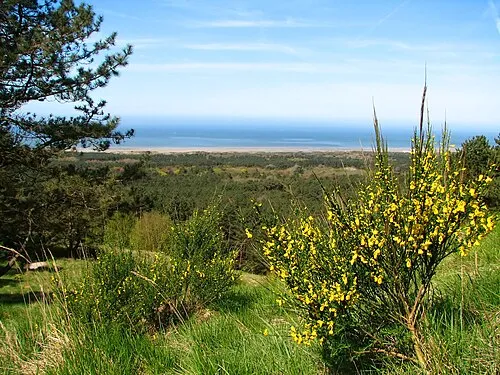 Mont Saint-Frieux Mountain, Neufchâtel-Hardelot17 km W
-
Forêt de Boulogne Natural site, Hauts-de-France10 km NW
-
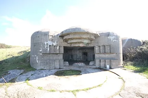 Fort de la Crèche Historic site, Wimereux20 km NW
-
Mont des Boucards Mountain, Wierre-Effroy15 km N
-
Forêt d'Engoudsent Natural site, Hauts-de-France11 km S
Sources & licences
Data last updated: