Bois de Faldaracon
Located in Pyrénées-Atlantiques, New Aquitaine Coordinates: 43°24′46″ N 1°24′24″ W
- Elevation
- 163 m
- above sea level
- Local time
- UTC+01:00
- Europe/Paris · UTC+01:00
- Airports
- BIQ Biarritz Pays Basque airport11 km
- EAS San Sebastián Airport32 km
About Bois de Faldaracon
Bois de Faldaracon is a natural site. Location: Pyrénées-Atlantiques, New Aquitaine. The best months to visit are June–September. The nearest airport is Biarritz Pays Basque airport (11 km). Nearby sights include Bois d'Égouralde and Artzamendi.
Climate of Bois de Faldaracon
Best months for sightseeingBest months for sightseeing: June–September.
This month · November
A wet month
Day 15° · Night 7° · Rain 145 mm
- Hottest month
- August (day 24°)
- Coldest month
- January (night 4°)
- Wettest month
- November (145 mm)
- Driest month
- July (61 mm)
Bars: average monthly low and high temperature. Below: precipitation. Monthly averages for 1970–2000 at about 18 km resolution, adjusted for elevation. Highlighted months are mild and relatively dry. Source: WorldClim 2.1 (CC BY 4.0).
Show values as a table
| Month | Jan | Feb | Mar | Apr | May | Jun | Jul | Aug | Sep | Oct | Nov | Dec |
|---|---|---|---|---|---|---|---|---|---|---|---|---|
| Average high (°C) | 12° | 13° | 14° | 16° | 19° | 21° | 24° | 24° | 23° | 19° | 15° | 12° |
| Average low (°C) | 4° | 5° | 6° | 7° | 10° | 13° | 15° | 16° | 13° | 10° | 7° | 5° |
| Precipitation (mm) | 125 | 105 | 95 | 118 | 94 | 67 | 61 | 89 | 95 | 119 | 145 | 129 |
Other places to visit in this season: June July August September
How to get to Bois de Faldaracon
The nearest airport is Biarritz Pays Basque airport (BIQ), 11 km to the northwest as the crow flies. The nearest large city is Donostia / San Sebastian, 47 km to the west.
Airports
- Biarritz Pays Basque airport (BIQ) Biarritz 11 kmnorthwest
- San Sebastián Airport (EAS) Hondarribia 32 kmwest
- Pamplona Airport (PNA) Pamplona 74 kmsouth
Nearby large cities
- Donostia / San Sebastian Population: 185.4K 47 kmwest
- Pamplona Population: 208.2K 69 kmsouth
- Vitoria-Gasteiz Population: 257.4K 120 kmsouthwest
- Bilbao Population: 347.3K 124 kmwest
- Barakaldo Population: 100.4K 129 kmwest
Straight-line distances; road distances are longer. Airport data: OurAirports.
Day trips from Bois de Faldaracon
Within 100 km: 142 historic and cultural sites, 536 natural sites, 190 lakes, rivers and coasts.
0–25 km87 places
- Pic Atchuria Mountain 22 kmSW
- Gorramendi Mountain 23 kmS
- Alcurruntz Mountain 23 kmS
- Alto Aizpitza Mountain 24 kmS
25–60 km280 places
- Valle de Baztan Natural site 29 kmS
- Iglesia San Juan Bautista Attraction 35 kmSW
- Kontxa / La Concha Beach 48 kmW
- Zurriola Beach 47 kmW
60–100 km501 places
- Fourmat Mountain 95 kmSE
- Yamaguchi Natural site 70 kmS
- Aubin River 63 kmE
- Playa de Malkorbe Hondartza Beach 66 kmW
Straight-line distances.
Nearest towns and villages
-
Jatxou Village, Arrondissement of Bayonne3.3 km SW
-
Ustaritz Village, Arrondissement of Bayonne4.3 km W
-
Jatxou Village, Jatxou3.3 km SW
-
Ustaritz Town, Ustaritz4.3 km W
-
Villefranque Village, Arrondissement of Bayonne4.6 km NW
-
Villefranque Village, Villefranque4.6 km NW
Nearby attractions & nature
Everything nearby-
Bois d'Égouralde Natural site, Pyrénées-Atlantiques3.1 km NE
-
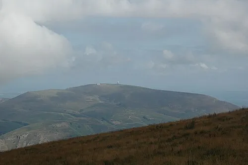 Artzamendi Mountain, Itxassou14 km S
-
Bois d'Ustaritz Natural site, Pyrénées-Atlantiques8.6 km SW
-
Mont Ursuya Mountain, Macaye9.7 km SE
-
Bois d'Aphalagne Natural site, Pyrénées-Atlantiques9.5 km W
-
Pic du Mondarrain Mountain, Espelette12 km S
-
Jardin Botanique Natural site, Bayonne11 km NW
-
Pic d'Ezcondray Mountain, Espelette11 km S
Sources & licences
Data last updated: