- Population
- 225,544
- 225.5K
- Elevation
- 150 m
- above sea level
- Local time
- UTC+01:00
- Europe/Paris · UTC+01:00
- Places inside
- 297
- listed under Arrondissement of Bernay
- Airports
- DOL Deauville Normandie airport45 km
- CFR Caen Carpiquet airport80 km
About Arrondissement of Bernay
Arrondissement of Bernay is a municipality. Location: Eure, Normandy. Population: 225,544. Elevation: 150 m. The best months to visit are June–September. The nearest airport is Deauville Normandie airport (45 km). Nearby sights include Charentonne River and Forêt de Beaumont.
Photos of Arrondissement of Bernay
-
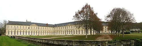
Bec Abbey Roland Brierre · CC BY-SA 3.0

Climate of Arrondissement of Bernay
Best months for sightseeingBest months for sightseeing: June–September.
This month · November
A cold month
Day 10° · Night 5° · Rain 73 mm
- Hottest month
- August (day 22°)
- Coldest month
- February (night 2°)
- Wettest month
- December (77 mm)
- Driest month
- July (49 mm)
Bars: average monthly low and high temperature. Below: precipitation. Monthly averages for 1970–2000 at about 18 km resolution, adjusted for elevation. Highlighted months are mild and relatively dry. Source: WorldClim 2.1 (CC BY 4.0).
Show values as a table
| Month | Jan | Feb | Mar | Apr | May | Jun | Jul | Aug | Sep | Oct | Nov | Dec |
|---|---|---|---|---|---|---|---|---|---|---|---|---|
| Average high (°C) | 7° | 7° | 10° | 13° | 16° | 19° | 22° | 22° | 19° | 15° | 10° | 8° |
| Average low (°C) | 2° | 2° | 3° | 5° | 8° | 11° | 13° | 13° | 11° | 8° | 5° | 3° |
| Precipitation (mm) | 70 | 62 | 54 | 51 | 57 | 55 | 49 | 50 | 59 | 75 | 73 | 77 |
Other places to visit in this season: June July August September
How to get to Arrondissement of Bernay
The nearest airport is Deauville Normandie airport (DOL), 45 km to the northwest as the crow flies. For international flights: Beauvais-Tillé airport (BVA) (114 km). The nearest large city is Rouen, 50 km to the northeast.
Airports
- Deauville Normandie airport (DOL) Deauville 45 kmnorthwest
- Caen Carpiquet airport (CFR) Caen 80 kmwest
- Beauvais-Tillé airport (BVA) Beauvais 114 kmeast
Nearby large cities
- Rouen Population: 116.3K 50 kmnortheast
- Le Havre Population: 186K 58 kmnorthwest
- Caen Population: 110.6K 73 kmwest
- Cergy-Pontoise Population: 183.4K 105 kmeast
- Saint-Quentin-en-Yvelines Population: 146.6K 108 kmeast
Straight-line distances; road distances are longer. Airport data: OurAirports.
Day trips from Arrondissement of Bernay
Within 100 km: 245 historic and cultural sites, 129 natural sites, 129 lakes, rivers and coasts.
0–25 km10 places
- Forêt de Conches Natural site 25 kmSE
- Forêt de Cinglais Natural site 22 kmSW
- Bois de Broglie Natural site 12 kmS
- Forêt de Beaumont Natural site 11 kmSE
25–60 km175 places
- Biotropica Natural site 47 kmNE
- Plage du Temple Beach 57 kmW
- Plage du Casino Beach 56 kmNW
- Plage de Deauville Beach 50 kmNW
60–100 km318 places
- Dive River 99 kmS
- Cloche River 87 kmS
- Gold Beach Beach 89 kmW
- Juno Beach Beach 82 kmW
Straight-line distances.
Arrondissement of Bernay and similar cities
Side by side with cities of similar size in the same country: population, elevation and climate.
| Measure | Arrondissement of Bernay | Rennes | Paris 15 Vaugirard | Lille |
|---|---|---|---|---|
| Population | 225.5K | 227.8K | 229.7K | 238.7K |
| Elevation | 150 m | 39 m | 47 m | 20 m |
| Summer day (hottest month) | 22° | 24° | 25° | 23° |
| Winter night (coldest month) | 2° | 3° | 2° | 1° |
| Annual rainfall | 732 mm | 738 mm | 632 mm | 716 mm |
| Best months | Jun–Sep | Jun–Sep | May–Sep | Jun–Aug |
| Distance | — | 203 km | 125 km | 243 km |
Climate values are 1970–2000 monthly averages; straight-line distance.
Places in Arrondissement of Bernay
297 places- 241 Le Mesnil-Saint-Jean 202
- 242 Épreville-en-Lieuvin 201
- 243 Folleville 201
- 244 Fresne-Cauverville 200
- 245 Neuville-sur-Authou 196
- 246 Plainville 190
- 247 Saint-Antonin-de-Sommaire 184
- 248 Saint-Léger-du-Gennetey 184
- 249 Feuguerolles 178
- 250 Bois-Anzeray 176
- 251 Le Troncq 175
- 252 Villettes 175
- 253 Saint-Sulpice-de-Grimbouville 174
- 254 Armentières-sur-Avre 173
- 255 La Poterie-Mathieu 172
- 256 Le Favril 172
- 257 Saint-Philbert-sur-Boissey 172
- 258 Hecmanville 170
- 259 Bazoques 163
- 260 La Goulafrière 163
- 261 Malouy 161
- 262 Chambord 156
- 263 La Pyle 156
- 264 Le Planquay 156
- 265 Saint-Agnan-de-Cernières 155
- 266 Tocqueville 155
- 267 Duranville 154
- 268 Vannecrocq 151
- 269 Piencourt 150
- 270 Courteilles 147
- 271 Livet-sur-Authou 146
- 272 Saint-Christophe-sur-Avre 146
- 273 Saint-Benoît-des-Ombres 142
- 274 Brétigny 139
- 275 Aizier 136
- 276 Gournay-le-Guérin 132
- 277 Voiscreville 127
- 278 Saint-Germain-de-Pasquier 126
- 279 Corneville-la-Fouquetière 122
- 280 Bailleul-la-Vallée 120
- 281 Écauville 112
- 282 Chennebrun 110
- 283 Heudreville-en-Lieuvin 109
- 284 Morsan 109
- 285 Saint-Ouen-de-Pontcheuil 97
- 286 La Chapelle-Hareng 94
- 287 Mesnil-Rousset 92
- 288 Saint-Denis-d'Augerons 88
- 289 Notre-Dame-d'Épine 81
- 290 Mélicourt 80
- 291 Les Places 78
- 292 L'Hosmes 69
- 293 Barville 64
- 294 Saint-Laurent-du-Tencement 63
- 295 Saint-Victor-sur-Avre 59
- 296 Noards 55
- 297 Vieux-Port 46
Bar: population relative to the most populous place in this list.
Nearby attractions & nature
Everything nearby-
Charentonne River River, Eure6.9 km E
-
Forêt de Beaumont Natural site, Eure11 km SE
-
Bois de Broglie Natural site, Eure12 km S
-
Forêt de Conches Natural site, Eure25 km SE
-
Château de Mailloc Historic site, Valorbiquet24 km W
-
Forêt de Cinglais Natural site, Calvados22 km SW
Sources & licences
Data last updated: