Baudretot
Located in Virandeville, Arrondissement of Cherbourg Coordinates: 49°34′44″ N 1°42′10″ W
- Elevation
- 40 m
- above sea level
- Local time
- UTC+01:00
- Europe/Paris · UTC+01:00
- Airports
- ACI Alderney Airport40 km
- JER Jersey Airport55 km
About Baudretot
Baudretot is a village. Location: Virandeville, Arrondissement of Cherbourg. Elevation: 40 m. The best months to visit are June–September. The nearest airport is Alderney Airport (40 km). Nearby sights include Heauville DGPS-Transmitter and Divette.
Climate of Baudretot
Best months for sightseeingBest months for sightseeing: June–September.
This month · November
A wet month
Day 12° · Night 7° · Rain 119 mm
- Hottest month
- August (day 21°)
- Coldest month
- February (night 4°)
- Wettest month
- November (119 mm)
- Driest month
- July (46 mm)
Bars: average monthly low and high temperature. Below: precipitation. Monthly averages for 1970–2000 at about 18 km resolution, adjusted for elevation. Highlighted months are mild and relatively dry. Source: WorldClim 2.1 (CC BY 4.0).
Show values as a table
| Month | Jan | Feb | Mar | Apr | May | Jun | Jul | Aug | Sep | Oct | Nov | Dec |
|---|---|---|---|---|---|---|---|---|---|---|---|---|
| Average high (°C) | 9° | 9° | 11° | 12° | 15° | 18° | 20° | 21° | 19° | 16° | 12° | 10° |
| Average low (°C) | 4° | 4° | 5° | 6° | 9° | 11° | 14° | 14° | 13° | 10° | 7° | 5° |
| Precipitation (mm) | 103 | 76 | 77 | 57 | 61 | 50 | 46 | 52 | 78 | 100 | 119 | 111 |
Other places to visit in this season: June July August September
How to get to Baudretot
The nearest airport is Alderney Airport (ACI), 40 km to the west as the crow flies. The nearest large city is Caen, 107 km to the southeast.
Airports
- Alderney Airport (ACI) Saint Anne 40 kmwest
- Jersey Airport (JER) St. Peter 55 kmsouthwest
- Guernsey Airport (GCI) Saint Peter Port 67 kmwest
Nearby large cities
- Caen Population: 110.6K 107 kmsoutheast
- Bournemouth Population: 163.6K 128 kmnorth
- Poole Population: 151.5K 128 kmnorth
- Le Havre Population: 186K 131 kmeast
- Portsmouth Population: 208.1K 143 kmnorth
Straight-line distances; road distances are longer. Airport data: OurAirports.
Day trips from Baudretot
Within 100 km: 58 historic and cultural sites, 50 natural sites, 62 lakes, rivers and coasts.
0–25 km53 places
- Plage Collignon Beach 13 kmNE
- Plage Napoléon Beach 10 kmNE
- Plage de Collignon Beach 14 kmNE
- Plage de Bretteville Beach 15 kmNE
25–60 km40 places
- La Nace Mountain 40 kmW
- Le Puits Gervais Mountain 41 kmW
- Ollonde River 27 kmS
- Utah Beach Beach 42 kmSE
60–100 km77 places
- Gold Beach Beach 89 kmE
- Juno Beach Beach 96 kmE
- Omaha Beach Beach 65 kmE
- Plage Verger Beach 99 kmS
Straight-line distances.
Nearby attractions & nature
Everything nearby-
Heauville DGPS-Transmitter Landmark, Groix5.5 km W
-
Divette River, Manche8.6 km NE
-
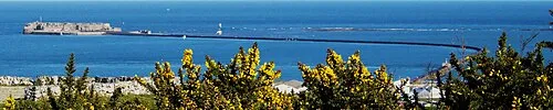 Île Pelée Island, Normandy13 km NE
-
Anse de Querqueville Natural site, Manche11 km N
-
Plage Napoléon Beach, Normandy10 km NE
-
Plage du Platé Beach, Siouville-Hague11 km W
Sources & licences
Data last updated: