- Population
- 187,300
- 187.3K
- Elevation
- 54 m
- above sea level
- Local time
- UTC+01:00
- Europe/Paris · UTC+01:00
- Places inside
- 144
- listed under Arrondissement of Cherbourg
- Airports
- ACI Alderney Airport52 km
- JER Jersey Airport57 km
About Arrondissement of Cherbourg
Arrondissement of Cherbourg is a municipality. Location: Manche, Normandy. Population: 187,300. Elevation: 54 m. The best months to visit are June–September. The nearest airport is Alderney Airport (52 km). Nearby sights include Gloire and Cotentin.
Photos of Arrondissement of Cherbourg
-
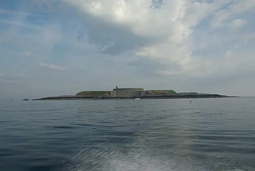
Île du Large Jeremy14650 · CC BY-SA 3.0 -
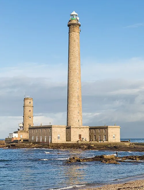
Pointe de Barfleur Light Raimond Spekking · CC BY-SA 4.0


Climate of Arrondissement of Cherbourg
Best months for sightseeingBest months for sightseeing: June–September.
This month · November
A wet month
Day 12° · Night 7° · Rain 117 mm
- Hottest month
- August (day 21°)
- Coldest month
- February (night 4°)
- Wettest month
- November (117 mm)
- Driest month
- July (47 mm)
Bars: average monthly low and high temperature. Below: precipitation. Monthly averages for 1970–2000 at about 18 km resolution, adjusted for elevation. Highlighted months are mild and relatively dry. Source: WorldClim 2.1 (CC BY 4.0).
Show values as a table
| Month | Jan | Feb | Mar | Apr | May | Jun | Jul | Aug | Sep | Oct | Nov | Dec |
|---|---|---|---|---|---|---|---|---|---|---|---|---|
| Average high (°C) | 8° | 9° | 11° | 12° | 16° | 18° | 20° | 21° | 18° | 15° | 12° | 9° |
| Average low (°C) | 4° | 4° | 5° | 6° | 8° | 11° | 13° | 14° | 12° | 10° | 7° | 5° |
| Precipitation (mm) | 99 | 74 | 75 | 59 | 63 | 51 | 47 | 52 | 77 | 100 | 117 | 108 |
Other places to visit in this season: June July August September
How to get to Arrondissement of Cherbourg
The nearest airport is Alderney Airport (ACI), 52 km to the northwest as the crow flies. The nearest large city is Caen, 94 km to the east.
Airports
- Alderney Airport (ACI) Saint Anne 52 kmnorthwest
- Jersey Airport (JER) St. Peter 57 kmsouthwest
- Guernsey Airport (GCI) Saint Peter Port 76 kmwest
Nearby large cities
- Caen Population: 110.6K 94 kmeast
- Le Havre Population: 186K 120 kmeast
- Bournemouth Population: 163.6K 137 kmnorth
- Poole Population: 151.5K 137 kmnorth
- Portsmouth Population: 208.1K 147 kmnorth
Straight-line distances; road distances are longer. Airport data: OurAirports.
Day trips from Arrondissement of Cherbourg
Within 100 km: 106 historic and cultural sites, 55 natural sites, 79 lakes, rivers and coasts.
0–25 km54 places
- Ollonde River 22 kmSW
- Plage Collignon Beach 16 kmN
- Plage Napoléon Beach 16 kmN
- Plage de Collignon Beach 16 kmN
25–60 km52 places
- La Nace Mountain 53 kmNW
- Le Puits Gervais Mountain 53 kmNW
- Omaha Beach Beach 52 kmE
- Utah Beach Beach 30 kmE
60–100 km134 places
- Gold Beach Beach 77 kmE
- Juno Beach Beach 84 kmE
- Sword Beach Beach 91 kmE
- Mont-Saint-Michel Beach 98 kmS
Straight-line distances.
Arrondissement of Cherbourg and similar cities
Side by side with cities of similar size in the same country: population, elevation and climate.
| Measure | Arrondissement of Cherbourg | Le Havre | Paris 20 Ménilmontant | Cergy-Pontoise |
|---|---|---|---|---|
| Population | 187.3K | 186K | 185.1K | 183.4K |
| Elevation | 54 m | 5 m | 96 m | 54 m |
| Summer day (hottest month) | 21° | 21° | 25° | 24° |
| Winter night (coldest month) | 4° | 4° | 2° | 1° |
| Annual rainfall | 922 mm | 731 mm | 641 mm | 641 mm |
| Best months | Jun–Sep | Jun–Sep | May–Sep | Jun–Sep |
| Distance | — | 120 km | 297 km | 269 km |
Climate values are 1970–2000 monthly averages; straight-line distance.
Places in Arrondissement of Cherbourg
144 places- 61 Saint-Martin-le-Gréard 489
- 62 Héauville 474
- 63 Sotteville 467
- 64 Saint-Christophe-du-Foc 431
- 65 Saint-Germain-de-Tournebut 428
- 66 Lieusaint 427
- 67 Breuville 421
- 68 Valcanville 410
- 69 Anneville-en-Saire 394
- 70 Rauville-la-Place 381
- 71 Étienville 373
- 72 Huberville 369
- 73 Orglandes 366
- 74 Fresville 365
- 75 Émondeville 356
- 76 Saint-Jean-de-la-Rivière 347
- 77 Saint-Marcouf 342
- 78 Magneville 339
- 79 L'Étang-Bertrand 338
- 80 Fierville-les-Mines 335
- 81 Brillevast 326
- 82 Le Vast 320
- 83 Sainte-Geneviève 320
- 84 Théville 319
- 85 Sortosville-en-Beaumont 316
- 86 Blosville 309
- 87 Le Ham 309
- 88 Tocqueville 282
- 89 Quinéville 279
- 90 Saint-Georges-de-la-Rivière 273
- 91 Varouville 266
- 92 Morville 265
- 93 Saint-Maurice-en-Cotentin 258
- 94 Crasville 254
- 95 La Pernelle 254
- 96 Le Rozel 253
- 97 La Haye-d'Ectot 247
- 98 Lestre 247
- 99 Carneville 236
- 100 Éroudeville 236
- 101 Maupertus-sur-Mer 220
- 102 Le Mesnil 218
- 103 Octeville-l'Avenel 216
- 104 Sainte-Colombe 216
- 105 Canteloup 215
- 106 Sénoville 207
- 107 Urville 207
- 108 Liesville-sur-Douve 204
- 109 Clitourps 200
- 110 La Bonneville 194
- 111 Saint-Martin-de-Varreville 188
- 112 Flottemanville 185
- 113 Saint-Cyr 185
- 114 Hémevez 181
- 115 Fontenay-sur-Mer 180
- 116 Golleville 174
- 117 Ozeville 156
- 118 Hautteville-Bocage 152
- 119 Turqueville 147
- 120 Baubigny 146
Bar: population relative to the most populous place in this list.
Nearby attractions & nature
Everything nearby-
Gloire River, Manche2.1 km S
-
Cotentin Natural site, Manche4.2 km E
-
Seye River, Manche7.4 km S
-
Saudre River, Manche11 km S
-
Bois de Barnavast Natural site, Manche13 km NE
-
Forêt de Saint-Sauveur Natural site, Manche15 km S
-
Bois de Blangueville Natural site, Manche15 km NE
-
Divette River, Manche14 km N
Other cities and towns in Manche
-
 La Glacerie Town, Cherbourg-en-Cotentin11 km N
-
Valognes Town, Valognes6.1 km E
-
Tourlaville Town, Cherbourg-en-Cotentin14 km N
-
Octeville Town, Cherbourg-en-Cotentin14 km NW
-
Cherbourg Town, Cherbourg-en-Cotentin15 km N
-
Équeurdreville-Hainneville Town, Cherbourg-en-Cotentin17 km NW
Sources & licences
Data last updated: