- Population
- 114
- 114
- Elevation
- 614 m
- above sea level
- Local time
- UTC+01:00
- Europe/Paris · UTC+01:00
- Places inside
- 2
- listed under Leychert
- Airports
- CCF Carcassonne Salvaza Airport56 km
- LEU Pirineus - la Seu d'Urgel Airport72 km
About Leychert
Leychert is a village. Location: Arrondissement of Pamiers, Ariège. Population: 114. Elevation: 614 m. The best months to visit are June–September. The nearest airport is Carcassonne Salvaza Airport (56 km). Nearby sights include Roc Marot and Pic de l'Aspre.
Climate of Leychert
Best months for sightseeingBest months for sightseeing: June–September.
This month · November
A cold month
Day 12° · Night 4° · Rain 83 mm
- Hottest month
- July (day 25°)
- Coldest month
- January (night 1°)
- Wettest month
- May (105 mm)
- Driest month
- July (61 mm)
Bars: average monthly low and high temperature. Below: precipitation. Monthly averages for 1970–2000 at about 18 km resolution, adjusted for elevation. Highlighted months are mild and relatively dry. Source: WorldClim 2.1 (CC BY 4.0).
Show values as a table
| Month | Jan | Feb | Mar | Apr | May | Jun | Jul | Aug | Sep | Oct | Nov | Dec |
|---|---|---|---|---|---|---|---|---|---|---|---|---|
| Average high (°C) | 8° | 9° | 12° | 14° | 18° | 21° | 25° | 25° | 22° | 17° | 12° | 9° |
| Average low (°C) | 1° | 1° | 3° | 5° | 8° | 12° | 14° | 14° | 12° | 8° | 4° | 2° |
| Precipitation (mm) | 76 | 71 | 72 | 87 | 105 | 87 | 61 | 76 | 75 | 86 | 83 | 79 |
Other places to visit in this season: June July August September
How to get to Leychert
The nearest airport is Carcassonne Salvaza Airport (CCF), 56 km to the northeast as the crow flies. For international flights: Toulouse-Blagnac Airport (TLS) (82 km). The nearest large city is Toulouse, 77 km to the north.
Airports
- Carcassonne Salvaza Airport (CCF) Carcassonne 56 kmnortheast
- Pirineus - la Seu d'Urgel Airport (LEU) La Seu d'Urgell Pyrenees and Andorra 72 kmsouth
- Toulouse-Blagnac Airport (TLS) Toulouse/Blagnac 82 kmnorth
Nearby large cities
- Toulouse Population: 511.7K 77 kmnorth
- Perpignan Population: 110.7K 99 kmeast
- Girona Population: 100.3K 140 kmsoutheast
- Terrassa Population: 218.5K 155 kmsouth
- Sabadell Population: 211.7K 159 kmsouth
Straight-line distances; road distances are longer. Airport data: OurAirports.
Day trips from Leychert
Within 100 km: 178 historic and cultural sites, 1,583 natural sites, 255 lakes, rivers and coasts.
0–25 km120 places
- Lac de Montbel Lake 17 kmE
- Pic de Soularac Mountain 15 kmS
- Pic de Saint-Barthélemy Mountain 14 kmS
- Roc de Querquéou Mountain 22 kmSW
25–60 km585 places
- Artigue River 49 kmW
- Pic de la Bassera Mountain 52 kmSW
- Pic de les Molleres del Puigpedrós Mountain 52 kmS
- Pic de Portavera Mountain 54 kmSW
60–100 km1,311 places
- Base de loisirs de Bouconne Natural site 90 kmNW
- Forêt de Montaigut Natural site 90 kmNW
- Esglesia de Sant Esteve de Ginast Attraction 97 kmSW
- Estany de Travessani Lake 79 kmSW
Straight-line distances.
Places in Leychert
2 placesBar: population relative to the most populous place in this list.
Mountains & nature1
- Pic des Monges · Mountain
Nearby attractions & nature
Everything nearby-
Roc Marot Mountain, Roquefixade2.6 km E
-
Pic de l'Aspre Mountain, Soula2.6 km W
-
Cap de Touron Mountain, L'Herm3.4 km W
-
Roc Nègre Mountain, Soula5.5 km W
-
Cap de la Mounjo Mountain, Raissac6.8 km E
-
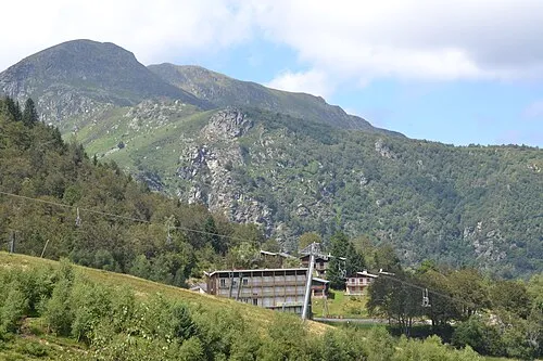 Mont Fourcat Mountain, Montferrier10 km S
Sources & licences
Data last updated: