Pech de l'Estelhe
Located in Auriac, Arrondissement of Narbonne Coordinates: 42°54′39″ N 2°30′53″ E
- Elevation
- 777 m
- above sea level
- Local time
- UTC+01:00
- Europe/Paris · UTC+01:00
- Airports
- PGF Perpignan-Rivesaltes (Llabanère) Airport35 km
- CCF Carcassonne Salvaza Airport38 km
About Pech de l'Estelhe
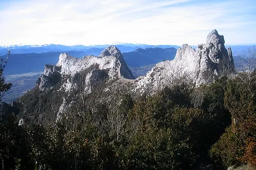
Pech de l'Estelhe is a mountain. Location: Auriac, Arrondissement of Narbonne. Elevation: 777 m. The best months to visit are July–August. The nearest airport is Perpignan-Rivesaltes (Llabanère) Airport (35 km). Nearby sights include Milobre de Massac and Mont Escoujeat.
Climate of Pech de l'Estelhe
Best months for sightseeingBest months for sightseeing: July–August.
This month · November
A cold month
Day 10° · Night 3° · Rain 68 mm
- Hottest month
- July (day 24°)
- Coldest month
- January (night 0°)
- Wettest month
- October (87 mm)
- Driest month
- July (29 mm)
Bars: average monthly low and high temperature. Below: precipitation. Monthly averages for 1970–2000 at about 18 km resolution, adjusted for elevation. Highlighted months are mild and relatively dry. Source: WorldClim 2.1 (CC BY 4.0).
Show values as a table
| Month | Jan | Feb | Mar | Apr | May | Jun | Jul | Aug | Sep | Oct | Nov | Dec |
|---|---|---|---|---|---|---|---|---|---|---|---|---|
| Average high (°C) | 7° | 8° | 10° | 12° | 16° | 20° | 24° | 23° | 20° | 15° | 10° | 8° |
| Average low (°C) | 0° | 1° | 2° | 4° | 8° | 11° | 14° | 14° | 11° | 7° | 3° | 1° |
| Precipitation (mm) | 70 | 60 | 60 | 67 | 74 | 55 | 29 | 49 | 63 | 87 | 68 | 79 |
How to get to Pech de l'Estelhe
The nearest airport is Perpignan-Rivesaltes (Llabanère) Airport (PGF), 35 km to the southeast as the crow flies. The nearest large city is Perpignan, 39 km to the southeast.
Airports
- Perpignan-Rivesaltes (Llabanère) Airport (PGF) Perpignan/Rivesaltes 35 kmsoutheast
- Carcassonne Salvaza Airport (CCF) Carcassonne 38 kmnorthwest
- Castres Mazamet Airport (DCM) Castres 74 kmnorth
Nearby large cities
- Perpignan Population: 110.7K 39 kmsoutheast
- Girona Population: 100.3K 106 kmsouth
- Toulouse Population: 511.7K 116 kmnorthwest
- Montpellier Population: 248.3K 135 kmnortheast
- Mataró Population: 127K 152 kmsouth
Straight-line distances; road distances are longer. Airport data: OurAirports.
Day trips from Pech de l'Estelhe
Within 100 km: 155 historic and cultural sites, 1,346 natural sites, 257 lakes, rivers and coasts.
0–25 km134 places
- Casic Mountain 21 kmS
- Roc de Lansac Mountain 17 kmS
- Pla de Saint-Paul Mountain 8 kmS
- Sarrat Naout Mountain 22 kmSW
25–60 km527 places
- Puig del Torn Mountain 58 kmS
- Roc de la Sentinella Mountain 57 kmS
- Pic Bastiments Mountain 60 kmSW
- Roc de Frausa Mountain 57 kmS
60–100 km1,097 places
- Platja de Perafita Beach 73 kmSE
- Puig Joan Mountain 72 kmSE
- Platja de Port-alguer Beach 93 kmSE
- Platja d'Empúries Beach 99 kmSE
Straight-line distances.
Nearest towns and villages
-
Auriac Village, Auriac2.9 km NW
-
Soulatgé Village, Arrondissement of Narbonne3.7 km S
-
Soulatgé Village, Soulatgé3.7 km S
-
Rouffiac-des-Corbières Village, Rouffiac-des-Corbières4.7 km SE
-
Savignan Village, Auriac3.5 km NW
-
Rouffiac-des-Corbières Village, Arrondissement of Narbonne4.6 km SE
Nearby attractions & nature
Everything nearby-
Milobre de Massac Mountain, Auriac1.1 km NE
-
Mont Escoujeat Mountain, Auriac2.3 km N
-
Roc de Matefagine Mountain, Massac2.5 km E
-
Roc de Sagnes Mountain, Duilhac-sous-Peyrepertuse5.3 km S
-
Pech de la Paille Mountain, Fourtou6.3 km W
-
 Corbières Mountain, Aude9.7 km E
-
La Quille Mountain, Duilhac-sous-Peyrepertuse7.8 km SE
-
Pech d'Auroux Mountain, Soulatgé6.7 km S
Sources & licences
Data last updated: