Saint-Maurice
Located in Fondamente, Arrondissement of Millau Coordinates: 43°51′56″ N 3°04′32″ E
- Elevation
- 452 m
- above sea level
- Local time
- UTC+01:00
- Europe/Paris · UTC+01:00
- Airports
- BZR Béziers Vias airport64 km
- DCM Castres Mazamet Airport72 km
About Saint-Maurice
Saint-Maurice is a village. Location: Fondamente, Arrondissement of Millau. Elevation: 452 m. The best months to visit are June–September. The nearest airport is Béziers Vias airport (64 km). Nearby sights include Abbaye de Nonenque and Bois des Ginestoux.
Climate of Saint-Maurice
Best months for sightseeingBest months for sightseeing: June–September.
This month · November
A cold month
Day 12° · Night 5° · Rain 72 mm
- Hottest month
- July (day 26°)
- Coldest month
- January (night 1°)
- Wettest month
- October (95 mm)
- Driest month
- July (36 mm)
Bars: average monthly low and high temperature. Below: precipitation. Monthly averages for 1970–2000 at about 18 km resolution, adjusted for elevation. Highlighted months are mild and relatively dry. Source: WorldClim 2.1 (CC BY 4.0).
Show values as a table
| Month | Jan | Feb | Mar | Apr | May | Jun | Jul | Aug | Sep | Oct | Nov | Dec |
|---|---|---|---|---|---|---|---|---|---|---|---|---|
| Average high (°C) | 8° | 9° | 12° | 14° | 19° | 23° | 26° | 26° | 22° | 17° | 12° | 9° |
| Average low (°C) | 1° | 2° | 3° | 5° | 9° | 13° | 15° | 15° | 12° | 9° | 5° | 2° |
| Precipitation (mm) | 77 | 63 | 54 | 69 | 75 | 59 | 36 | 52 | 67 | 95 | 72 | 76 |
Other places to visit in this season: June July August September
How to get to Saint-Maurice
The nearest airport is Béziers Vias airport (BZR), 64 km to the south as the crow flies. The nearest large city is Montpellier, 70 km to the southeast.
Airports
- Béziers Vias airport (BZR) Béziers 64 kmsouth
- Castres Mazamet Airport (DCM) Castres 72 kmsouthwest
- Rodez–Aveyron Airport (RDZ) Rodez/Marcillac 77 kmnorthwest
Nearby large cities
- Montpellier Population: 248.3K 70 kmsoutheast
- Nîmes Population: 148.2K 103 kmeast
- Perpignan Population: 110.7K 131 kmsouth
- Toulouse Population: 511.7K 135 kmwest
- Aix-en-Provence Population: 146.8K 195 kmeast
Straight-line distances; road distances are longer. Airport data: OurAirports.
Day trips from Saint-Maurice
Within 100 km: 84 historic and cultural sites, 381 natural sites, 215 lakes, rivers and coasts.
0–25 km30 places
- Mont Trois Terres Mountain 19 kmS
- Mont Saint-Amand Mountain 24 kmSE
- Montagne de Montmare Mountain 15 kmS
- Bois de Saint-Thomas Natural site 16 kmSW
25–60 km186 places
- Lac du Salagou Lake 33 kmSE
- Lac de Pareloup Lake 46 kmNW
- Pic Saint-Loup Mountain 60 kmE
- Roc des Pézouls Mountain 40 kmE
60–100 km464 places
- Marseillan Plage Beach 72 kmSE
- Plage de l'Espiguette Beach 94 kmSE
- Plage du Couchant Beach 87 kmSE
- Plage du Grand Travers Beach 86 kmSE
Straight-line distances.
Nearby attractions & nature
Everything nearby-
Abbaye de Nonenque Historic site, Marnhagues-et-Latour5.2 km NW
-
Bois des Ginestoux Natural site, Aveyron6.1 km W
-
Puech de Lion Mountain, Tauriac-de-Camarès12 km SW
-
Sauve Mousse Mountain, Brusque12 km SW
-
Abbaye de Sylvanès Historic site, Sylvanès9.9 km W
-
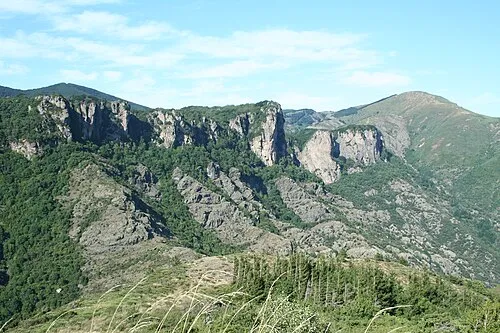 Montagne de Marcou Mountain, Saint-Geniès-de-Varensal19 km S
Sources & licences
Data last updated: