- Population
- 129
- 129
- Elevation
- 162 m
- above sea level
- Local time
- UTC+01:00
- Europe/Paris · UTC+01:00
- Places inside
- 1
- listed under Lamazère
- Airports
- LDE Tarbes-Lourdes-Pyrénées Airport56 km
- PUF Pau Pyrénées Airport73 km
About Lamazère
Lamazère is a village. Location: Arrondissement of Mirande, Gers. Population: 129. Elevation: 162 m. The best months to visit are June–September. The nearest airport is Tarbes-Lourdes-Pyrénées Airport (56 km). Nearby sights include Abbaye Notre-Dame de Berdoues and Petite Baise.
Climate of Lamazère
Best months for sightseeingBest months for sightseeing: June–September.
This month · November
A wet month
Day 14° · Night 5° · Rain 104 mm
- Hottest month
- July (day 26°)
- Coldest month
- January (night 2°)
- Wettest month
- May (116 mm)
- Driest month
- July (70 mm)
Bars: average monthly low and high temperature. Below: precipitation. Monthly averages for 1970–2000 at about 18 km resolution, adjusted for elevation. Highlighted months are mild and relatively dry. Source: WorldClim 2.1 (CC BY 4.0).
Show values as a table
| Month | Jan | Feb | Mar | Apr | May | Jun | Jul | Aug | Sep | Oct | Nov | Dec |
|---|---|---|---|---|---|---|---|---|---|---|---|---|
| Average high (°C) | 10° | 12° | 14° | 16° | 20° | 23° | 26° | 26° | 24° | 19° | 14° | 11° |
| Average low (°C) | 2° | 3° | 4° | 6° | 10° | 13° | 15° | 15° | 12° | 9° | 5° | 3° |
| Precipitation (mm) | 100 | 98 | 94 | 110 | 116 | 88 | 70 | 76 | 79 | 99 | 104 | 97 |
Other places to visit in this season: June July August September
How to get to Lamazère
The nearest airport is Tarbes-Lourdes-Pyrénées Airport (LDE), 56 km to the southwest as the crow flies. For international flights: Toulouse-Blagnac Airport (TLS) (74 km). The nearest large city is Toulouse, 80 km to the east.
Airports
- Tarbes-Lourdes-Pyrénées Airport (LDE) Tarbes/Lourdes/Pyrénées 56 kmsouthwest
- Pau Pyrénées Airport (PUF) Pau/Pyrénées (Uzein) 73 kmwest
- Toulouse-Blagnac Airport (TLS) Toulouse/Blagnac 74 kmeast
Nearby large cities
- Toulouse Population: 511.7K 80 kmeast
- Bordeaux Population: 265.3K 165 kmnorthwest
- Pamplona Population: 208.2K 189 kmsouthwest
- Donostia / San Sebastian Population: 185.4K 198 kmwest
- Lleida Population: 140.8K 216 kmsouth
Straight-line distances; road distances are longer. Airport data: OurAirports.
Day trips from Lamazère
Within 100 km: 165 historic and cultural sites, 786 natural sites, 264 lakes, rivers and coasts.
0–25 km19 places
- Bois du Turc Natural site 7 kmSE
- Bois de Montpellier Natural site 14 kmNW
- Bois de Mazous Natural site 24 kmNW
- Bois de Berdoues Natural site 13 kmS
25–60 km125 places
- le Plèche Mountain 32 kmSE
- Cap de Montardon Mountain 60 kmS
- Pic de Pinçon Mountain 58 kmS
- Pic du Pla de Souil Mountain 58 kmS
60–100 km1,071 places
- Base de loisirs de Bouconne Natural site 64 kmE
- Forêt de Montaigut Natural site 64 kmE
- Fourmat Mountain 89 kmSW
- Aubin River 89 kmW
Straight-line distances.
Places in Lamazère
1 placeBar: population relative to the most populous place in this list.
Nearby attractions & nature
Everything nearby-
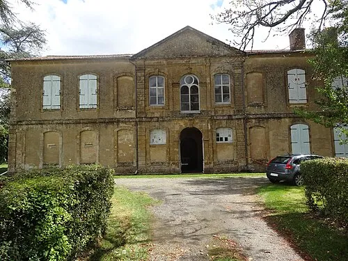 Abbaye Notre-Dame de Berdoues Attraction, Berdoues9.2 km S
-
Petite Baise River, Gers4.8 km NW
-
Château de Loubersan Historic site, Loubersan7.7 km SE
-
Bois du Turc Natural site, Gers6.9 km SE
-
Lizet River, Gers10 km NW
-
St Maurus church in St-Maur Gers Attraction, Saint-Maur13 km SW
Sources & licences
Data last updated: