- Population
- 221
- 221
- Elevation
- 1,087 m
- above sea level
- Local time
- UTC+01:00
- Europe/Paris · UTC+01:00
- Places inside
- 2
- listed under Le Buisson
- Airports
- RDZ Rodez–Aveyron Airport65 km
- AUR Aurillac airport71 km
About Le Buisson
Le Buisson is a village. Location: Arrondissement of Mende, Lozère. Population: 221. Elevation: 1,087 m. The best months to visit are July–August. The nearest airport is Rodez–Aveyron Airport (65 km). Nearby sights include Pic de Mus and Truc de l'Église.
Photos of Le Buisson
-
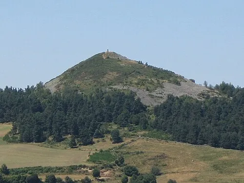
Pic de Mus Jean-marc PLANCHON · CC BY-SA 3.0

Climate of Le Buisson
Best months for sightseeingBest months for sightseeing: July–August.
This month · November
A cold month
Day 7° · Night 0° · Rain 84 mm
- Hottest month
- July (day 22°)
- Coldest month
- January (night -3°)
- Wettest month
- October (115 mm)
- Driest month
- July (45 mm)
Bars: average monthly low and high temperature. Below: precipitation. Monthly averages for 1970–2000 at about 18 km resolution, adjusted for elevation. Highlighted months are mild and relatively dry. Source: WorldClim 2.1 (CC BY 4.0).
Show values as a table
| Month | Jan | Feb | Mar | Apr | May | Jun | Jul | Aug | Sep | Oct | Nov | Dec |
|---|---|---|---|---|---|---|---|---|---|---|---|---|
| Average high (°C) | 4° | 5° | 8° | 10° | 14° | 18° | 22° | 22° | 18° | 13° | 7° | 5° |
| Average low (°C) | -3° | -3° | -1° | 1° | 5° | 8° | 10° | 10° | 8° | 5° | 0° | -2° |
| Precipitation (mm) | 85 | 70 | 60 | 75 | 89 | 66 | 45 | 62 | 79 | 115 | 84 | 81 |
How to get to Le Buisson
The nearest airport is Rodez–Aveyron Airport (RDZ), 65 km to the west as the crow flies. For international flights: Clermont-Ferrand Auvergne airport (CFE) (129 km). The nearest large city is Montpellier, 124 km to the southeast.
Airports
- Rodez–Aveyron Airport (RDZ) Rodez/Marcillac 65 kmwest
- Aurillac airport (AUR) Aurillac 71 kmnorthwest
- Clermont-Ferrand Auvergne airport (CFE) Clermont-Ferrand 129 kmnorth
Nearby large cities
- Montpellier Population: 248.3K 124 kmsoutheast
- Nîmes Population: 148.2K 126 kmsoutheast
- Saint-Etienne Population: 176.3K 128 kmnortheast
- Clermont-Ferrand Population: 147.9K 129 kmnorth
- Lyon Population: 520.8K 178 kmnortheast
Straight-line distances; road distances are longer. Airport data: OurAirports.
Day trips from Le Buisson
Within 100 km: 166 historic and cultural sites, 583 natural sites, 197 lakes, rivers and coasts.
0–25 km60 places
- Truc du Midi Mountain 12 kmSE
- Truc de l'Homme Mountain 16 kmN
- Truc de Fortunio Mountain 24 kmE
- Signal de Randon Mountain 25 kmE
25–60 km259 places
- Lac de Charpal Lake 27 kmE
- Lac du Bouchet Lake 54 kmNE
- Lac du barrage de Naussac Lake 48 kmE
- Lac de Grandval Lake 35 kmN
60–100 km627 places
- Ancien îlot Gambetta Island 71 kmNW
- Lac de Montcineyre Lake 96 kmN
- Lac de la Landie Lake 96 kmN
- Lac d'Issarlès Lake 69 kmE
Straight-line distances.
Places in Le Buisson
2 placesBar: population relative to the most populous place in this list.
Cities & villages1
- Le Gibertès · Village
Nearby attractions & nature
Everything nearby-
Pic de Mus Mountain, Saint-Laurent-de-Muret3.6 km SW
-
Truc de l'Église Mountain, Saint-Laurent-de-Muret6.2 km SW
-
Puech del Trap Mountain, Saint-Laurent-de-Muret6.3 km SW
-
Puech de l'Evers Mountain, Saint-Laurent-de-Muret6.6 km SW
-
Bois de Faibesse Natural site, Lozère5.9 km E
-
le Plo Mountain, Saint-Laurent-de-Muret6.1 km W
Sources & licences
Data last updated: