Forêt de Touffou
Located in Loire-Atlantique, Pays de la Loire Region Coordinates: 47°07′38″ N 1°29′16″ W
- Elevation
- 50 m
- above sea level
- Local time
- UTC+01:00
- Europe/Paris · UTC+01:00
- Airports
- NTE Nantes Atlantique Airport10 km
- RNS Rennes-Saint-Jacques Airport106 km
About Forêt de Touffou
Forêt de Touffou is a natural site. Location: Loire-Atlantique, Pays de la Loire Region. The best months to visit are June–September. The nearest airport is Nantes Atlantique Airport (10 km). Nearby sights include Maine and Abbaye de Villeneuve.
Climate of Forêt de Touffou
Best months for sightseeingBest months for sightseeing: June–September.
This month · November
A cold month
Day 12° · Night 5° · Rain 85 mm
- Hottest month
- August (day 25°)
- Coldest month
- January (night 2°)
- Wettest month
- December (86 mm)
- Driest month
- June (42 mm)
Bars: average monthly low and high temperature. Below: precipitation. Monthly averages for 1970–2000 at about 18 km resolution, adjusted for elevation. Highlighted months are mild and relatively dry. Source: WorldClim 2.1 (CC BY 4.0).
Show values as a table
| Month | Jan | Feb | Mar | Apr | May | Jun | Jul | Aug | Sep | Oct | Nov | Dec |
|---|---|---|---|---|---|---|---|---|---|---|---|---|
| Average high (°C) | 8° | 10° | 12° | 15° | 19° | 22° | 24° | 25° | 21° | 17° | 12° | 9° |
| Average low (°C) | 2° | 2° | 4° | 6° | 9° | 11° | 13° | 13° | 11° | 9° | 5° | 3° |
| Precipitation (mm) | 83 | 72 | 57 | 57 | 60 | 42 | 43 | 43 | 66 | 79 | 85 | 86 |
Other places to visit in this season: June July August September
How to get to Forêt de Touffou
The nearest airport is Nantes Atlantique Airport (NTE), 10 km to the west as the crow flies. The nearest large city is Nantes, 11 km to the northwest.
Airports
- Nantes Atlantique Airport (NTE) Nantes 10 kmwest
- Rennes-Saint-Jacques Airport (RNS) Saint-Jacques-de-la-Lande, Ille-et-Vilaine 106 kmnorth
- La Rochelle Île de Ré Airport (LRH) La Rochelle 108 kmsouth
Nearby large cities
- Nantes Population: 325.1K 11 kmnorthwest
- Angers Population: 168.3K 80 kmnortheast
- Rennes Population: 227.8K 110 kmnorth
- Le Mans Population: 144.5K 160 kmnortheast
- Tours Population: 141.6K 169 kmeast
Straight-line distances; road distances are longer. Airport data: OurAirports.
Day trips from Forêt de Touffou
Within 100 km: 161 historic and cultural sites, 98 natural sites, 183 lakes, rivers and coasts.
0–25 km55 places
- Île d'Arouix Island 17 kmN
- Lac de Grand-Lieu Lake 14 kmW
- Forêt de Machecoul Natural site 23 kmSW
- Parc du grand blottereau Natural site 11 kmN
25–60 km137 places
- Plage de la Boutinardière Beach 43 kmW
- Plage de la Birochère Beach 46 kmW
- Plage de la Source Beach 46 kmW
- Plage de la Noëveillard Beach 48 kmW
60–100 km250 places
- Noirmoutier Island 60 kmW
- Île d'Yeu Island 80 kmSW
- Plage de la Courance Beach 61 kmW
- Plage Sainte-Marguerite Beach 64 kmW
Straight-line distances.
Nearest towns and villages
-
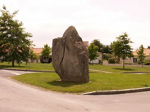 Les Sorinières Town, Les Sorinières3.9 km NW
-
Le Bignon Village, Arrondissement of Nantes3.1 km S
-
Le Bignon Village, Le Bignon3.2 km S
-
Les Sorinières Village, Arrondissement of Nantes3.9 km NW
-
Vertou Village, Arrondissement of Nantes4.7 km N
-
Vertou Town, Vertou4.8 km N
Nearby attractions & nature
Everything nearby-
Maine River, Loire-Atlantique4.3 km NE
-
Abbaye de Villeneuve Historic site, Les Sorinières3.5 km W
-
Île Beaulieu Island, Loire-Atlantique9.6 km NW
-
Parc du Crapa Natural site, Nantes9.8 km N
-
Sèvre Nantaise River, Loire-Atlantique8.9 km NW
-
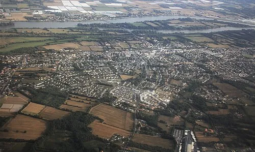 Île la Chenaie Island, Loire-Atlantique14 km N
-
Jardin des Plantes Natural site, Nantes11 km N
-
Parc du grand blottereau Natural site, Pays de la Loire Region11 km N
Sources & licences
Data last updated: