- Elevation
- 10 m
- above sea level
- Local time
- UTC+01:00
- Europe/Paris · UTC+01:00
- Airports
- NTE Nantes Atlantique Airport32 km
- RNS Rennes-Saint-Jacques Airport88 km
About Hâvre
Hâvre is a river. Location: Maine-et-Loire, Pays de la Loire Region. The best months to visit are June–September. The nearest airport is Nantes Atlantique Airport (32 km). Nearby sights include Pont de Champtoceaux and Donneau.
Climate of Hâvre
Best months for sightseeingBest months for sightseeing: June–September.
This month · November
A cold month
Day 12° · Night 5° · Rain 83 mm
- Hottest month
- August (day 25°)
- Coldest month
- February (night 2°)
- Wettest month
- November (83 mm)
- Driest month
- July (43 mm)
Bars: average monthly low and high temperature. Below: precipitation. Monthly averages for 1970–2000 at about 18 km resolution, adjusted for elevation. Highlighted months are mild and relatively dry. Source: WorldClim 2.1 (CC BY 4.0).
Show values as a table
| Month | Jan | Feb | Mar | Apr | May | Jun | Jul | Aug | Sep | Oct | Nov | Dec |
|---|---|---|---|---|---|---|---|---|---|---|---|---|
| Average high (°C) | 8° | 10° | 12° | 15° | 19° | 22° | 25° | 25° | 22° | 17° | 12° | 9° |
| Average low (°C) | 3° | 2° | 4° | 6° | 9° | 12° | 14° | 13° | 11° | 8° | 5° | 3° |
| Precipitation (mm) | 79 | 70 | 57 | 56 | 62 | 44 | 43 | 46 | 64 | 75 | 83 | 81 |
Other places to visit in this season: June July August September
How to get to Hâvre
The nearest airport is Nantes Atlantique Airport (NTE), 32 km to the southwest as the crow flies. The nearest large city is Nantes, 24 km to the southwest.
Airports
- Nantes Atlantique Airport (NTE) Nantes 32 kmsouthwest
- Rennes-Saint-Jacques Airport (RNS) Saint-Jacques-de-la-Lande, Ille-et-Vilaine 88 kmnorth
- La Rochelle Île de Ré Airport (LRH) La Rochelle 129 kmsouth
Nearby large cities
- Nantes Population: 325.1K 24 kmsouthwest
- Angers Population: 168.3K 57 kmeast
- Rennes Population: 227.8K 90 kmnorth
- Le Mans Population: 144.5K 134 kmnortheast
- Tours Population: 141.6K 151 kmeast
Straight-line distances; road distances are longer. Airport data: OurAirports.
Day trips from Hâvre
Within 100 km: 178 historic and cultural sites, 127 natural sites, 206 lakes, rivers and coasts.
0–25 km53 places
- Île d'Arouix Island 12 kmSW
- Étang de la Provostière Lake 21 kmN
- Étang de la Poitevinière Lake 22 kmN
- Plaine de Mazerolles Lake 16 kmW
25–60 km143 places
- Belle-Île Island 46 kmW
- Étang de la Taberge Lake 59 kmNW
- Étang de Saint-Aubin Lake 46 kmN
- Étang de Roches Lake 59 kmN
60–100 km315 places
- Noirmoutier Island 83 kmSW
- Plage de la Courance Beach 75 kmW
- Plage Sainte-Marguerite Beach 78 kmW
- Plage de la Baule Beach 81 kmW
Straight-line distances.
Nearest towns and villages
-
Oudon Village, Arrondissement of Châteaubriant-Ancenis0.4 km N
-
Orée d'Anjou Village, Arrondissement of Cholet1.7 km E
-
Oudon Village, Oudon0.5 km N
-
Champtoceaux Village, Orée d'Anjou1.8 km E
-
La Varenne Village, Orée d'Anjou4.2 km SW
-
Le Cellier Village, Arrondissement of Châteaubriant-Ancenis5.1 km SW
Nearby attractions & nature
Everything nearby-
Pont de Champtoceaux Landmark, Oudon0.7 km E
-
Donneau River, Loire-Atlantique3.2 km N
-
Forêt du Parc Natural site, Maine-et-Loire6.6 km SE
-
Divatte River, Loire-Atlantique6.3 km SW
-
château de Clermont-sur-Loire Historic site, Le Cellier4 km SW
-
Ruisseau des Marais de Grée River, Maine-et-Loire9.5 km E
-
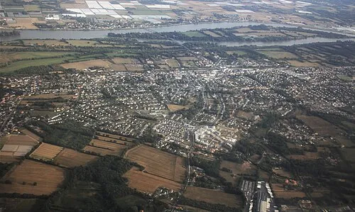 Île la Chenaie Island, Loire-Atlantique15 km SW
-
Île d'Arouix Island, Loire-Atlantique12 km SW
Sources & licences
Data last updated: