Falleron
Located in Arrondissement of La Roche-sur-Yon, Vendée Coordinates: 46°52′56″ N 1°42′14″ W
- Population
- 1,576
- 1.6K
- Elevation
- 33 m
- above sea level
- Local time
- UTC+01:00
- Europe/Paris · UTC+01:00
- Places inside
- 3
- listed under Falleron
- Airports
- NTE Nantes Atlantique Airport31 km
- LRH La Rochelle Île de Ré Airport87 km
About Falleron
Falleron is a village. Location: Arrondissement of La Roche-sur-Yon, Vendée. Population: 1,576. Elevation: 33 m. The best months to visit are June–September. The nearest airport is Nantes Atlantique Airport (31 km). Nearby sights include Forêt de Touvois and Forêt de Grand-Landes.
Climate of Falleron
Best months for sightseeingBest months for sightseeing: June–September.
This month · November
Outside the best season
Day 12° · Night 6° · Rain 87 mm
- Hottest month
- August (day 24°)
- Coldest month
- January (night 3°)
- Wettest month
- December (89 mm)
- Driest month
- August (39 mm)
Bars: average monthly low and high temperature. Below: precipitation. Monthly averages for 1970–2000 at about 18 km resolution, adjusted for elevation. Highlighted months are mild and relatively dry. Source: WorldClim 2.1 (CC BY 4.0).
Show values as a table
| Month | Jan | Feb | Mar | Apr | May | Jun | Jul | Aug | Sep | Oct | Nov | Dec |
|---|---|---|---|---|---|---|---|---|---|---|---|---|
| Average high (°C) | 9° | 10° | 12° | 15° | 19° | 22° | 24° | 24° | 21° | 17° | 12° | 10° |
| Average low (°C) | 3° | 3° | 5° | 6° | 10° | 12° | 14° | 14° | 12° | 9° | 6° | 4° |
| Precipitation (mm) | 85 | 73 | 56 | 57 | 59 | 41 | 41 | 39 | 65 | 81 | 87 | 89 |
Other places to visit in this season: June July August September
How to get to Falleron
The nearest airport is Nantes Atlantique Airport (NTE), 31 km to the north as the crow flies. The nearest large city is Nantes, 39 km to the north.
Airports
- Nantes Atlantique Airport (NTE) Nantes 31 kmnorth
- La Rochelle Île de Ré Airport (LRH) La Rochelle 87 kmsoutheast
- Rennes-Saint-Jacques Airport (RNS) Saint-Jacques-de-la-Lande, Ille-et-Vilaine 132 kmnorth
Nearby large cities
- Nantes Population: 325.1K 39 kmnorth
- Angers Population: 168.3K 109 kmnortheast
- Rennes Population: 227.8K 137 kmnorth
- Le Mans Population: 144.5K 190 kmnortheast
- Tours Population: 141.6K 191 kmeast
Straight-line distances; road distances are longer. Airport data: OurAirports.
Day trips from Falleron
Within 100 km: 155 historic and cultural sites, 86 natural sites, 150 lakes, rivers and coasts.
0–25 km17 places
- Lac de Grand-Lieu Lake 24 kmN
- Forêt de Touvois Natural site 5 kmNE
- Forêt de Machecoul Natural site 15 kmN
- Forêt de Grand-Landes Natural site 6 kmE
25–60 km159 places
- Noirmoutier Island 44 kmW
- Île d'Yeu Island 53 kmW
- Plage de la Courance Beach 59 kmNW
- Plage du Rocher Beach 56 kmS
60–100 km215 places
- Île de Ré Island 79 kmS
- Plage Nord Beach 87 kmSE
- Plage Sud Beach 87 kmSE
- La Plage d'Aytré Beach 96 kmSE
Straight-line distances.
Places in Falleron
3 placesBar: population relative to the most populous place in this list.
Cities & villages2
- La Cornulière · Village
- La Jaubretière · Village
Nearby attractions & nature
Everything nearby-
Forêt de Touvois Natural site, Loire-Atlantique4.7 km NE
-
Forêt de Grand-Landes Natural site, Vendée5.9 km E
-
Commanderie de Coudrie Historic site, Challans7.4 km SW
-
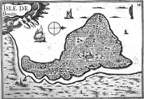 Île de Bouin Island, Vendée24 km NW
-
Château de La Coursaudière Historic site, Challans14 km W
-
Ancienne église Notre-Dame-de-l'Assomption Attraction, Challans14 km W
Sources & licences
Data last updated: